MyTopo
Ulysses Pennsylvania US Topo Map
Couldn't load pickup availability
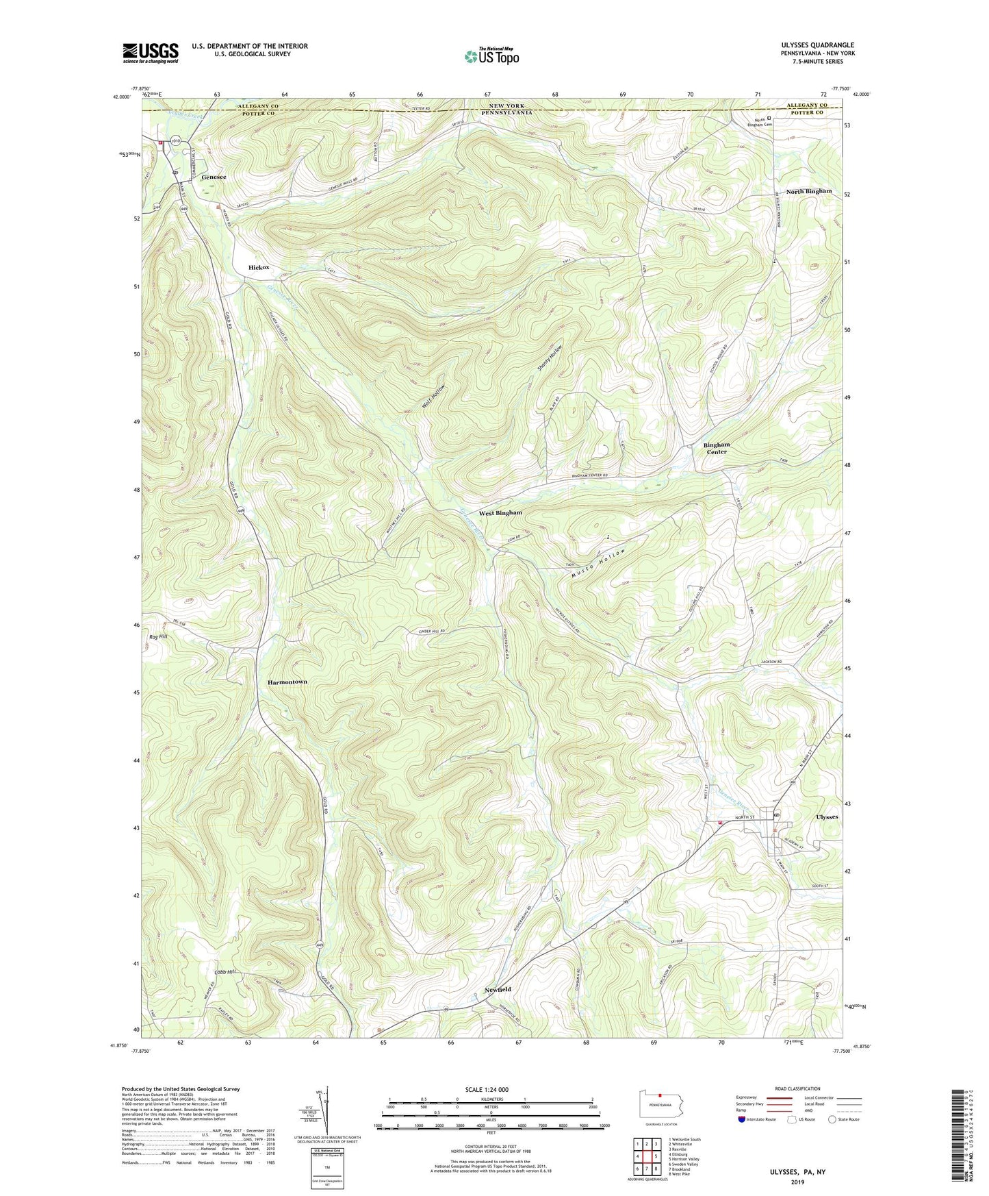
2023 topographic map quadrangle Ulysses in the states of Pennsylvania, New York. Scale: 1:24000. Based on the newly updated USGS 7.5' US Topo map series, this map is in the following counties: Potter, Allegany. The map contains contour data, water features, and other items you are used to seeing on USGS maps, but also has updated roads and other features. This is the next generation of topographic maps. Printed on high-quality waterproof paper with UV fade-resistant inks.
Quads adjacent to this one:
West: Ellisburg
Northwest: Wellsville South
North: Whitesville
Northeast: Rexville
East: Harrison Valley
Southeast: West Pike
South: Brookland
Southwest: Sweden Valley
This map covers the same area as the classic USGS quad with code o41077h7.
Contains the following named places: Ainsworth Brook, Bingham Center, Bingham Station, Borough of Ulysses, Cotton Brook, Cryder Creek, Genesee, Genesee Post Office, Genesee Township Volunteer Fire Department Station 37, Harmontown, Hickox, Jackson School, Kibboville Corners, Ludington Run, Middle Branch Genesee River, Mundy Brook, Musto Hollow, Newfield, Newfield School, North Bingham, North Bingham Cemetery, Pusher Siding, Shanty Hollow, Township of Bingham, Tri - Town Fire Company Station 47, Turner Creek, Ulysses, Ulysses Post Office, United States School, West Bingham, West Branch Genesee River, Wolf Hollow, ZIP Codes: 16923, 16941