MyTopo
Harrison Valley Pennsylvania US Topo Map
Couldn't load pickup availability
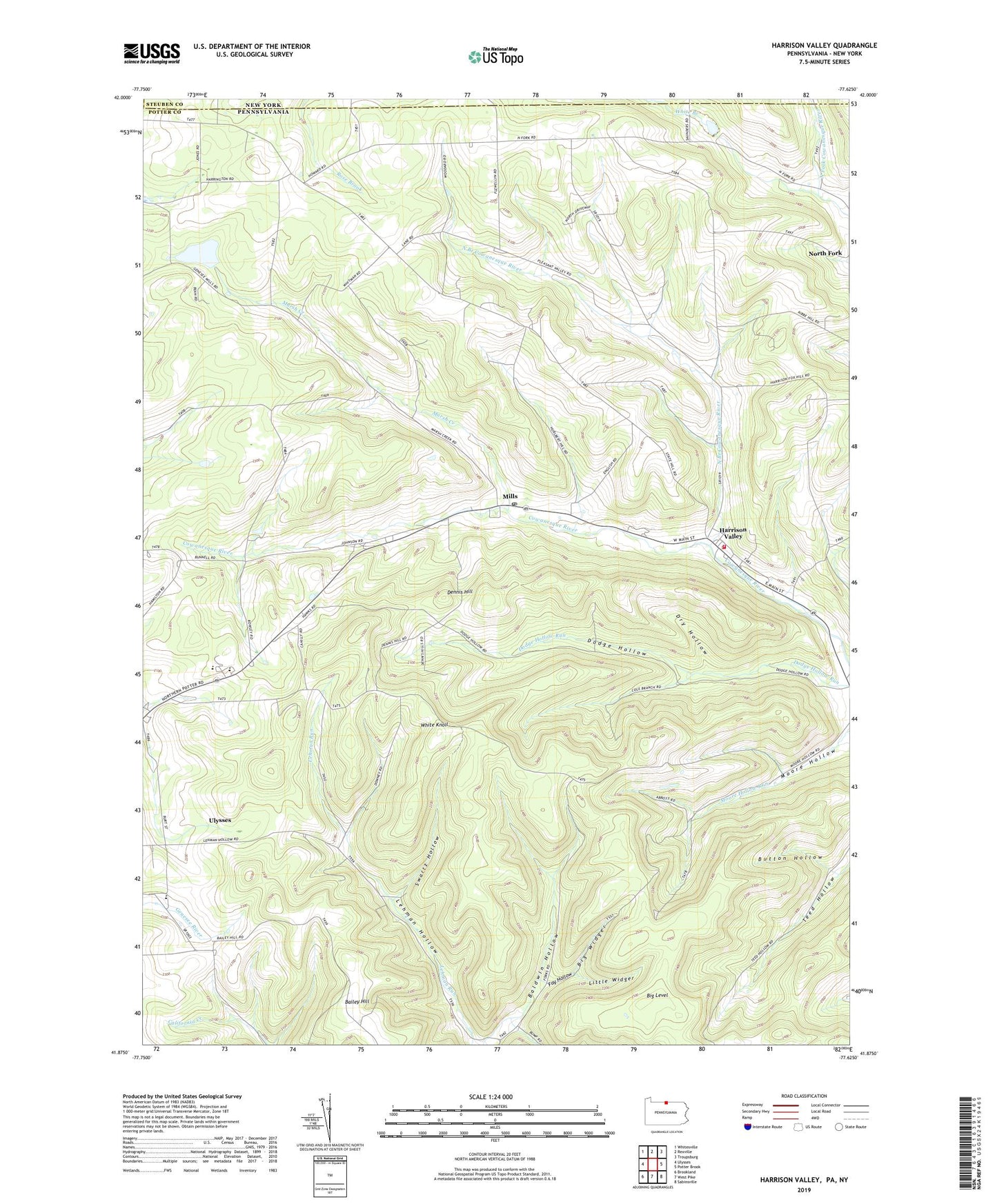
2023 topographic map quadrangle Harrison Valley in the state of Pennsylvania. Scale: 1:24000. Based on the newly updated USGS 7.5' US Topo map series, this map is in the following counties: Potter, Steuben, Allegany. The map contains contour data, water features, and other items you are used to seeing on USGS maps, but also has updated roads and other features. This is the next generation of topographic maps. Printed on high-quality waterproof paper with UV fade-resistant inks.
Quads adjacent to this one:
West: Ulysses
Northwest: Whitesville
North: Rexville
Northeast: Troupsburg
East: Potter Brook
Southeast: Sabinsville
South: West Pike
Southwest: Brookland
This map covers the same area as the classic USGS quad with code o41077h6.
Contains the following named places: Bailey Hill, Big Level, Big Widger, Button Hollow, Dennis Hill, Dodge Hollow, Dry Hollow, Fay Hollow, Harrison, Harrison Township Volunteer Fire Company Station 20, Harrison Valley, Kibbe Field, Little Widger, Marsh Creek, Mills, Mills Post Office, Moore Hollow, North Branch Cowanesque River, North Fork Dam, North Fork Reservoir, Northern Potter School, Northern Tier Childrens Home, Susquehannock State Forest, Swartz Hollow, Township of Harrison, White Knoll, Whites Corners, ZIP Codes: 16927, 16937