MyTopo
Rock Lake New York US Topo Map
Couldn't load pickup availability
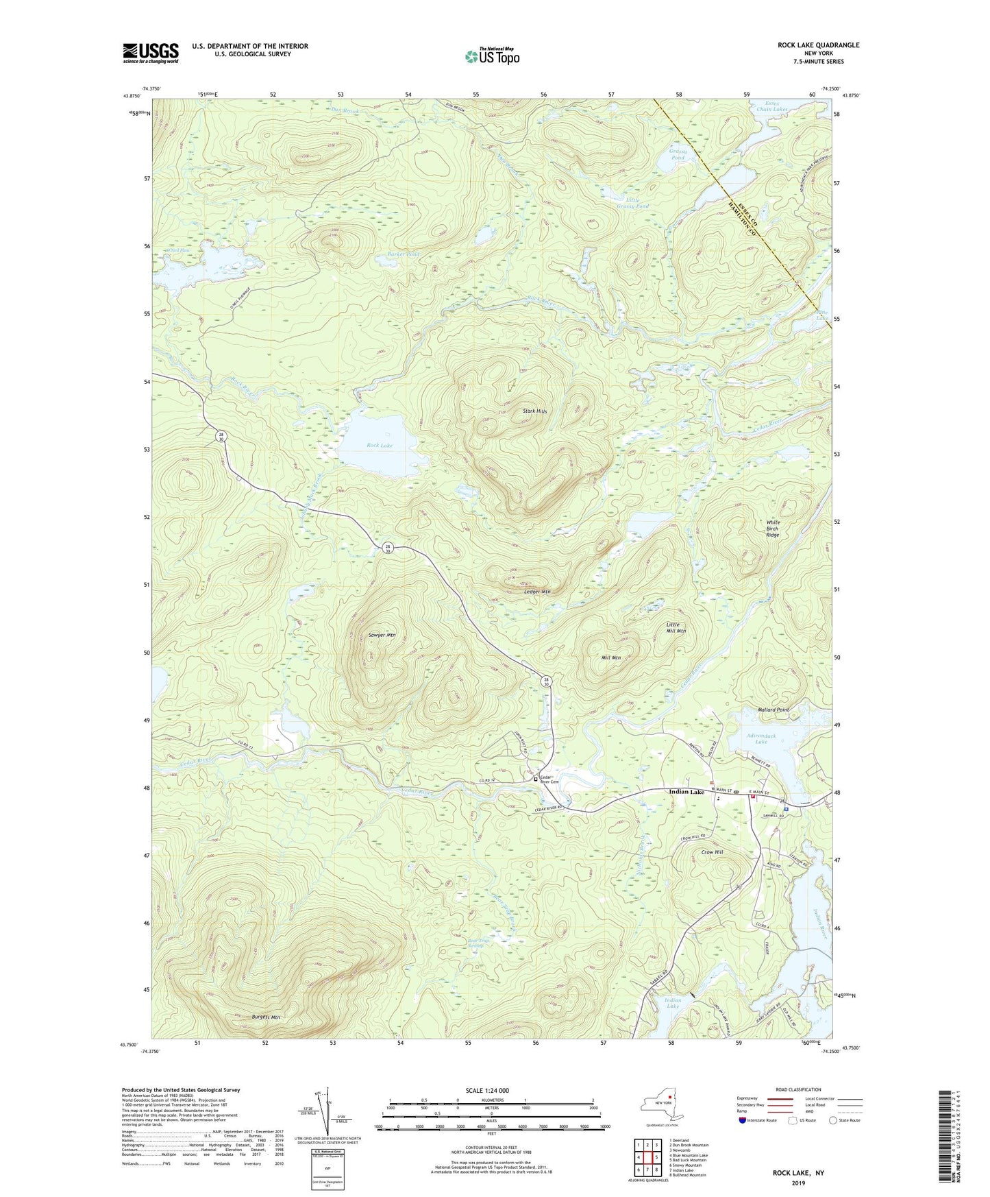
2019 topographic map quadrangle Rock Lake in the state of New York. Scale: 1:24000. Based on the newly updated USGS 7.5' US Topo map series, this map is in the following counties: Hamilton, Essex. The map contains contour data, water features, and other items you are used to seeing on USGS maps, but also has updated roads and other features. This is the next generation of topographic maps. Printed on high-quality waterproof paper with UV fade-resistant inks.
Quads adjacent to this one:
West: Blue Mountain Lake
Northwest: Deerland
North: Dun Brook Mountain
Northeast: Newcomb
East: Bad Luck Mountain
Southeast: Bullhead Mountain
South: Indian Lake
Southwest: Snowy Mountain
Contains the following named places: Adirondack Lake, Barker Pond, Bear Trap Brook, Bear Trap Swamp, Big Brook, Burgess Mountain, Byron Park, Cedar River Cemetery, Cedar River Golf Course, Crow Hill, Dun Brook, First Lake, Forest House, Grassy Pond, Independent Baptist Church, Indian Lake, Indian Lake Central School, Indian Lake First Baptist Church, Indian Lake Post Office, Indian Lake Volunteer Fire Department, Johnny Mack Brook, Ledger Mountain, Little Grassy Pond, Little Mill Mountain, Mallard Point, Mill Mountain, Nicholas Brook, O'Neil Flow, Rock Lake, Rock River, Round Pond Brook, Sawyer Mountain, Second Lake, Stark Hills, Town of Indian Lake, Unknown Pond, Wakely Lodge Golf Course, White Birch Ridge