MyTopo
Bullhead Mountain New York US Topo Map
Couldn't load pickup availability
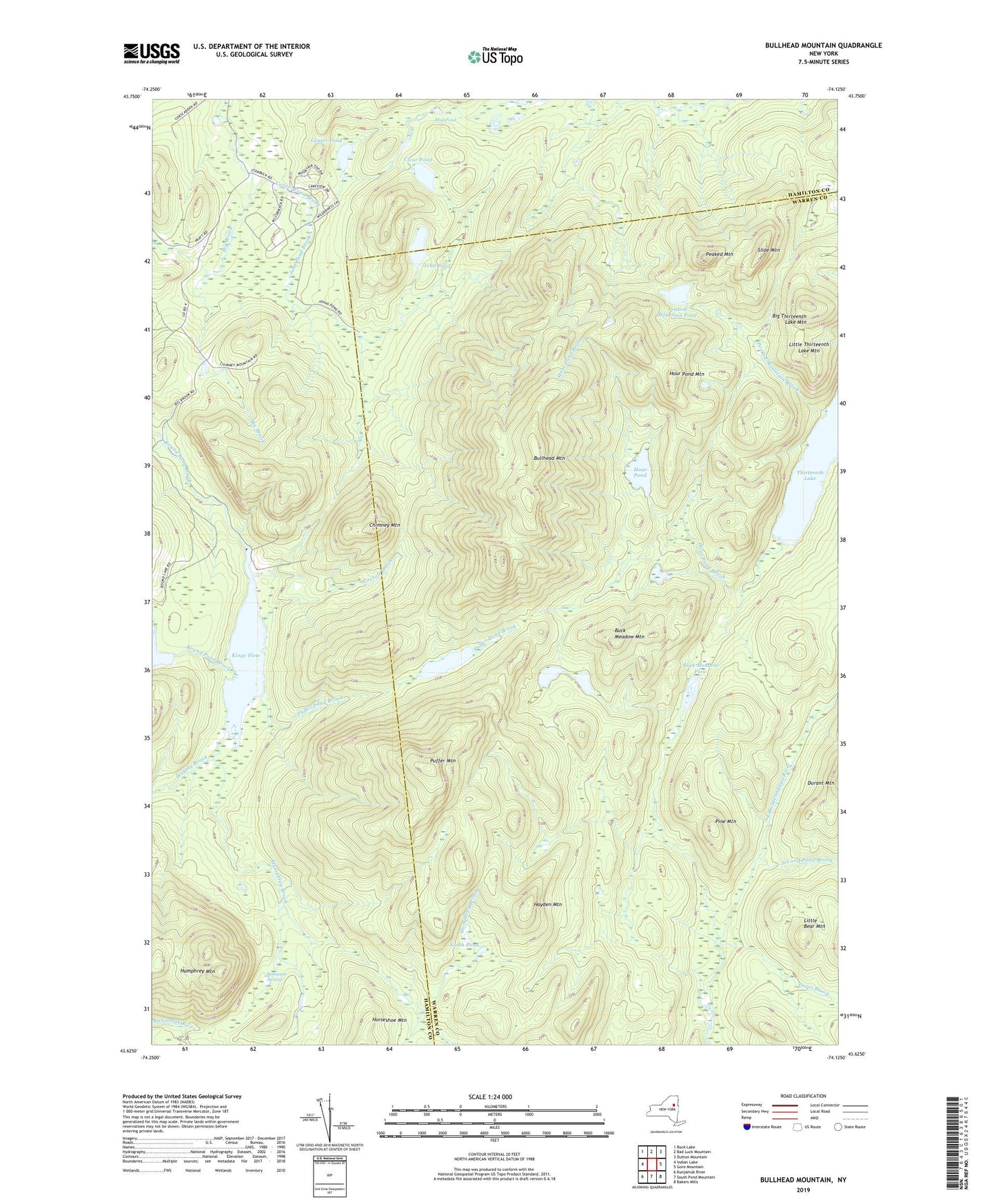
2023 topographic map quadrangle Bullhead Mountain in the state of New York. Scale: 1:24000. Based on the newly updated USGS 7.5' US Topo map series, this map is in the following counties: Warren, Hamilton. The map contains contour data, water features, and other items you are used to seeing on USGS maps, but also has updated roads and other features. This is the next generation of topographic maps. Printed on high-quality waterproof paper with UV fade-resistant inks.
Quads adjacent to this one:
West: Indian Lake
Northwest: Rock Lake
North: Bad Luck Mountain
Northeast: Dutton Mountain
East: Gore Mountain
Southeast: Bakers Mills
South: South Pond Mountain
Southwest: Kunjamuk River
Contains the following named places: Big Thirteenth Lake Mountain, Buck Meadow Flow, Buck Meadow Mountain, Bullhead Mountain, Carroll Brook, Center Pond, Center Pond Brook, Chimney Mountain, Clear Pond, Cross Brook, Hayden Mountain, Hour Pond, Hour Pond Brook, Hour Pond Mountain, Humphrey Brook, Humphrey Mountain, John Pond, John Pond Brook, Kings Flow, Little Bear Mountain, Little Thirteenth Lake Mountain, Mud Pond, North Pond, Peaked Mountain, Peaked Mountain Brook, Peaked Mountain Pond, Pine Mountain, Puffer Mountain, Puffer Pond, Puffer Pond Brook, Robinson Swamp, Second Pond Brook, Slide Mountain, Thirteenth Lake, Thornbush Acres Recreational Vehicle Park, Twin Ponds, Wakely Brook, Wilderness Lodge, ZIP Code: 12856