MyTopo
Ovid New York US Topo Map
Couldn't load pickup availability
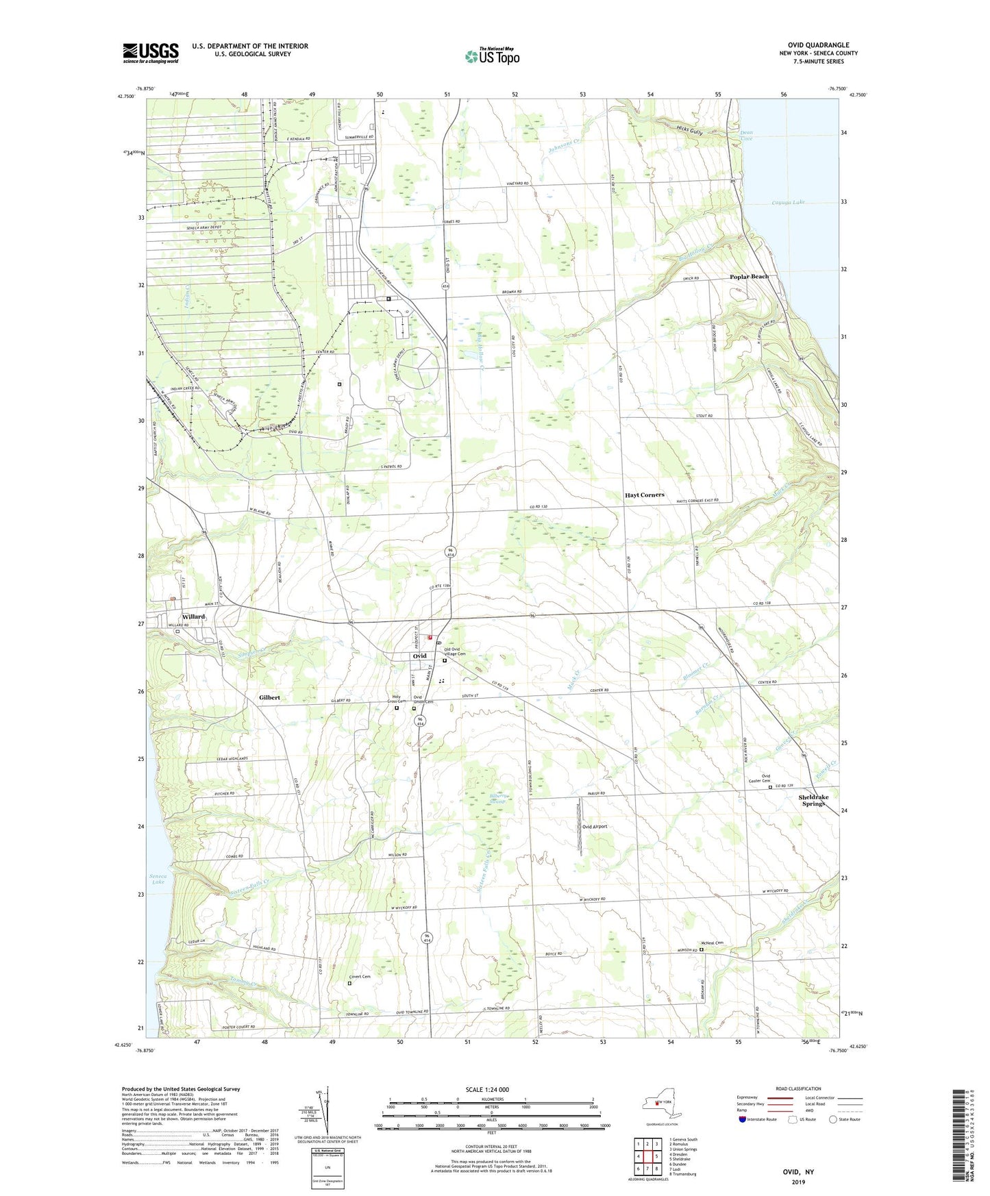
2023 topographic map quadrangle Ovid in the state of New York. Scale: 1:24000. Based on the newly updated USGS 7.5' US Topo map series, this map is in the following counties: Seneca. The map contains contour data, water features, and other items you are used to seeing on USGS maps, but also has updated roads and other features. This is the next generation of topographic maps. Printed on high-quality waterproof paper with UV fade-resistant inks.
Quads adjacent to this one:
West: Dresden
Northwest: Geneva South
North: Romulus
Northeast: Union Springs
East: Sheldrake
Southeast: Trumansburg
South: Lodi
Southwest: Dundee
This map covers the same area as the classic USGS quad with code o42076f7.
Contains the following named places: Big Hollow Creek, Bilberry Swamp, Bonavista State Golf Club, Buttonwood Grove Winery, Camp Babcock Hovey, Central School, Coan Corners, Covert Cemetery, Dean Cove, Edith B Ford Memorial Library, Five Points Correctional Facility, Gilbert, Hayt Corners, Hicks Gully, Holy Cross Catholic Church, Holy Cross Cemetery, Johnsons Creek, Marsh Corner, Martha Manor Farm, McNeal Cemetery, Old Ovid Village Cemetery, Ovid, Ovid Airport, Ovid Center Cemetery, Ovid Federated Church, Ovid Fire Department, Ovid Post Office, Ovid Union Cemetery, Poplar Beach, School Number 1, Seneca Community Church, Sheldrake Springs, Sixteen Falls Creek, Sned Acres Family Campground, South Seneca Community Volunteer Ambulance Corps, South Seneca High School, South Seneca Middle School, Tannery Corners, Tommy Creek, Town of Ovid, Town of Romulus, Village of Ovid, Willard, Willard Post Office, Willard State Hospital, ZIP Codes: 14521, 14588