MyTopo
Rushville New York US Topo Map
Couldn't load pickup availability
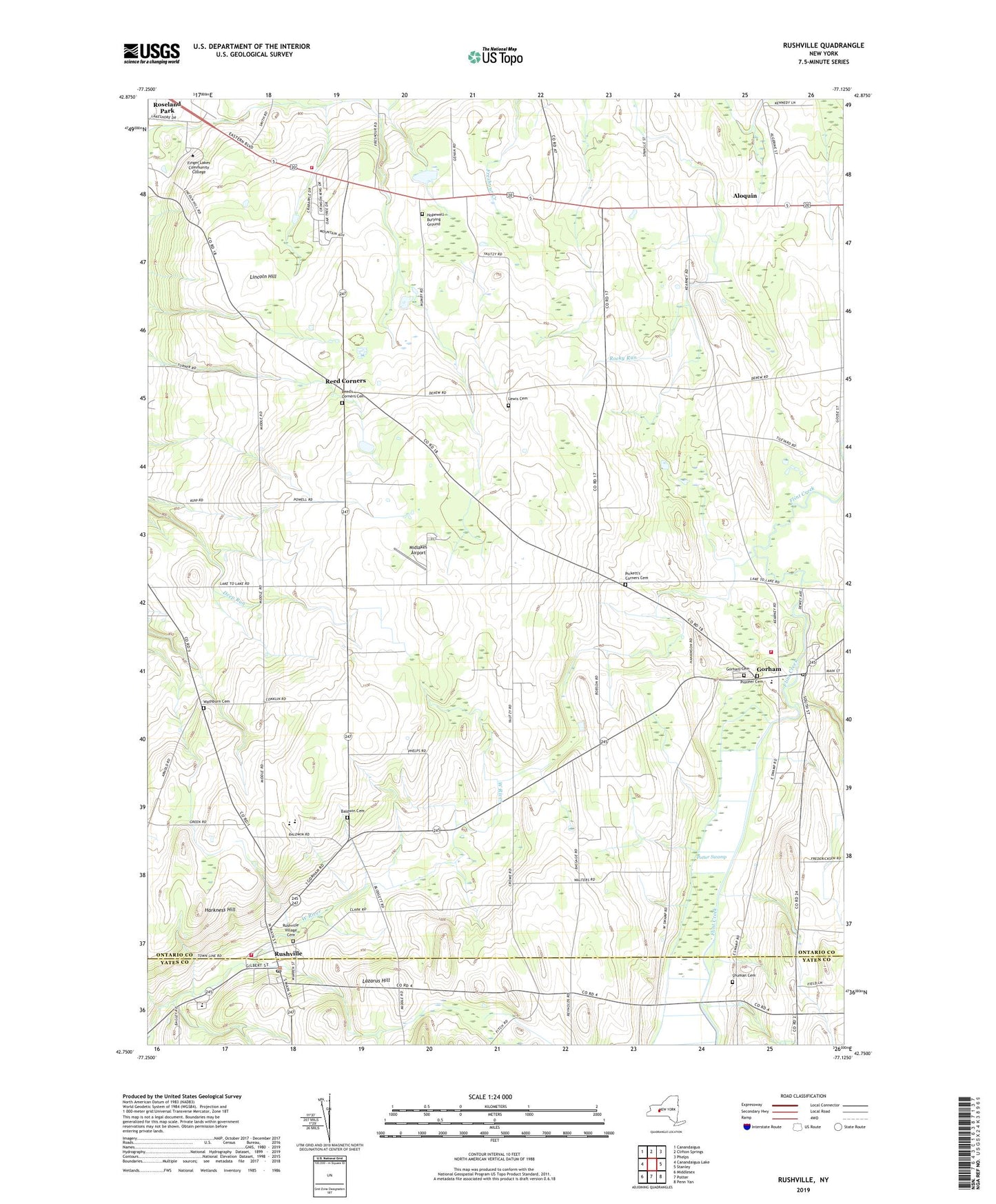
2019 topographic map quadrangle Rushville in the state of New York. Scale: 1:24000. Based on the newly updated USGS 7.5' US Topo map series, this map is in the following counties: Ontario, Yates. The map contains contour data, water features, and other items you are used to seeing on USGS maps, but also has updated roads and other features. This is the next generation of topographic maps. Printed on high-quality waterproof paper with UV fade-resistant inks.
Quads adjacent to this one:
West: Canandaigua Lake
Northwest: Canandaigua
North: Clifton Springs
Northeast: Phelps
East: Stanley
Southeast: Penn Yan
South: Potter
Southwest: Middlesex
Contains the following named places: Aldrich Trailer Park, Aloquin, Babbitt Corner, Baldwin Cemetery, Baldwin Corners, Bethel Baptist Church, Cole Corners, Gorham, Gorham Cemetery, Gorham Census Designated Place, Gorham Elementary School, Gorham Fire Department, Gorham Free Library, Gorham Post Office, Grace Bible Baptist Church, Granger, Harkness Hill, Hopewell Burying Ground, Hopewell Volunteer Fire Department Station 2, Lazarus Hill, Lewis Cemetery, Lincoln Hill, Marcus Whitman High School, Marcus Whitman Middle School, Mead Corner, Middlesex Valley Central School, Midlakes Airport, Parkway Drive-In, Pickett's Corners Cemetery, Pioneer Cemetery, Reed Corner Federated Church, Reed Corners, Reed's Corners Cemetery, Rushville, Rushville Hose Company, Rushville Post Office, Rushville United Methodist Church, Rushville Village Cemetery, School Number 1, School Number 10, School Number 5, School Number 9, Shuman Cemetery, Stanley Hall Gorham Ambulance Corps, Thomas Estates Mobile Home Park, Town of Gorham, United Methodist Church of Gorham, Village of Rushville, Washburn Cemetery, Wilson Corners, ZIP Codes: 14544, 14561