MyTopo
Middlesex New York US Topo Map
Couldn't load pickup availability
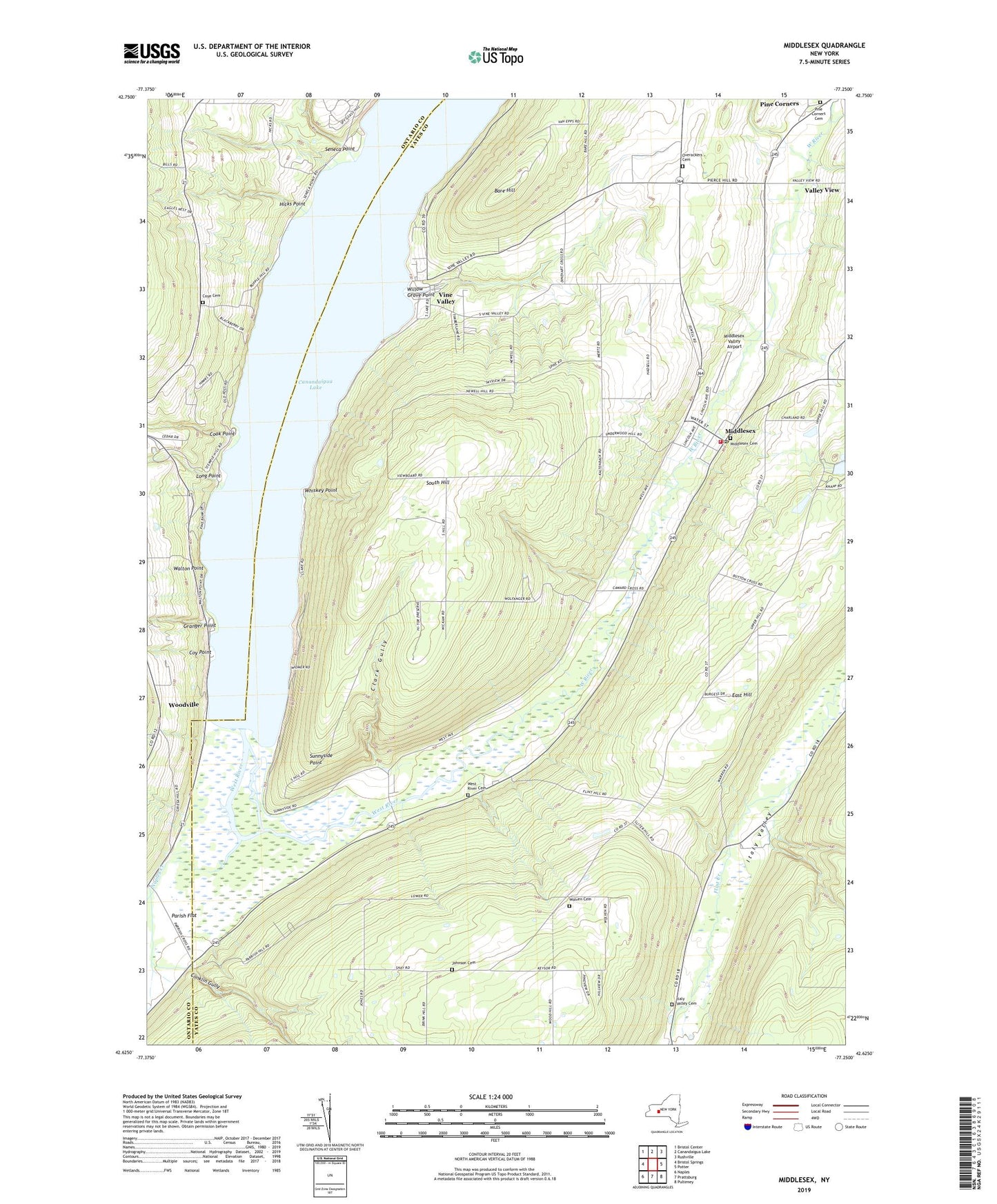
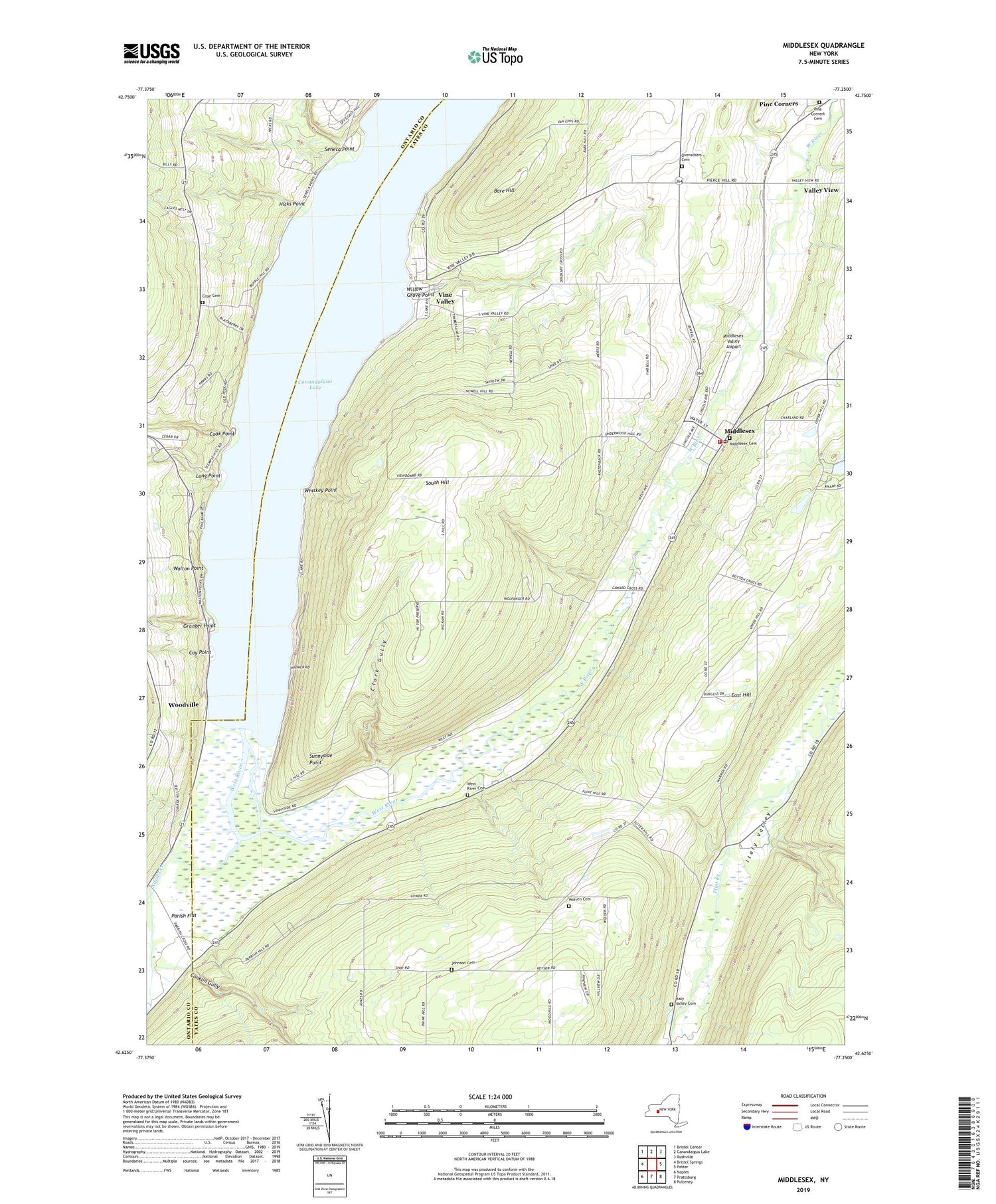
2023 topographic map quadrangle Middlesex in the state of New York. Scale: 1:24000. Based on the newly updated USGS 7.5' US Topo map series, this map is in the following counties: Yates, Ontario. The map contains contour data, water features, and other items you are used to seeing on USGS maps, but also has updated roads and other features. This is the next generation of topographic maps. Printed on high-quality waterproof paper with UV fade-resistant inks.
Quads adjacent to this one:
West: Bristol Springs
Northwest: Bristol Center
North: Canandaigua Lake
Northeast: Rushville
East: Potter
Southeast: Pulteney
South: Prattsburg
Southwest: Naples
This map covers the same area as the classic USGS quad with code o42077f3.
Contains the following named places: Bare Hill, Clark Gully, Conklin Gully, Cook Point, Corey Gully, Covel Corner, Coy Point, Coye Cemetery, East Hill, Granger Point, Hicks Point, Indian Village Recreational Vehicle Park, Italy Valley Cemetery, Johnson Cemetery, Long Point, Majestic Hills Golf Course, Middlesex, Middlesex Baptist Church, Middlesex Cemetery, Middlesex Fire Department, Middlesex Post Office, Middlesex Town Hall, Middlesex United Methodist Church, Middlesex Valley Airport, Middlesex Valley Volunteer Ambulance Service, Naples Creek, Overacker Corners, Overackers Cemetery, Parish Flat, Pine Corners, Pine Corners Cemetery, School Number 2, School Number 3, School Number 4, School Number 5, School Number 6, School Number 7, Seneca Point, Seneca Point Gully, South Hill, Sunnyside Point, Town of Middlesex, Valley View, Vine Valley, Vine Valley Farm, Vine Valley United Methodist Church, Walton Point, West River, West River Cemetery, Whiskey Point, Williams Corner, Willow Grove Point, Wolven Cemetery, Woodville, ZIP Code: 14507