
MyTopo
Saint Regis Falls New York US Topo Map
Couldn't load pickup availability
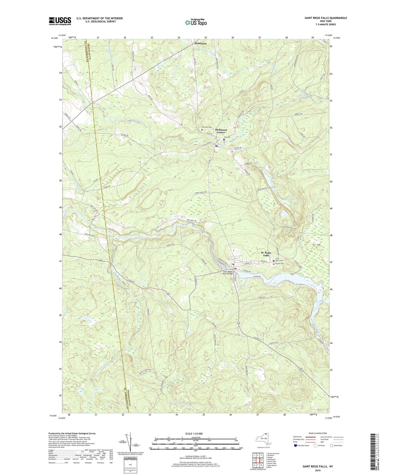
2019 topographic map quadrangle Saint Regis Falls in the state of New York. Scale: 1:24000. Based on the newly updated USGS 7.5' US Topo map series, this map is in the following counties: Franklin, St. Lawrence. The map contains contour data, water features, and other items you are used to seeing on USGS maps, but also has updated roads and other features. This is the next generation of topographic maps. Printed on high-quality waterproof paper with UV fade-resistant inks.
Quads adjacent to this one:
West: Nicholville
Northwest: North Lawrence
North: Brushton
Northeast: Bangor
East: Santa Clara
Southeast: Meno
South: Lake Ozonia
Southwest: Sylvan Falls
Contains the following named places: Baker Pond, Deer River Picnic Area, Dexter Lake Outlet, Dickinson, Dickinson Center, Dickinson Center Post Office, Dickinson Volunteer Fire Department, Fairview Cemetery, Forest Cemetery, Franklin State Forest Number Nine, Guide Board School, Ives Cemetery, Lake Ozonia Outlet, Lake Ozonia School, Mud Pond, Palmer School, Saint Anns Cemetery, Saint Regis Falls, Saint Regis Falls Census Designated Place, Saint Regis Falls Central School, Saint Regis Falls Post Office, Saint Regis Falls Volunteer Fire Department, Saint Regis River Bridge, School Number 2, School Number 3, School Number 5, School Number 6, Town of Dickinson, ZIP Code: 12930


