MyTopo
Sargent Ponds New York US Topo Map
Couldn't load pickup availability
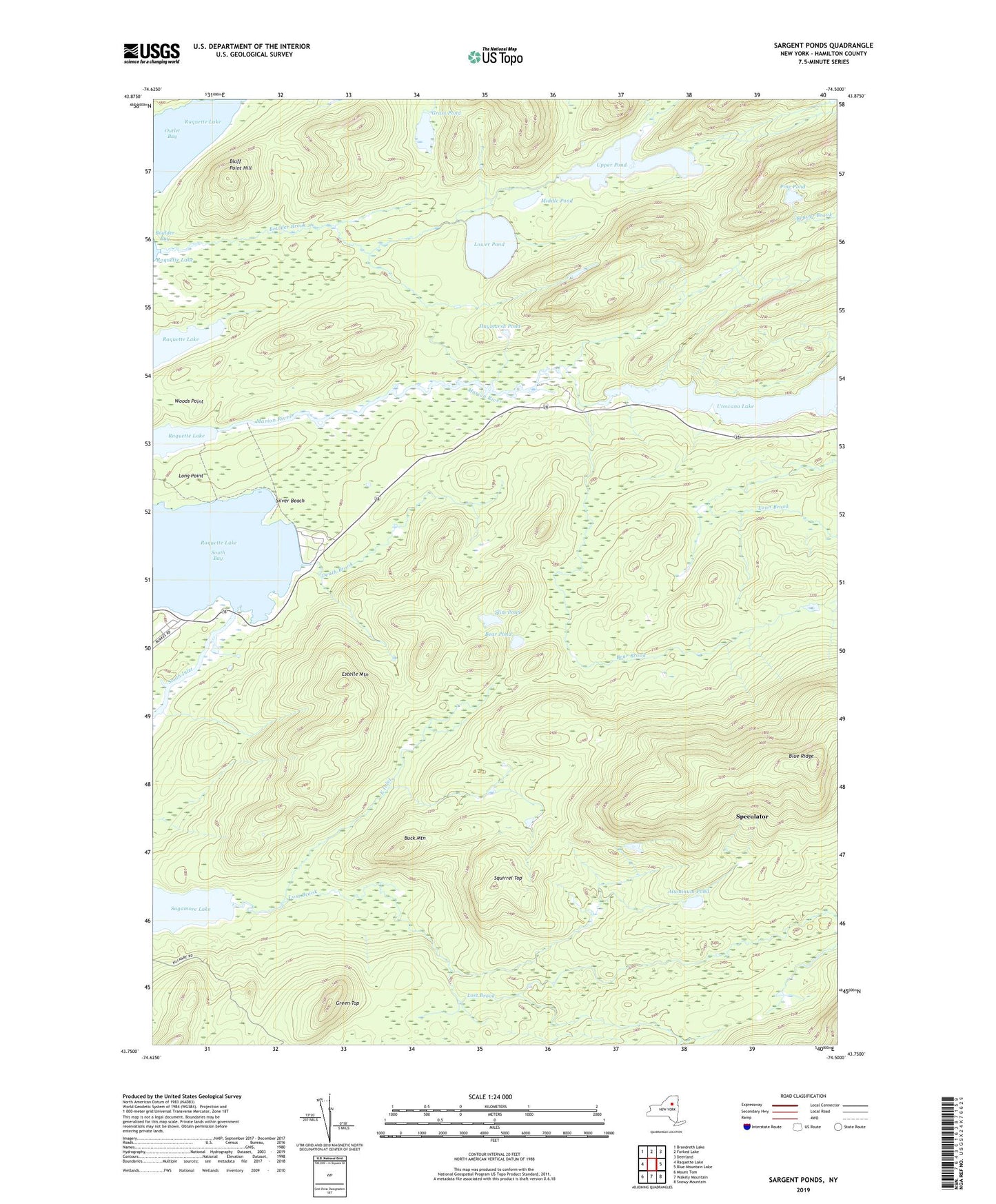
2019 topographic map quadrangle Sargent Ponds in the state of New York. Scale: 1:24000. Based on the newly updated USGS 7.5' US Topo map series, this map is in the following counties: Hamilton. The map contains contour data, water features, and other items you are used to seeing on USGS maps, but also has updated roads and other features. This is the next generation of topographic maps. Printed on high-quality waterproof paper with UV fade-resistant inks.
Quads adjacent to this one:
West: Raquette Lake
Northwest: Brandreth Lake
North: Forked Lake
Northeast: Deerland
East: Blue Mountain Lake
Southeast: Snowy Mountain
South: Wakely Mountain
Southwest: Mount Tom
Contains the following named places: Aluminum Pond, Bear Brook, Bear Pond, Bluff Point Hill, Boulder Brook, Buck Mountain, Death Brook, East Inlet, Eldon Lake, Estelle Mountain, Golden Beach Campsite, Golden Beach State Campground, Grass Pond, Green Top, Haymarsh Pond, Loon Brook, Lost Brook, Lower Pond, Marion River, Middle Pond, Outlet Bay, Pine Pond, Sagamore Lake, Sargent Ponds, Silver Beach, Slim Pond, South Bay, South Inlet, Squirrel Top, Upper Pond, Utowana Lake