MyTopo
Mount Tom New York US Topo Map
Couldn't load pickup availability
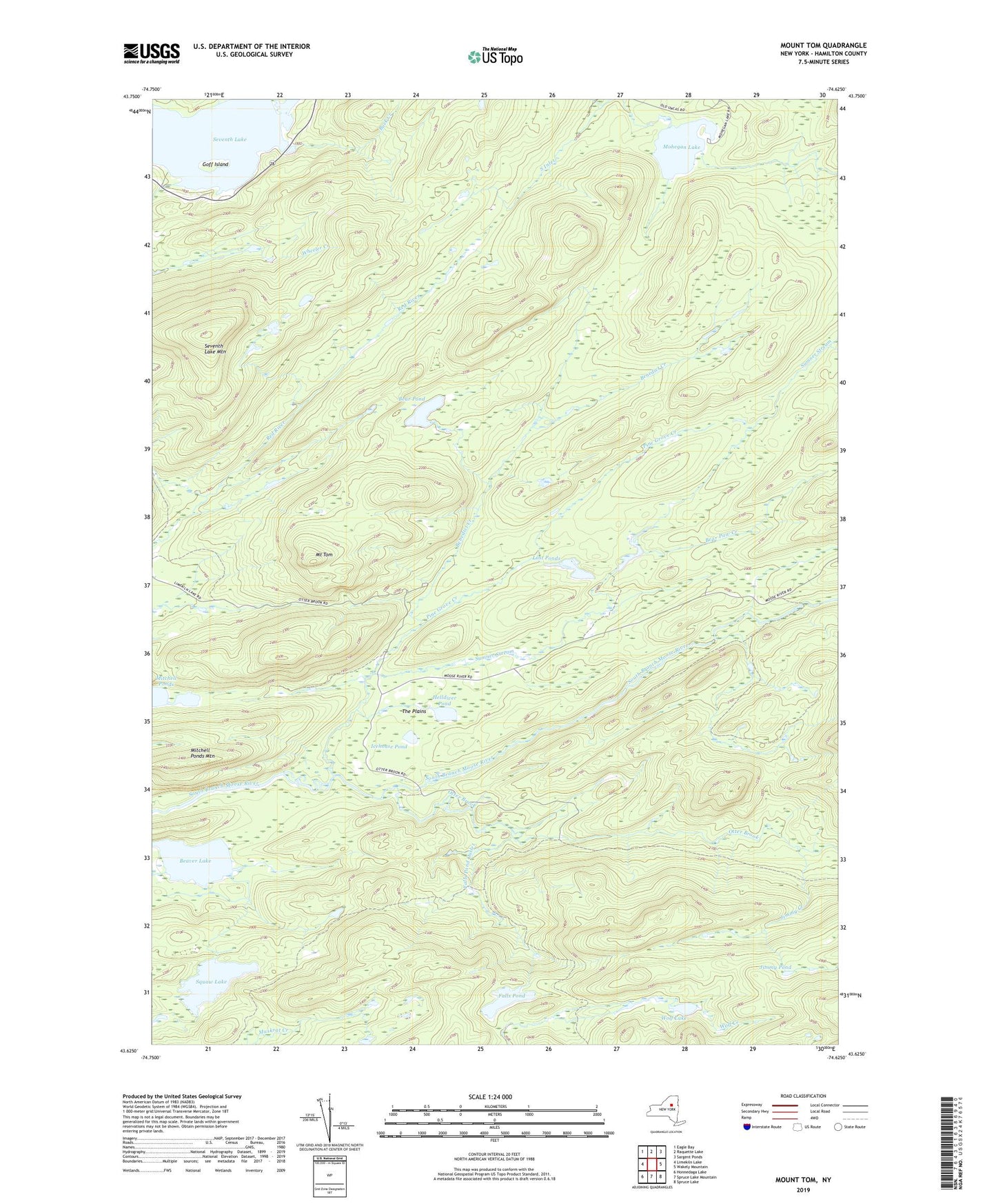
2023 topographic map quadrangle Mount Tom in the state of New York. Scale: 1:24000. Based on the newly updated USGS 7.5' US Topo map series, this map is in the following counties: Hamilton. The map contains contour data, water features, and other items you are used to seeing on USGS maps, but also has updated roads and other features. This is the next generation of topographic maps. Printed on high-quality waterproof paper with UV fade-resistant inks.
Quads adjacent to this one:
West: Limekiln Lake
Northwest: Eagle Bay
North: Raquette Lake
Northeast: Sargent Ponds
East: Wakely Mountain
Southeast: Spruce Lake
South: Spruce Lake Mountain
Southwest: Honnedaga Lake
Contains the following named places: Bear Paw Creek, Bear Pond, Beaver Lake, Benedict Creek, Buck Creek, Camp Uncas, Falls Pond, Falls Pond Outlet, Goff Island, Helldiver Pond, Icehouse Pond, Jimmy Creek, Jimmy Pond, Kenwells, Lost Ponds, Mitchell Ponds, Mitchell Ponds Mountain, Mohegan Lake, Moose River Recreation Area, Mount Tom, Otter Brook, Pine Grove Creek, Seventh Lake, Seventh Lake Mountain, Squaw Lake, Sumner Stream, The Plains, Town of Inlet, Wheeler Creek, Wolf Lake, ZIP Code: 13360