MyTopo
Schroon Lake New York US Topo Map
Couldn't load pickup availability
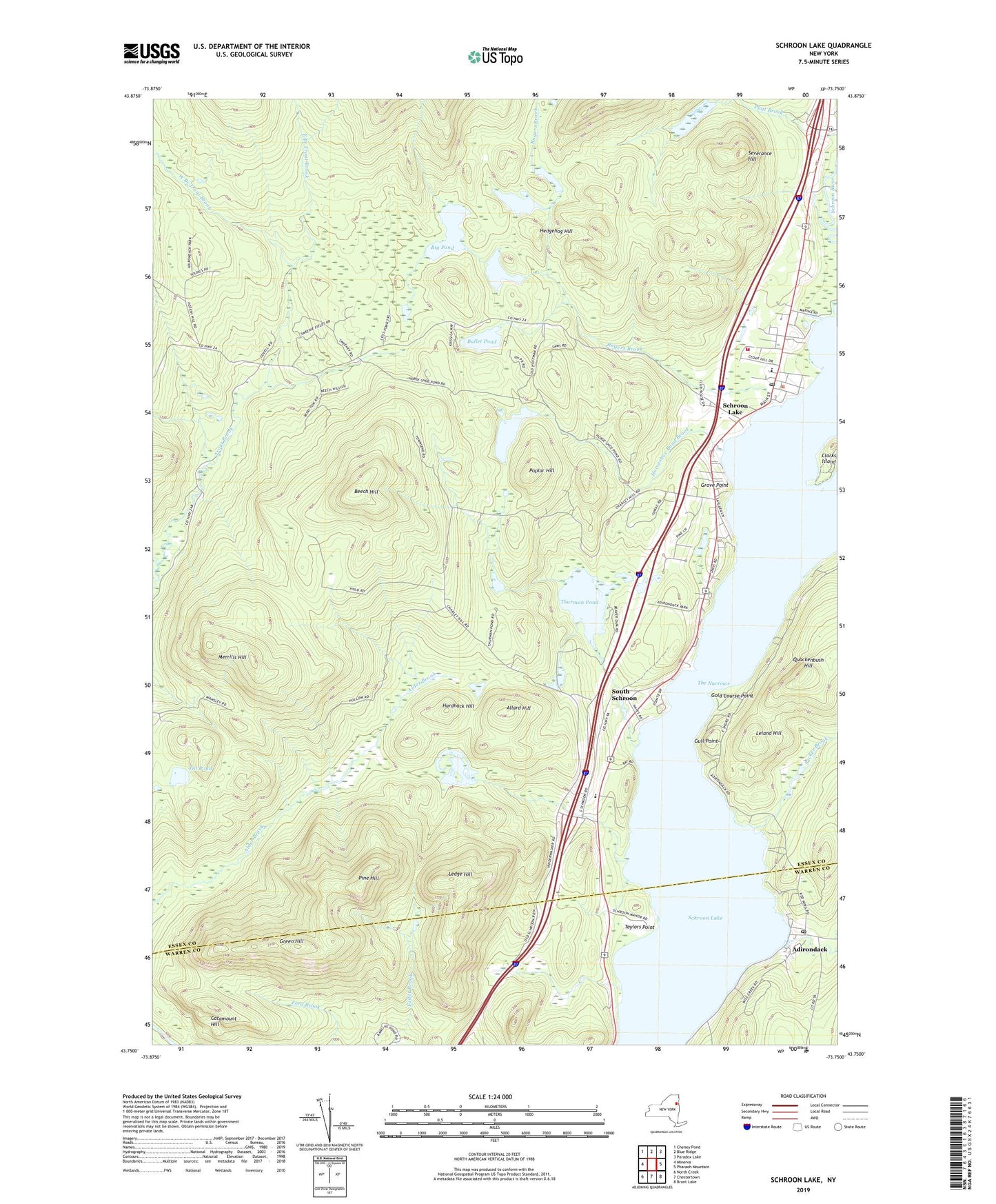
2019 topographic map quadrangle Schroon Lake in the state of New York. Scale: 1:24000. Based on the newly updated USGS 7.5' US Topo map series, this map is in the following counties: Essex, Warren. The map contains contour data, water features, and other items you are used to seeing on USGS maps, but also has updated roads and other features. This is the next generation of topographic maps. Printed on high-quality waterproof paper with UV fade-resistant inks.
Quads adjacent to this one:
West: Minerva
Northwest: Cheney Pond
North: Blue Ridge
Northeast: Paradox Lake
East: Pharaoh Mountain
Southeast: Brant Lake
South: Chestertown
Southwest: North Creek
Contains the following named places: Adirondack, Adirondack Post Office, Allard Hill, Beech Hill, Big Pond, Buck Hollow, Bullet Pond, Catamount Hill, Clarks Island, East Branch Trout Brook, Gold Course Point, Green Hill, Grove Point, Gull Point, Hardhack Hill, Hedgehog Hill, Horseshoe Pond, Horseshoe Pond Brook, Ledge Hill, Leland Hill, Marsh Pond, Merrills Hill, Mill Brook, North Pond, Our Lady of Lourdes Church, Pat Pond, Pine Hill, Poplar Hill, Quackenbush Hill, Rogers Brook, Schroon Lake, Schroon Lake Census Designated Place, Schroon Lake Community Church, Schroon Lake Municipal Golf Course, Schroon Lake Post Office, Schroon Lake Volunteer Fire Department, Schroon Lake Wastewater Treatment Plant, Severance Hill, South Schroon, Sucker Brook, Taylors Point, The Narrows, Thurman Pond, Town of Schroon, West Branch Trout Brook, Word of Life Fellowship, ZIP Codes: 12860, 12870