MyTopo
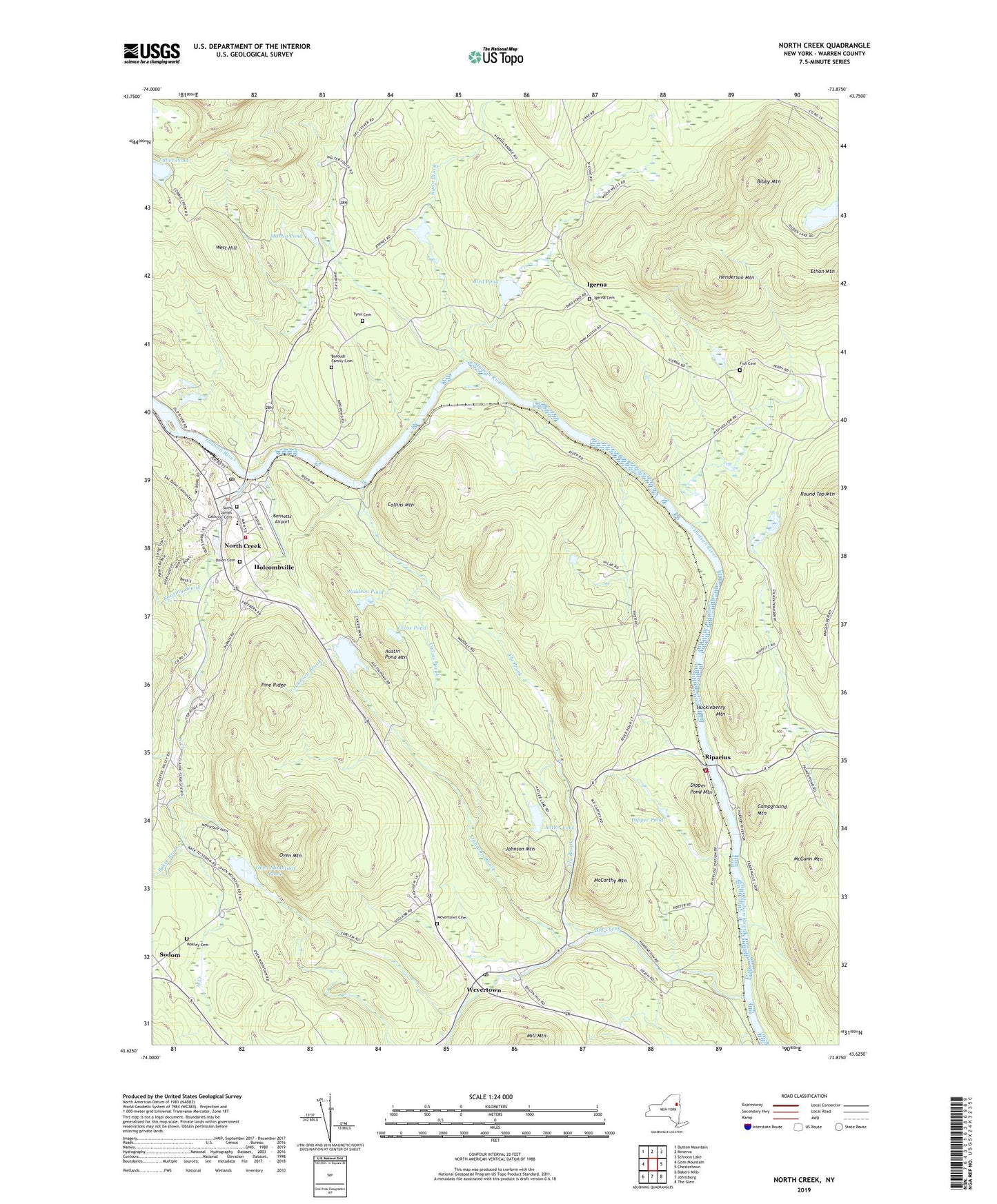
North Creek New York US Topo Map
Couldn't load pickup availability
2023 topographic map quadrangle North Creek in the state of New York. Scale: 1:24000. Based on the newly updated USGS 7.5' US Topo map series, this map is in the following counties: Warren. The map contains contour data, water features, and other items you are used to seeing on USGS maps, but also has updated roads and other features. This is the next generation of topographic maps. Printed on high-quality waterproof paper with UV fade-resistant inks.
Quads adjacent to this one:
West: Gore Mountain
Northwest: Dutton Mountain
North: Minerva
Northeast: Schroon Lake
East: Chestertown
Southeast: The Glen
South: Johnsburg
Southwest: Bakers Mills
This map covers the same area as the classic USGS quad with code o43073f8.
Contains the following named places: Adirondack Tri - County Health Care Center, Antler Lake, Austin Pond, Austin Pond Mountain, Baker Brook, Baroudi Family Cemetery, Bennetts Airport, Bibby Mountain, Bird Pond, Byrnes Corners, Calvary Bible Church, Campground Mountain, Collins Brook, Collins Mountain, Cross Pond, Dipper Pond, Dipper Pond Mountain, Fish Cemetery, Fuller Pond, Henderson Mountain, Hidden Lake, Holcombville, Huckleberry Mountain, Igerna, Igerna Cemetery, Johnsburg Central School, Johnsburg Emergency Squad, Johnson Brook, Johnson Mountain, Martin Pond, McCarthy Mountain, McGann Mountain, Mill Creek, North Creek, North Creek Census Designated Place, North Creek Fire Department, North Creek Post Office, Oven Mountain, Oven Mountain Pond, Pine Ridge, Riparius, Riparius Post Office, Riverside Volunteer Fire Department, Roaring Brook, Saint James Catholic Cemetery, Sodom, Straight Brook, Town of Johnsburg Library, Tyrel Cemetery, Union Cemetery, Vly Brook, Wakley Cemetery, Waldron Pond, West Hill, Wevertown, Wevertown Cemetery, Wevertown Post Office, Wevertown Volunteer Fire Company, ZIP Codes: 12862, 12886