MyTopo
Paradox Lake New York US Topo Map
Couldn't load pickup availability
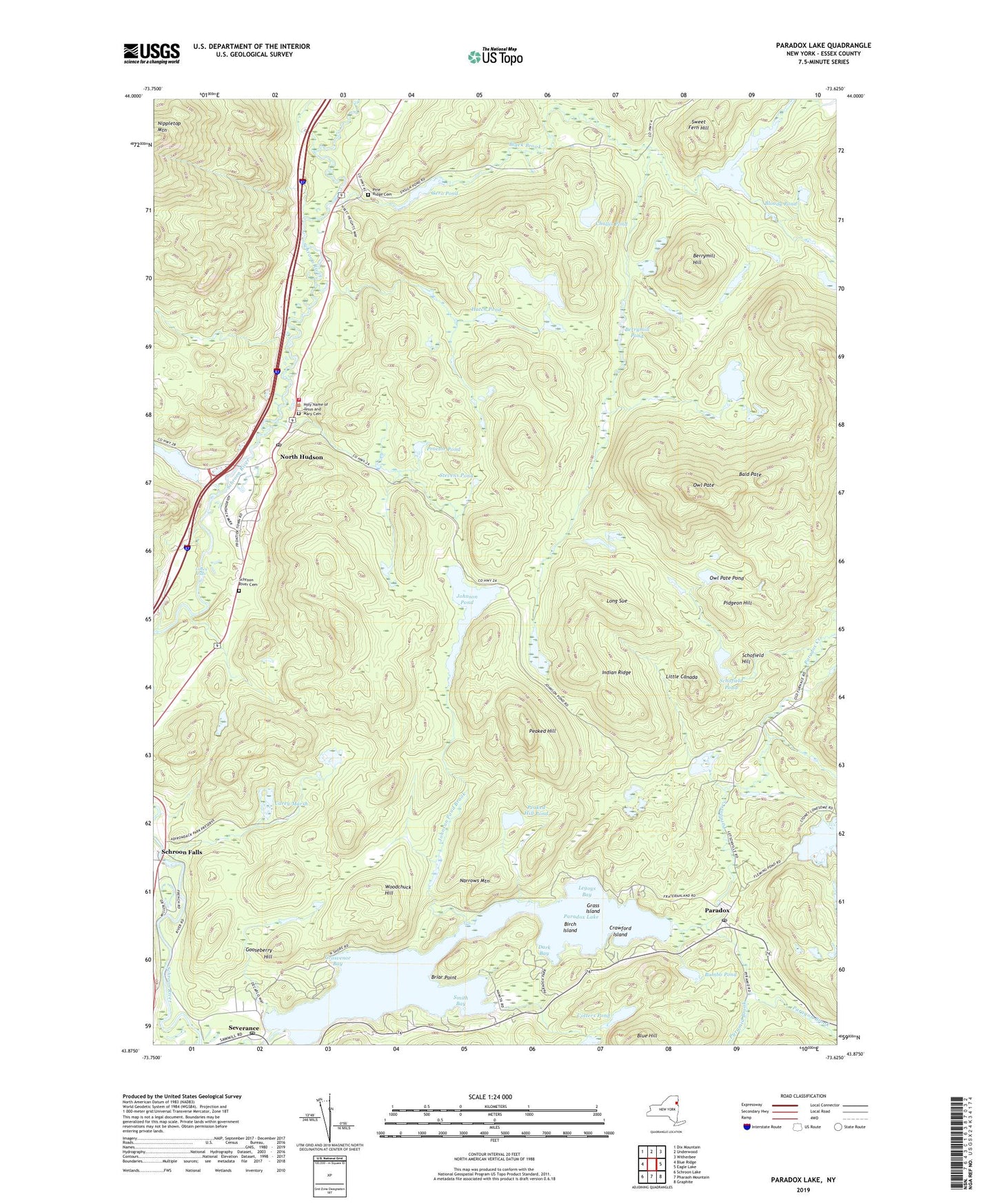
2023 topographic map quadrangle Paradox Lake in the state of New York. Scale: 1:24000. Based on the newly updated USGS 7.5' US Topo map series, this map is in the following counties: Essex. The map contains contour data, water features, and other items you are used to seeing on USGS maps, but also has updated roads and other features. This is the next generation of topographic maps. Printed on high-quality waterproof paper with UV fade-resistant inks.
Quads adjacent to this one:
West: Blue Ridge
Northwest: Dix Mountain
North: Underwood
Northeast: Witherbee
East: Eagle Lake
Southeast: Graphite
South: Pharaoh Mountain
Southwest: Schroon Lake
This map covers the same area as the classic USGS quad with code o43073h6.
Contains the following named places: Bald Pate, Bass Lake, Berrymill Hill, Berrymill Pond, Birch Island, Black Brook, Bloody Pond, Briar Point, Bumbo Pond, Burnt Mill Brook, Carey Marsh, Challis Pond, Cotters Pond, Crawford Island, Dark Bay, Flemings Pond, Gero Pond, Gooseberry Hill, Grass Island, Grosvenor Bay, Hammond Pond, Hatch Pond, Holy Name of Jesus and Mary Cemetery, Indian Ridge, Johnson Pond, Johnson Pond Brook, Legoys Bay, Linsey Falls, Little Canada, Long Sue, Moose Mountain Pond, Narrows Mountain, North Hudson, North Hudson Post Office, North Hudson Town Landfill, North Hudson Volunteer Fire Department, Owl Pate, Owl Pate Pond, Palmer Pond, Paradox, Paradox Creek, Paradox Lake, Paradox Post Office, Paragon Brook, Peaked Hill, Peaked Hill Pond, Peaked Hill Trail, Pidgeon Hill, Pine Ridge Cemetery, Proctor Pond, Schofield Hill, Schofield Pond, Schroon Falls, Schroon River Cemetery, Severance, Severance Post Office, Smith Bay, Stevens Pond, Sweet Fern Hill, The Branch, Walker Brook, Woodchuck Hill, ZIP Code: 12858