MyTopo
Pharaoh Mountain New York US Topo Map
Couldn't load pickup availability
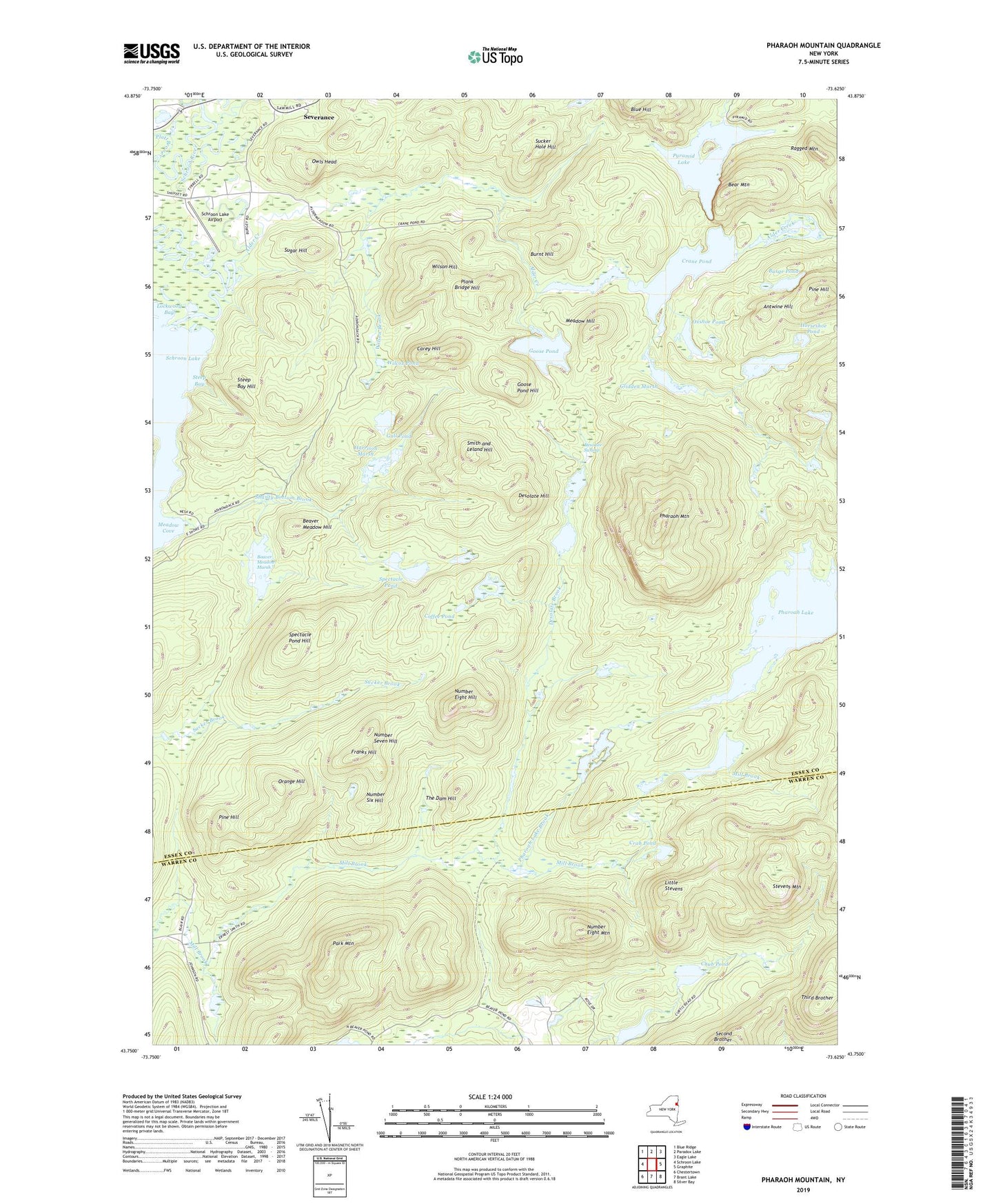
2023 topographic map quadrangle Pharaoh Mountain in the state of New York. Scale: 1:24000. Based on the newly updated USGS 7.5' US Topo map series, this map is in the following counties: Essex, Warren. The map contains contour data, water features, and other items you are used to seeing on USGS maps, but also has updated roads and other features. This is the next generation of topographic maps. Printed on high-quality waterproof paper with UV fade-resistant inks.
Quads adjacent to this one:
West: Schroon Lake
Northwest: Blue Ridge
North: Paradox Lake
Northeast: Eagle Lake
East: Graphite
Southeast: Silver Bay
South: Brant Lake
Southwest: Chestertown
This map covers the same area as the classic USGS quad with code o43073g6.
Contains the following named places: Alder Creek, Alder Pond, Antwine Hill, Bear Mountain, Beaver Meadow Hill, Beaver Meadow Marsh, Blue Hill, Burge Pond, Burnt Hill, Carey Hill, Chub Pond, Coffee Pond, Crab Pond, Crane Pond, Desolate Brook, Desolate Hill, Desolate Swamp, Franks Hill, Glidden Marsh, Goose Pond, Goose Pond Hill, Gull Pond, Harrison Marsh, Horseshoe Pond, Little Stevens, Lockwood Bay, Long Swing Trail, Meadow Cove, Meadow Hill, Number Eight Hill, Number Eight Mountain, Number Seven Hill, Number Six Hill, Orange Hill, Owls Head, Oxshoe Pond, Park Mountain, Pharaoh Mountain, Pharoah Lake, Pharoah Lake Brook, Pharoah Mountain Trail, Pine Hill, Plank Bridge Hill, Platt Brook, Pyramid Brook, Pyramid Lake, Ragged Mountain, Rock Pond Brook, Schroon Lake Airport, Shanty Bottom Brook, Smith and Leland Hill, Spectacle Pond, Spectacle Pond Hill, Spectacle Pond Trail, Steep Bay, Steep Bay Hill, Stevens Mountain, Sucker Hole Hill, Sugar Hill, The Dam Hill, Third Brother, Whortleberry Pond, Wilcox Pond, Wilson Brook, Wilson Hill, ZIP Codes: 12808, 12872