MyTopo
Sherman New York US Topo Map
Couldn't load pickup availability
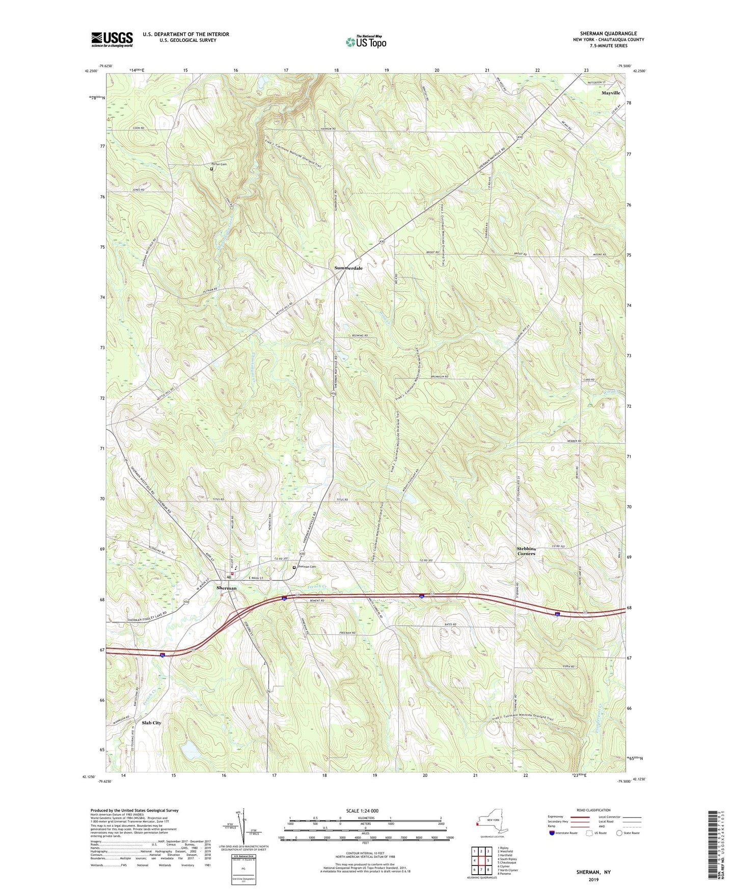
2019 topographic map quadrangle Sherman in the state of New York. Scale: 1:24000. Based on the newly updated USGS 7.5' US Topo map series, this map is in the following counties: Chautauqua. The map contains contour data, water features, and other items you are used to seeing on USGS maps, but also has updated roads and other features. This is the next generation of topographic maps. Printed on high-quality waterproof paper with UV fade-resistant inks.
Quads adjacent to this one:
West: South Ripley
Northwest: Ripley
North: Westfield
Northeast: Hartfield
East: Chautauqua
Southeast: Panama
South: North Clymer
Southwest: Clymer
Contains the following named places: Abundant Life Seventh Day Adventist Church, Central School, Clearview School, First Baptist Church, Main Street Theatre, Minerva Free Library, North Harmony Church, Pleasant View Dairy Farms, Porter Cemetery, Saint Isaac Jogues Church, Sherman, Sherman Assembly of God Church, Sherman Cemetery, Sherman Community Church, Sherman Fire Department Stanley Hose Company, Sherman Post Office, Slab City, State Reforestation Area Chautauqua Number 11, Stebbins Corners, Summerdale, Town of Chautauqua, Town of Sherman, Twin Ponds Airport, Village of Sherman, Village of Sherman Garage, Woodcrest Golf Course, ZIP Codes: 14757, 14781