
MyTopo
South Ripley New York US Topo Map
Couldn't load pickup availability
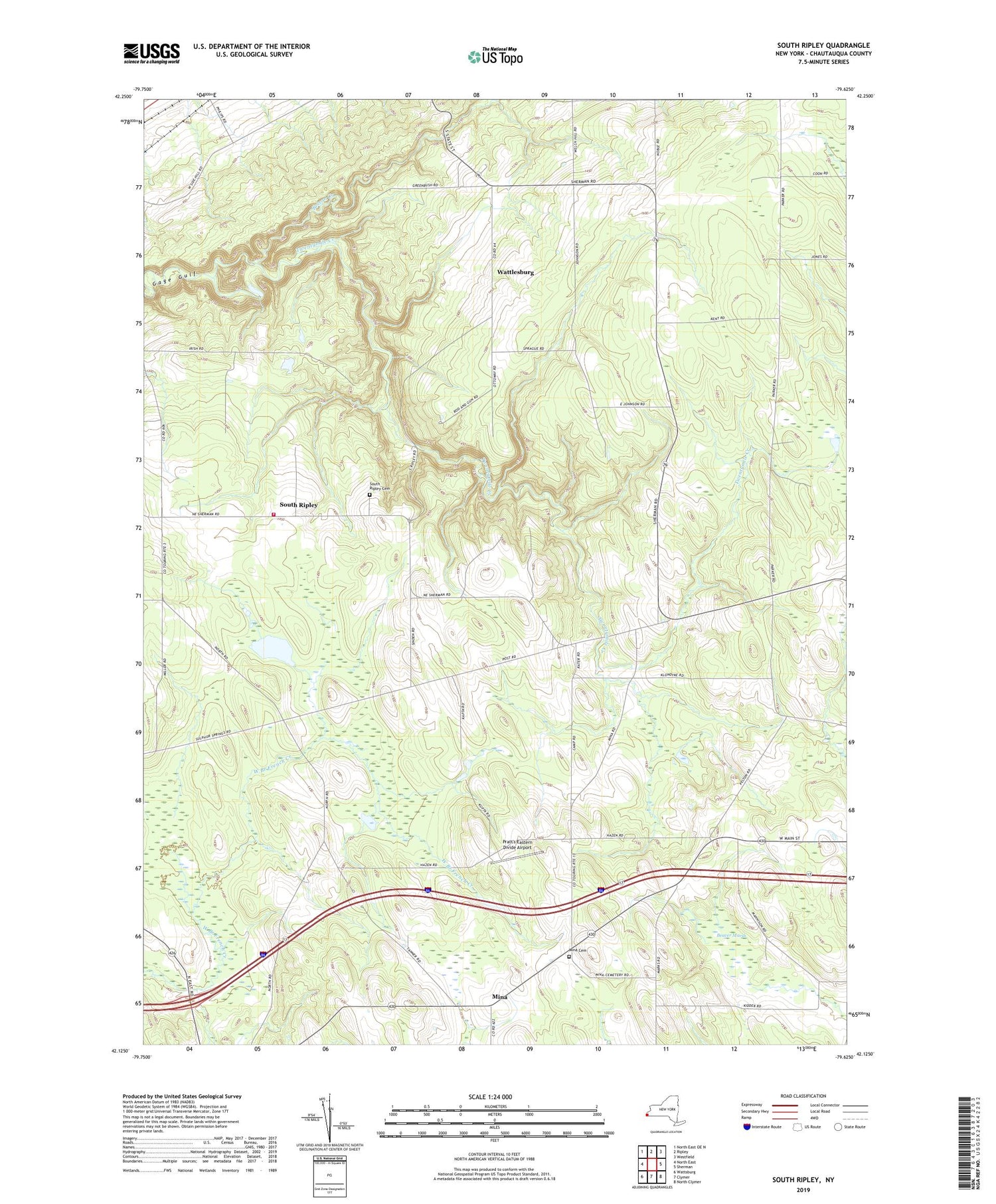
2019 topographic map quadrangle South Ripley in the state of New York. Scale: 1:24000. Based on the newly updated USGS 7.5' US Topo map series, this map is in the following counties: Chautauqua. The map contains contour data, water features, and other items you are used to seeing on USGS maps, but also has updated roads and other features. This is the next generation of topographic maps. Printed on high-quality waterproof paper with UV fade-resistant inks.
Quads adjacent to this one:
West: North East
North: Ripley
Northeast: Westfield
East: Sherman
Southeast: North Clymer
South: Clymer
Southwest: Wattsburg
Contains the following named places: Beaver Marsh, Belson Creek, Blueberry Sky Farm Winery, Christian Missionary Alliance Church, Mina, Mina Cemetery, Minnegar Corners, Pratt's Eastern Divide Airport, Raters Corners, Ripley Fire District Station 2, Sheldon Corners, South Ripley, South Ripley Cemetery, South Ripley Church, Town of Mina, Town of Ripley, Wattlesburg, ZIP Codes: 14736, 14775


