MyTopo
Sprout Brook New York US Topo Map
Couldn't load pickup availability
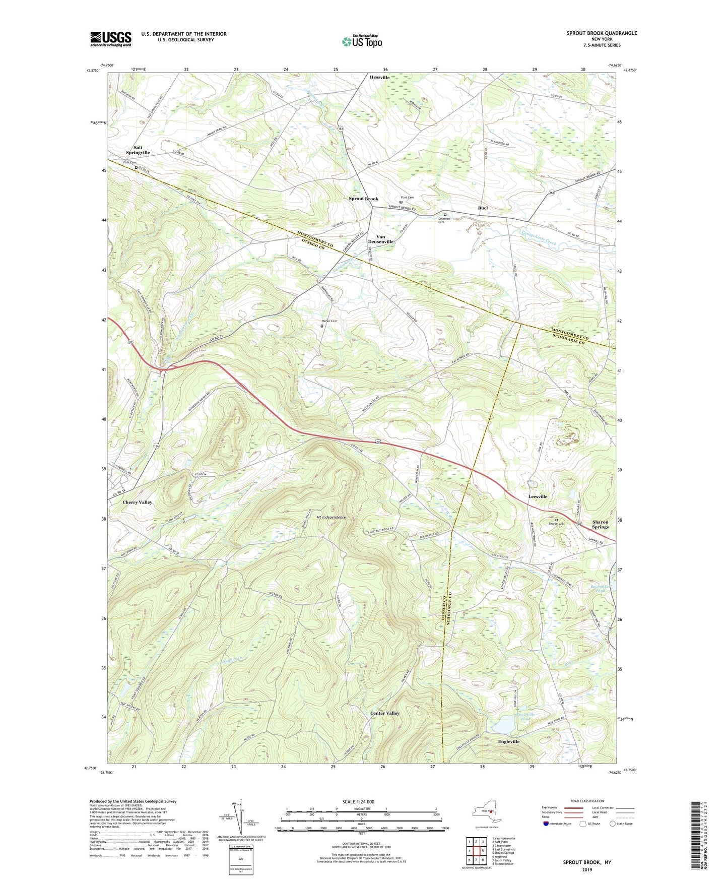
2023 topographic map quadrangle Sprout Brook in the state of New York. Scale: 1:24000. Based on the newly updated USGS 7.5' US Topo map series, this map is in the following counties: Otsego, Montgomery, Schoharie. The map contains contour data, water features, and other items you are used to seeing on USGS maps, but also has updated roads and other features. This is the next generation of topographic maps. Printed on high-quality waterproof paper with UV fade-resistant inks.
Quads adjacent to this one:
West: East Springfield
Northwest: Van Hornesville
North: Fort Plain
Northeast: Canajoharie
East: Sharon Springs
Southeast: Richmondville
South: South Valley
Southwest: Westford
This map covers the same area as the classic USGS quad with code o42074g6.
Contains the following named places: Bowmaker Pond, Bowmans Creek, Boyle's Landing, Buel, Center Valley, Coleman Cemetery, Engleville, Engleville Pond, Flint Cemetery, Hessville, Judds Falls, Leesville, McFee Cemetery, Mount Independence, Saint Thomas Roman Catholic Church, Salt Springville, School Number 12, School Number 13, School Number 14, School Number 2, School Number 3, Sharon Cemetery, Sharon Orchards, Sprout Brook, Stone House Farm, Town of Cherry Valley, Van Deusenville, WJIV-FM (Cherry Valley), ZIP Code: 13320