MyTopo
East Springfield New York US Topo Map
Couldn't load pickup availability
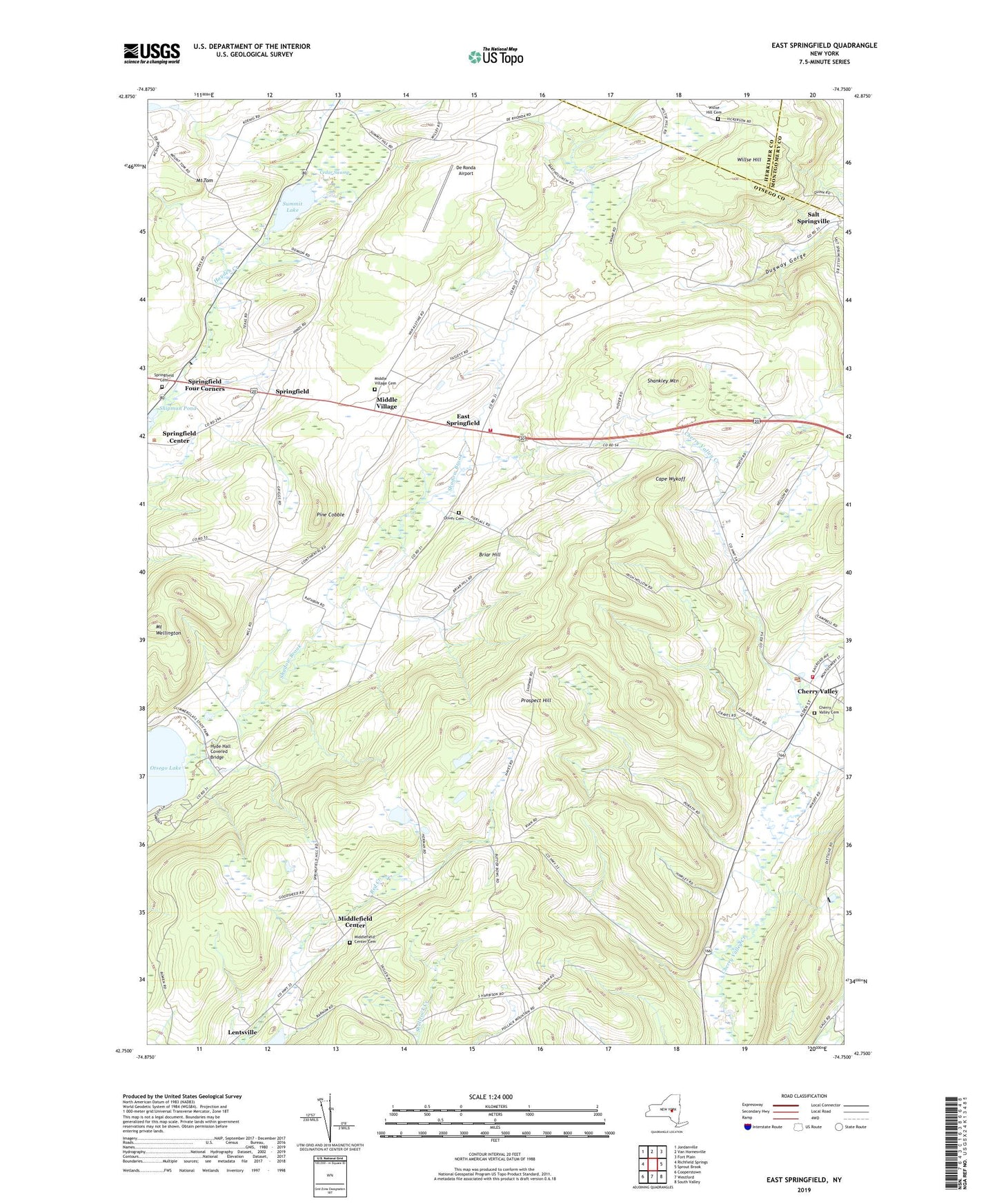
2023 topographic map quadrangle East Springfield in the state of New York. Scale: 1:24000. Based on the newly updated USGS 7.5' US Topo map series, this map is in the following counties: Otsego, Herkimer, Montgomery. The map contains contour data, water features, and other items you are used to seeing on USGS maps, but also has updated roads and other features. This is the next generation of topographic maps. Printed on high-quality waterproof paper with UV fade-resistant inks.
Quads adjacent to this one:
West: Richfield Springs
Northwest: Jordanville
North: Van Hornesville
Northeast: Fort Plain
East: Sprout Brook
Southeast: South Valley
South: Westford
Southwest: Cooperstown
This map covers the same area as the classic USGS quad with code o42074g7.
Contains the following named places: Briar Hill, Cape Wykoff, Cedar Swamp, Cherry Valley, Cherry Valley - Springfield Elementary School, Cherry Valley - Springfield Junior and Senior High School, Cherry Valley Assembly of God, Cherry Valley Cemetery, Cherry Valley Fire District, Cherry Valley Memorial Library, Cherry Valley Post Office, Continental School, Cooperstown Shadow Brook Campground, De Ronda Airport, Dugway Gorge, East Springfield, First Presbyterian Church, Grace Episcopal Church, Hyde Bay, Hyde Hall Covered Bridge, Lentsville, Middle Village, Middle Village Cemetery, Middlefield Center, Middlefield Center Cemetery, Mount Tom, Mount Wellington, Oliver Cemetery, Pine Cobble, Prospect Hill, School Number 9, Shadow Brook, Shankley Mountain, Shipman Pond, Springfield, Springfield Cemetery, Springfield Center Census Designated Place, Springfield Church, Springfield Four Corners, Springfield Volunteer Fire Department Station 1, Stanley School, Summit Lake, Town of Springfield, Village of Cherry Valley, Watercolor Airport, Willse Hill Cemetery, ZIP Codes: 13333, 13468