MyTopo
Tomhannock New York US Topo Map
Couldn't load pickup availability
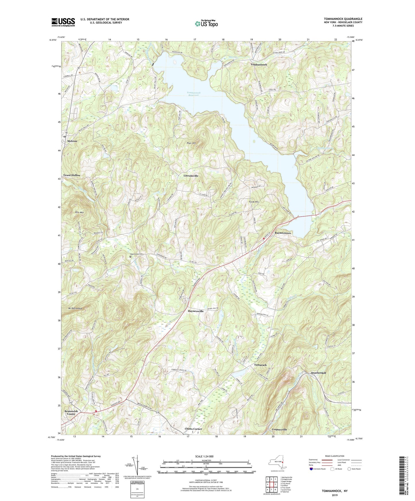
2019 topographic map quadrangle Tomhannock in the state of New York. Scale: 1:24000. Based on the newly updated USGS 7.5' US Topo map series, this map is in the following counties: Rensselaer. The map contains contour data, water features, and other items you are used to seeing on USGS maps, but also has updated roads and other features. This is the next generation of topographic maps. Printed on high-quality waterproof paper with UV fade-resistant inks.
Quads adjacent to this one:
West: Troy North
Northwest: Mechanicville
North: Schaghticoke
Northeast: Eagle Bridge
East: Grafton
Southeast: Taborton
South: Averill Park
Southwest: Troy South
Contains the following named places: Bornt Family Farms, Brunswick Center, Brunswick Town Hall, Center Brunswick United Methodist Church, Center Brunswick Volunteer Fire House, Clums Corner, Fords Hill, Gilead Lutheran Church, Gooseberry Honey And Herb Farm, Haynersville, Herrington Farms, Hillside Organic Farm, Indian Creek, Kingdom Hall of Jehovahs Witnesses, Lincolnville, Maplewood Cemetery, Melrose, Melrose Post Office, Misty Hills Farm, Mount Rafinesque, Mountain Gardens Tree Farm, Otter Creek, Piser Hill, Quackenkill, Quackenkill Sandstone Quarry, Raymertown, Raymertown Fire District, Rice Mountain, Schaghticoke Town Hall, School Number 12, School Number 4, School Number 5, School Number 6, Sunkauissia Creek, Tamarac Elementary School, Tamarac Secondary School, Tamarack, Tarbox Farms, Terrace Haven Mobile Home Park, Tomhannock, Tomhannock Reservoir, Town of Brunswick, Town of Pittstown, Viewmere Farm, ZIP Codes: 12121, 12185