MyTopo
Grafton New York US Topo Map
Couldn't load pickup availability
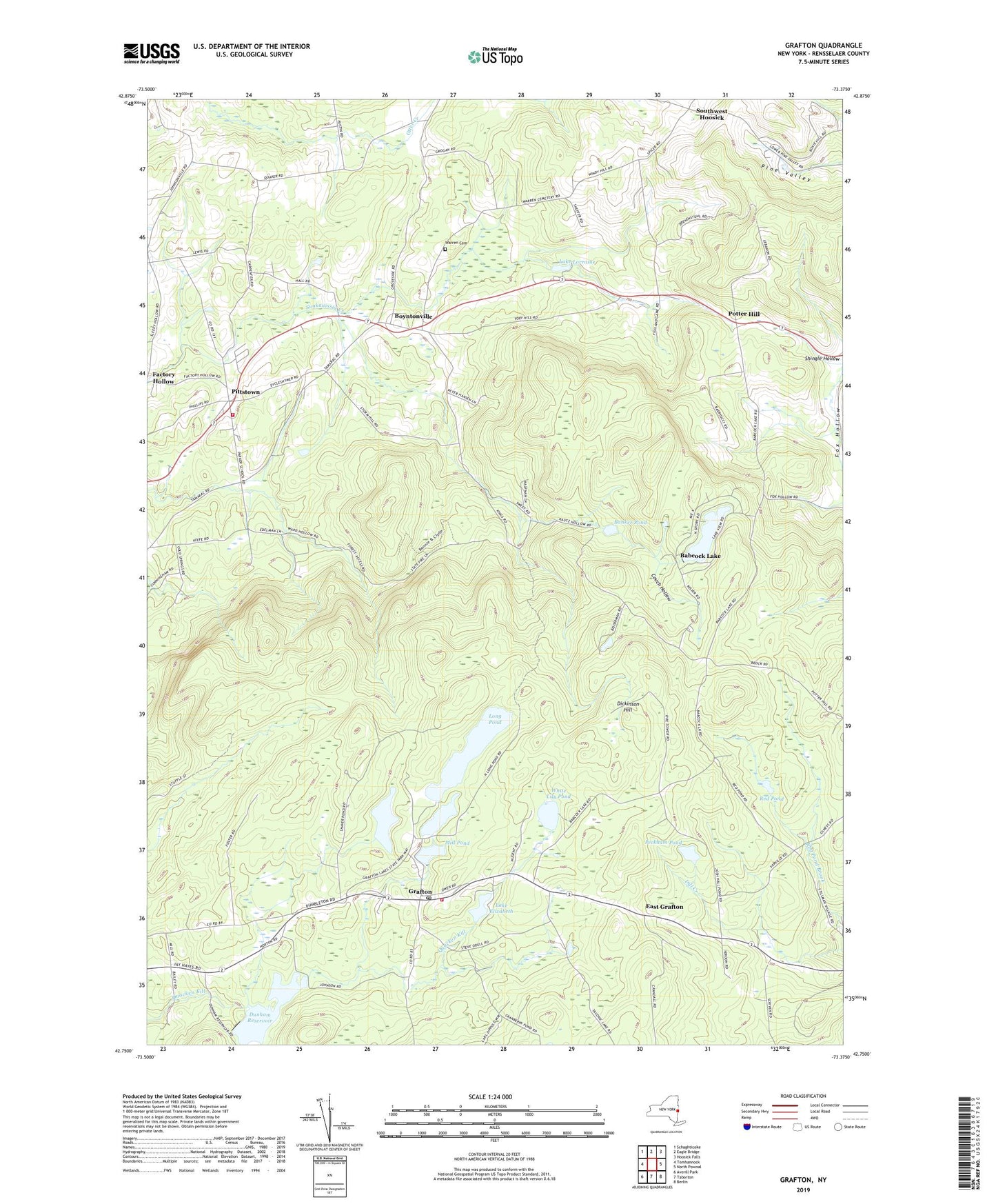
2023 topographic map quadrangle Grafton in the state of New York. Scale: 1:24000. Based on the newly updated USGS 7.5' US Topo map series, this map is in the following counties: Rensselaer. The map contains contour data, water features, and other items you are used to seeing on USGS maps, but also has updated roads and other features. This is the next generation of topographic maps. Printed on high-quality waterproof paper with UV fade-resistant inks.
Quads adjacent to this one:
West: Tomhannock
Northwest: Schaghticoke
North: Eagle Bridge
Northeast: Hoosick Falls
Southeast: Berlin
South: Taborton
Southwest: Averill Park
This map covers the same area as the classic USGS quad with code o42073g4.
Contains the following named places: Babcock Lake, Banker Pond, Boyntonville, Camp Yowochas, Cobb School, Couch Hollow, Dickinson Hill, Dunham Reservoir, East Grafton, Factory Hollow, Fox Hollow, Grafton, Grafton Elementary School, Grafton Post Office, Grafton United Methodist Church, Grafton Volunteer Fire Company, Groveside School, Lake Elizabeth, Lake Lorraine, Long Pond, Mill Pond, Mountain Chapel Church, Peckham Pond, Pittstown, Pittstown United Methodist Church, Pittstown Volunteer Emergency Corps, Pittstown Volunteer Fire Department, Potter Hill, Red Pond, Saint Georges Church, Saint John Francis Regis Catholic Church, School Number 5, Second Pond, Shaver Pond, South District School, Southwest Hoosick, Town of Grafton, Ward Hollow, Warren Cemetery, White Lily Pond, ZIP Code: 12052