MyTopo
Eagle Bridge New York US Topo Map
Couldn't load pickup availability
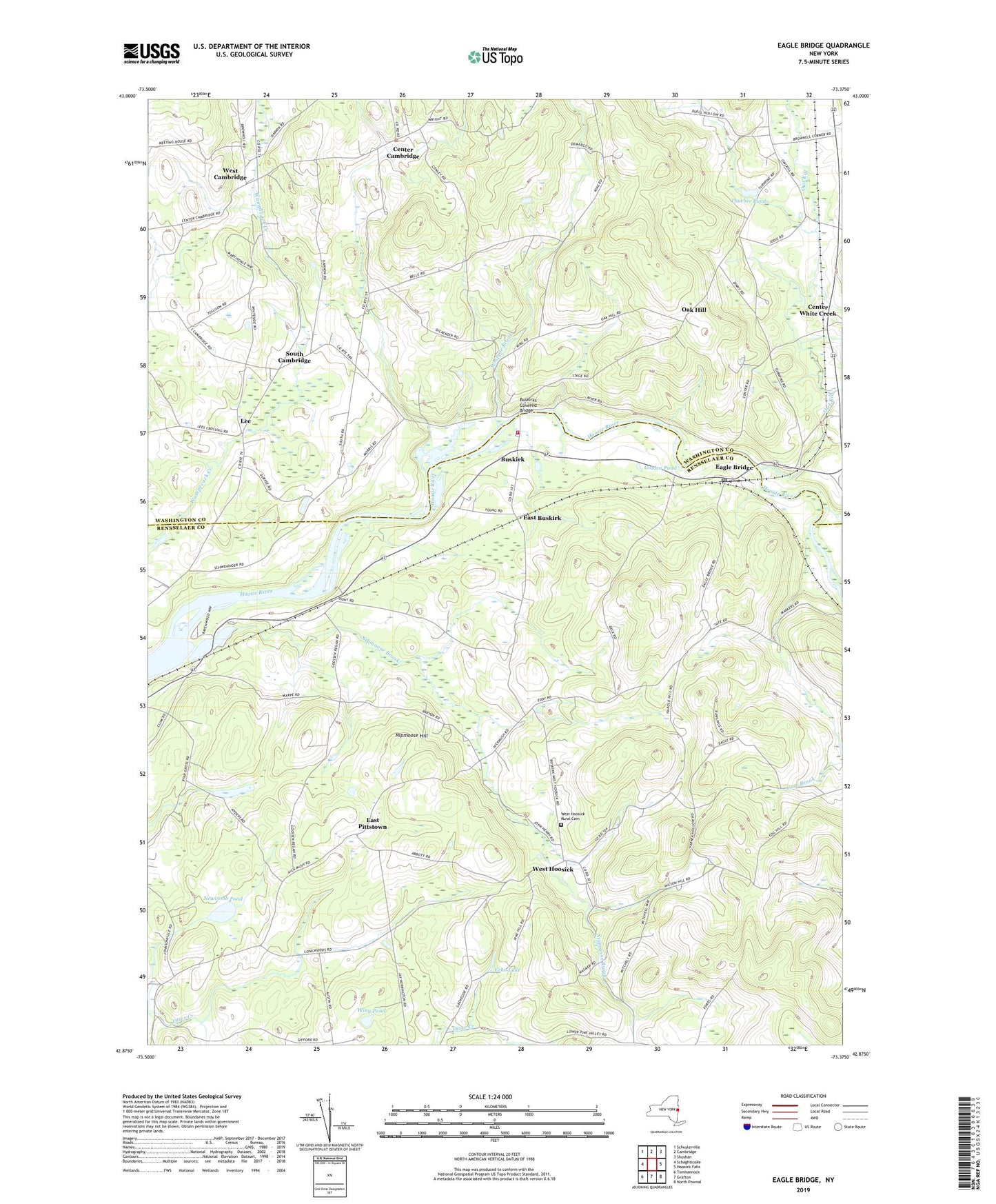
2023 topographic map quadrangle Eagle Bridge in the state of New York. Scale: 1:24000. Based on the newly updated USGS 7.5' US Topo map series, this map is in the following counties: Rensselaer, Washington. The map contains contour data, water features, and other items you are used to seeing on USGS maps, but also has updated roads and other features. This is the next generation of topographic maps. Printed on high-quality waterproof paper with UV fade-resistant inks.
Quads adjacent to this one:
West: Schaghticoke
Northwest: Schuylerville
North: Cambridge
Northeast: Shushan
East: Hoosick Falls
South: Grafton
Southwest: Tomhannock
This map covers the same area as the classic USGS quad with code o42073h4.
Contains the following named places: Buskirk, Buskirk Reformed Church, Buskirk Volunteer Fire Department, Buskirks Covered Bridge, Case Brook, Center Cambridge, Center White Creek, Diamondwood Estates, Eagle Bridge, Eagle Bridge Post Office, East Buskirk, East Pittstown, Echo Lake, Golden Pond, Lee, Moseleys Airport, Newcomb Pond, Nipmoose Brook, Nipmoose Hill, Oak Hill, Owl Kill, Passing Fancy Farm, Pencil Brook, School Number 3, School Number 4, South Cambridge, Stannard Farm, Thurber Pond, West Cambridge, West Hoosick, West Hoosick Baptist Church, West Hoosick Rural Cemetery, Whipple Brook, Whiteside Church, Wing Pond, WNGN-FM (Hoosick Falls), ZIP Codes: 12028, 12094