MyTopo
Alpine New York US Topo Map
Couldn't load pickup availability
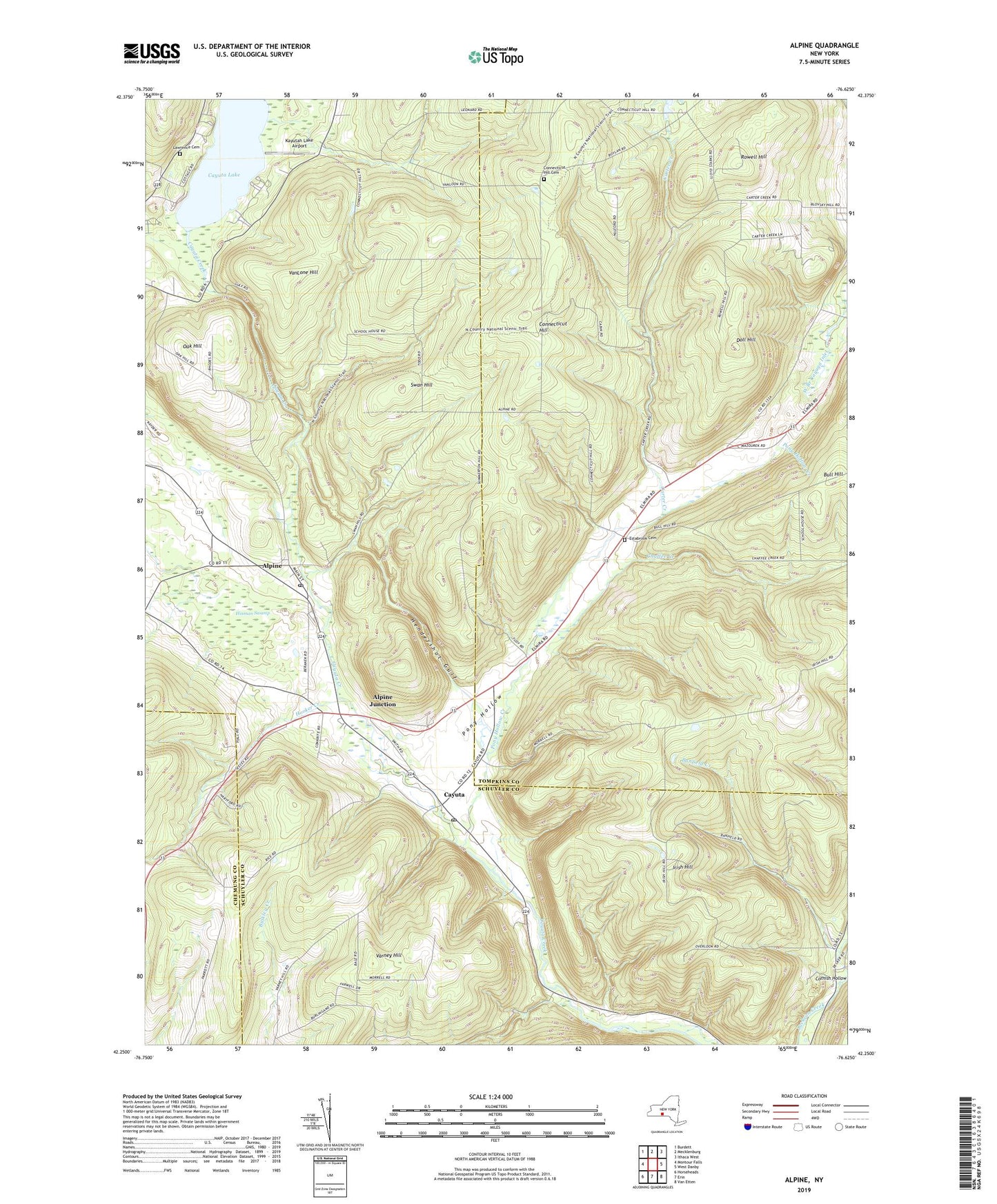
2023 topographic map quadrangle Alpine in the state of New York. Scale: 1:24000. Based on the newly updated USGS 7.5' US Topo map series, this map is in the following counties: Schuyler, Tompkins, Chemung. The map contains contour data, water features, and other items you are used to seeing on USGS maps, but also has updated roads and other features. This is the next generation of topographic maps. Printed on high-quality waterproof paper with UV fade-resistant inks.
Quads adjacent to this one:
West: Montour Falls
Northwest: Burdett
North: Mecklenburg
Northeast: Ithaca West
East: West Danby
Southeast: Van Etten
South: Erin
Southwest: Horseheads
This map covers the same area as the classic USGS quad with code o42076c6.
Contains the following named places: Alpine, Alpine Junction, Alpine Post Office, Banfield Creek, Bible Baptist Fellowship, Carter Creek, Cayuta, Cayuta Lake, Cayuta Post Office, Chaffee Creek, Cliffside State Forest, Connecticut Hill Cemetery, Connecticut Hill State Game Management Area, Cool Lea Campground, Cornish Hollow, Doll Hill, Estabrook Cemetery, Hendershot Gulf, Hinman Swamp, Hooker Creek, Irish Hill, Kayutah Lake Airport, Lawrence Cemetery, Lawrence Memorial Chapel, Newfield State Forest, Oak Hill, Pony Hollow, Pony Hollow Creek, Rowell Hill, Swan Hill, The Gulf, Town of Catharine, Town of Cayuta, VanLone Hill, Varney Hill, Wildwood Mobile Home Park, ZIP Codes: 14805, 14824