MyTopo
West Almond New York US Topo Map
Couldn't load pickup availability
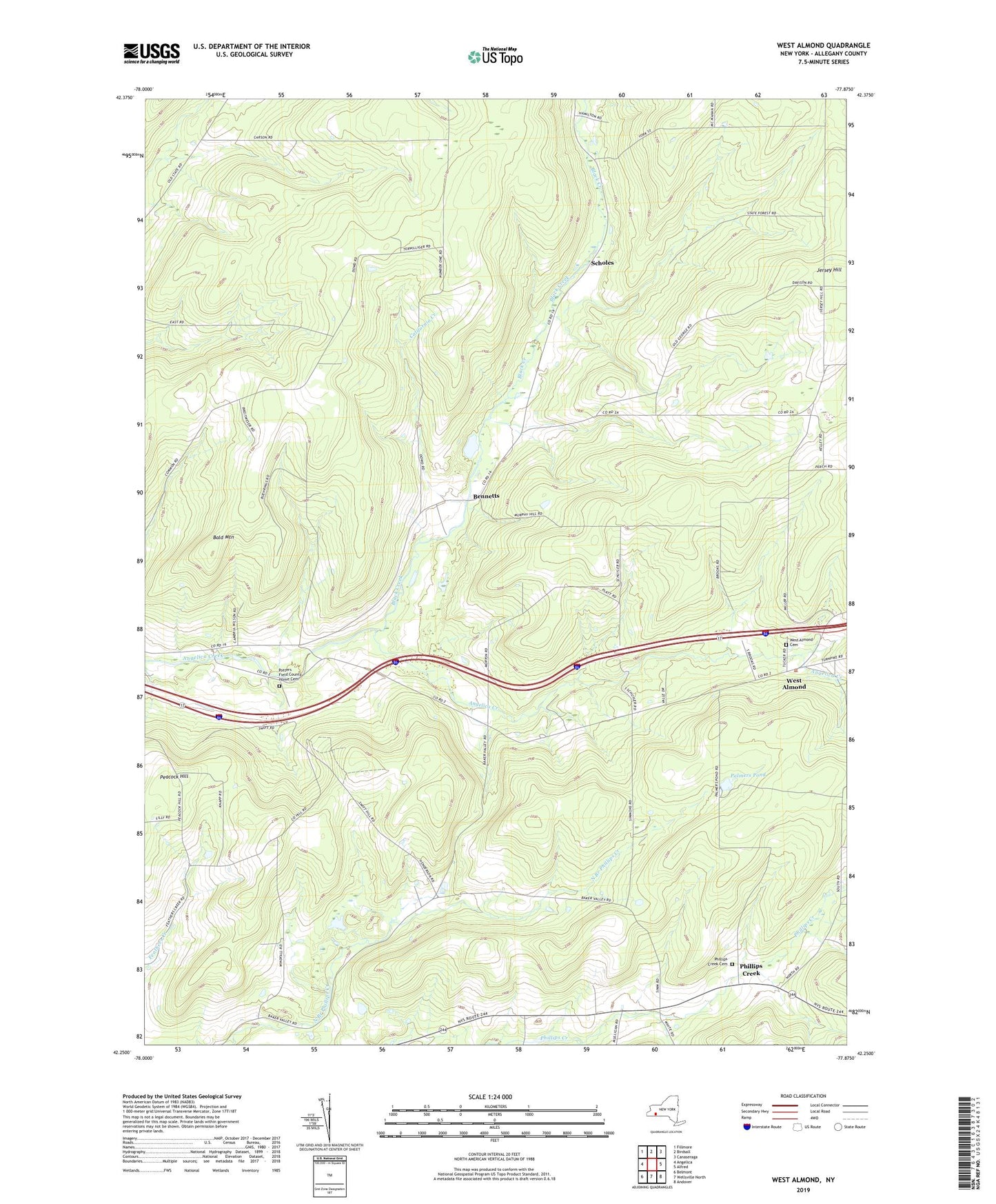
2019 topographic map quadrangle West Almond in the state of New York. Scale: 1:24000. Based on the newly updated USGS 7.5' US Topo map series, this map is in the following counties: Allegany. The map contains contour data, water features, and other items you are used to seeing on USGS maps, but also has updated roads and other features. This is the next generation of topographic maps. Printed on high-quality waterproof paper with UV fade-resistant inks.
Quads adjacent to this one:
West: Angelica
Northwest: Fillmore
North: Birdsall
Northeast: Canaseraga
East: Alfred
Southeast: Andover
South: Wellsville North
Southwest: Belmont
Contains the following named places: Bainbridge Family Farm, Bald Mountain, Bennetts, Black Creek, Black Creek School, California Creek, Jersey Hill School, Palmers Pond, Peacock Hill, Phillips Creek, Phillips Creek Cemetery, Potters Field County Home Cemetery, Scholes, School Number 1, School Number 2, School Number 3, School Number 4, School Number 6, School Number 7, School Number 8, Shadows Pond, Town of West Almond, West Almond, West Almond Cemetery, ZIP Codes: 14709, 14813