MyTopo
Canaseraga New York US Topo Map
Couldn't load pickup availability
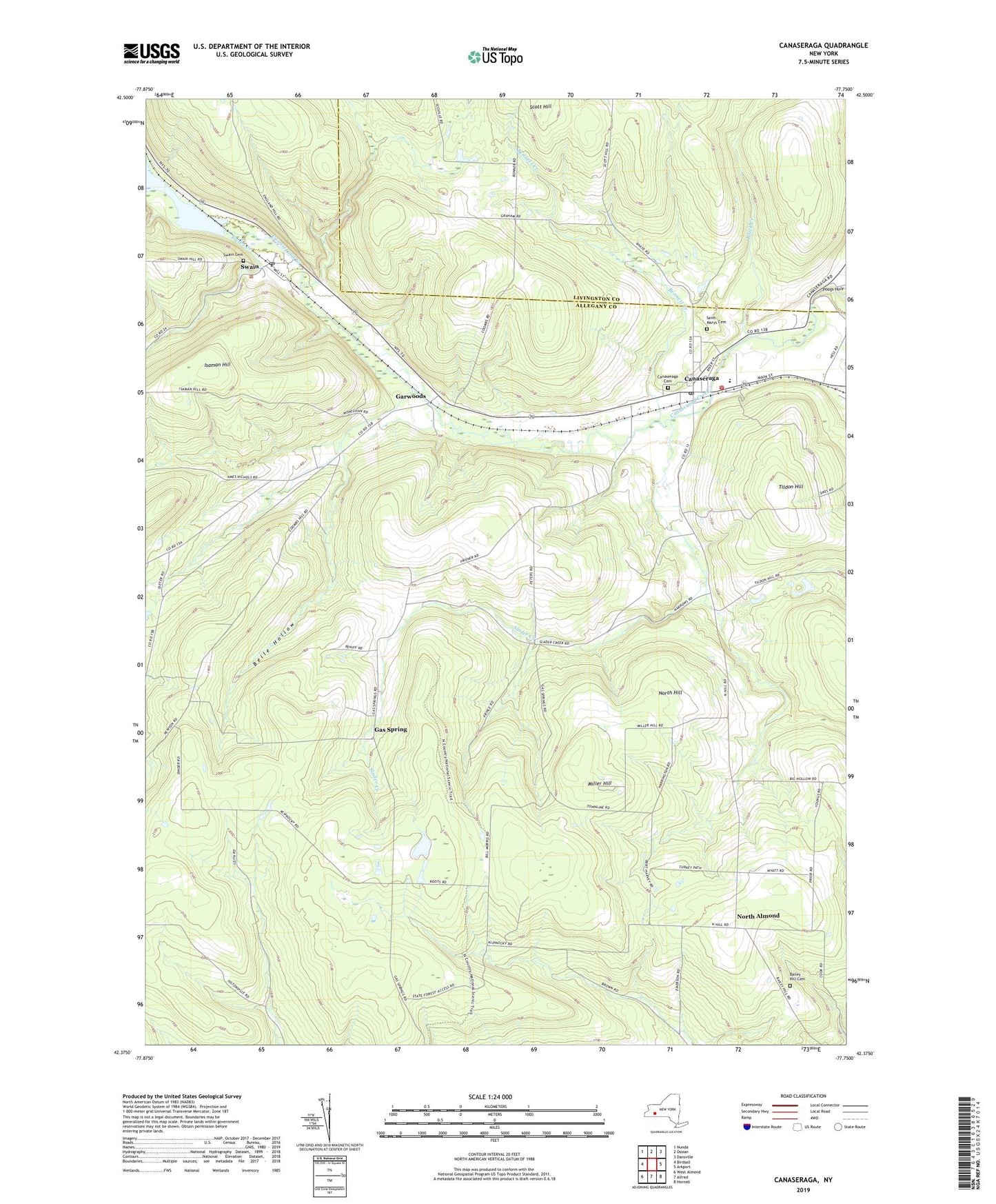
2023 topographic map quadrangle Canaseraga in the state of New York. Scale: 1:24000. Based on the newly updated USGS 7.5' US Topo map series, this map is in the following counties: Allegany, Livingston. The map contains contour data, water features, and other items you are used to seeing on USGS maps, but also has updated roads and other features. This is the next generation of topographic maps. Printed on high-quality waterproof paper with UV fade-resistant inks.
Quads adjacent to this one:
West: Birdsall
Northwest: Nunda
North: Ossian
Northeast: Dansville
East: Arkport
Southeast: Hornell
South: Alfred
Southwest: West Almond
This map covers the same area as the classic USGS quad with code o42077d7.
Contains the following named places: Bailey Hill Cemetery, Belle Hollow, Bennett Creek, Black Creek, Canaseraga, Canaseraga Cemetery, Canaseraga Fire Company, Canaseraga Four Corners Historic District, Canaseraga Post Office, Central School, Essential Club Free Library, Ewart Creek, Gardwoods United Methodist Church, Garwoods, Gas Spring, Grove, Hovey Gully, Isaman Hill, Masters Tabernacle Church, Mastin Corners, Miller Hill, New Michigan School, North Almond, North Hill, Saint Marys Cemetery, Saint Mary's Church, School Number 4, School Number 6, Scott Hill, Slader Creek, Swain, Swain Cemetery, Swain Post Office, Tildon Hill, Town of Burns, Valley Wesleyan Church, Village of Canaseraga, World Mission Fellowship, ZIP Code: 14822