MyTopo
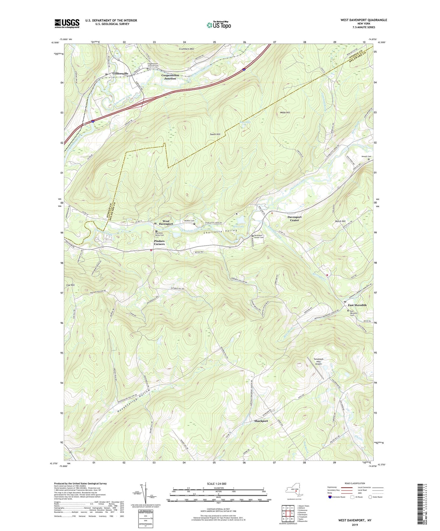
West Davenport New York US Topo Map
Couldn't load pickup availability
2019 topographic map quadrangle West Davenport in the state of New York. Scale: 1:24000. Based on the newly updated USGS 7.5' US Topo map series, this map is in the following counties: Delaware, Otsego. The map contains contour data, water features, and other items you are used to seeing on USGS maps, but also has updated roads and other features. This is the next generation of topographic maps. Printed on high-quality waterproof paper with UV fade-resistant inks.
Quads adjacent to this one:
West: Oneonta
Northwest: Mount Vision
North: Milford
Northeast: Schenevus
East: Davenport
Southeast: Bloomville
South: Delhi
Southwest: Treadwell
Contains the following named places: Alcott Trailer Park, Charlotte Valley Cemetery, Coe Hill School, Colliersville, Colliersville Post Office, Cooperstown Junction, Cooperstown Junction Cemetery, Cooperstown Medical Transport, Crawford Brook, Davenport Center, Davenport Center Cemetery, Davenport Center Census Designated Place, Dona Brook, Dutch Hill, East Meredith, East Meredith Cemetery, East Meredith Fire Department, East Meredith Post Office, East Meredith Presbyterian Church, Hanford Mills Museum, Houghtaling Hollow, Kortright Creek, McMinn Cemetery, Mine Brook, Mud Lake, Newell Cemetery, Pindars Corners, Pindars Corners Volunteer Fire Department, Pine Lake, Prosser Hollow, Prosser Hollow School, Pumpkin Hollow, Schenevus Creek, School Number 12, School Number 14, School Number 16, School Number 17, School Number 2, School Number 3, School Number 4, Shackport, Tomahawk Hills Airport, Town of Davenport, Webb Hill, West Davenport, West Davenport Post Office, Word of Faith Church, ZIP Codes: 13751, 13757, 13806, 13860