MyTopo
Davenport New York US Topo Map
Couldn't load pickup availability
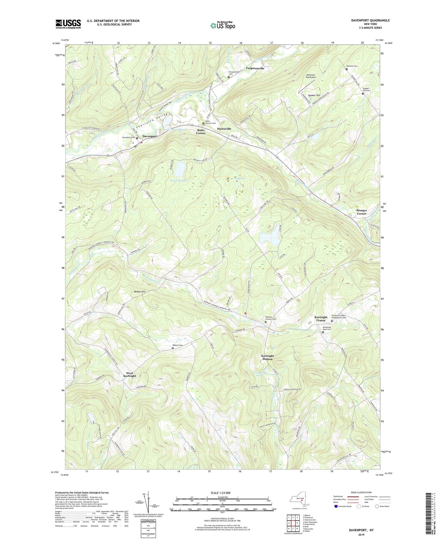
2023 topographic map quadrangle Davenport in the state of New York. Scale: 1:24000. Based on the newly updated USGS 7.5' US Topo map series, this map is in the following counties: Delaware, Otsego. The map contains contour data, water features, and other items you are used to seeing on USGS maps, but also has updated roads and other features. This is the next generation of topographic maps. Printed on high-quality waterproof paper with UV fade-resistant inks.
Quads adjacent to this one:
West: West Davenport
Northwest: Milford
North: Schenevus
Northeast: Charlotteville
East: Harpersfield
Southeast: Hobart
South: Bloomville
Southwest: Delhi
This map covers the same area as the classic USGS quad with code o42074d7.
Contains the following named places: Beaver Spring Pond, Beaver Springs Mobile Home Park, Bennett Cemetery, Blakely Cemetery, Bloomville Volunteer Fire Department Station 2, Braehead Road Cemetery, Butts Corner, Butts Corners Cemetery, Center Brook, Charlotte Valley School, Creamery Pond, Davenport, Davenport Cemetery, Davenport Fire Department, Davenport Post Office, Davenport Presbyterian Church, Doonan Corners, Doonans Corners Cemetery, Fergusonville, Fergusonville Cemetery, Gilchrist United Presbyterian Cemetery, Hoseaville, Keyser Brook, Kortright Center, Kortright Station, McKee Hill, Middle Brook, Mountain Top Airport, Mud Lake, Negro Brook, Quaker Hill, Quaker Hill Cemetery, School Number 1, School Number 12, School Number 13, School Number 7, Sexsmith Lake, Skate Creek Farm, Stone And Thistle Farm, Sturges Corner, Tedle Brook, Town of Kortright, United Methodist Church of Davenport, WDHI-FM (Delhi), West Kortright, ZIP Code: 13750