MyTopo
Bloomville New York US Topo Map
Couldn't load pickup availability
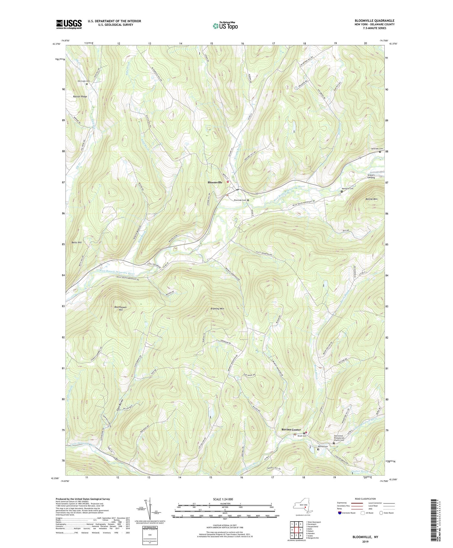
2023 topographic map quadrangle Bloomville in the state of New York. Scale: 1:24000. Based on the newly updated USGS 7.5' US Topo map series, this map is in the following counties: Delaware. The map contains contour data, water features, and other items you are used to seeing on USGS maps, but also has updated roads and other features. This is the next generation of topographic maps. Printed on high-quality waterproof paper with UV fade-resistant inks.
Quads adjacent to this one:
West: Delhi
Northwest: West Davenport
North: Davenport
Northeast: Harpersfield
East: Hobart
Southeast: Margaretville
South: Andes
Southwest: Hamden
This map covers the same area as the classic USGS quad with code o42074c7.
Contains the following named places: Betts Hill, Bloomville, Bloomville Census Designated Place, Bloomville Post Office, Bloomville United Methodist Church, Bloomville Volunteer Fire Department Station 1, Boomhower Hill, Bovina Cemetery, Bovina Center, Bovina Center CPO, Bovina Public Library, Bovina United Presbyterian Church, Bovina Volunteer Fire Department, Bramley Mountain, Bramley Mountain Farm, Bramley Mountain School, Brush Brook, Brush Cemetery, Byebrook Farm, Coulter Brook, Dry Brook, Elk Creek Cemetery, Federal Hill School, Glen Burnie, Glen Burnie School, Grace's Landing, High Meadows Farm, Kidd Brook, Kiff Brook, Maple Shade Farm, Miller Avenue School, Old United Presbyterian Church Cemetery, Pink Street School, Riverside Cemetery, Rose Brook, Sackrider Cemetery, School Number 1, School Number 2, Town of Bovina, Wetmore Cemetery, Wright Brook, ZIP Codes: 13739, 13740