MyTopo
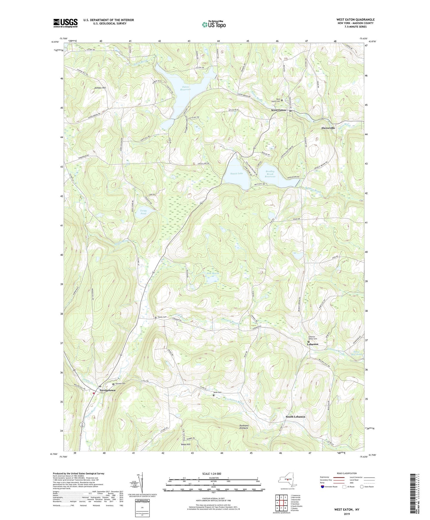
West Eaton New York US Topo Map
Couldn't load pickup availability
2019 topographic map quadrangle West Eaton in the state of New York. Scale: 1:24000. Based on the newly updated USGS 7.5' US Topo map series, this map is in the following counties: Madison. The map contains contour data, water features, and other items you are used to seeing on USGS maps, but also has updated roads and other features. This is the next generation of topographic maps. Printed on high-quality waterproof paper with UV fade-resistant inks.
Quads adjacent to this one:
West: Erieville
Northwest: Cazenovia
North: Morrisville
Northeast: Munnsville
East: Hamilton
Southeast: Earlville
South: Otselic
Southwest: South Otselic
Contains the following named places: Bradley Brook Reservoir, Dunhams Pinnacle, Eaton Reservoir, Fisk Marsh, Georgetown, Georgetown Post Office, Georgetown Station, Hatch Lake, Hawks Cemetery, Hillside Cemetery, Jackass Hill, Jackass Hills Farms, Lebanon, Lebanon Federated Church, Lebanon Valley Cemetery, Niles Cemetery, Otselic Creek, Otselic Valley Elementary School, Pierceville, School Number 1, South Lebanon, Texas Hill, Torpy Pond, Town of Georgetown, West Eaton, West Eaton Cemetery, West Eaton Post Office, West Eaton Volunteer Ambulance Corps, ZIP Codes: 13334, 13484