MyTopo
Erieville New York US Topo Map
Couldn't load pickup availability
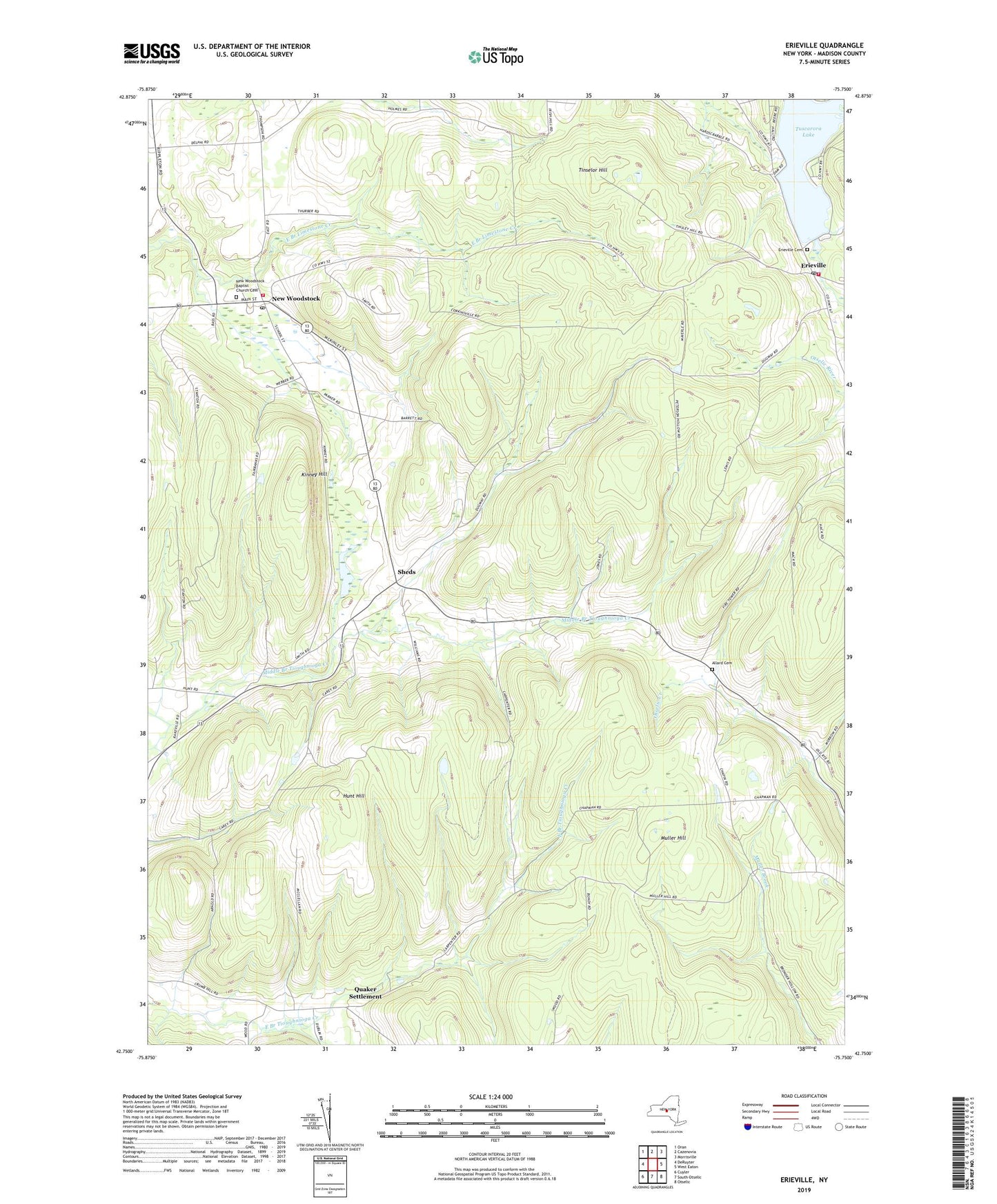
2023 topographic map quadrangle Erieville in the state of New York. Scale: 1:24000. Based on the newly updated USGS 7.5' US Topo map series, this map is in the following counties: Madison. The map contains contour data, water features, and other items you are used to seeing on USGS maps, but also has updated roads and other features. This is the next generation of topographic maps. Printed on high-quality waterproof paper with UV fade-resistant inks.
Quads adjacent to this one:
West: DeRuyter
Northwest: Oran
North: Cazenovia
Northeast: Morrisville
East: West Eaton
Southeast: Otselic
South: South Otselic
Southwest: Cuyler
This map covers the same area as the classic USGS quad with code o42075g7.
Contains the following named places: Allard Cemetery, Delphi Station, Erieville, Erieville Cemetery, Erieville Fire Department, Erieville Post Office, Hunt Hill, Kinney Hill, Muller Hill, New Woodstock, New Woodstock Baptist Church Cemetery, New Woodstock Free Library, New Woodstock Post Office, New Woodstock Volunteer Fire and Rescue, Pleasant Valley, Quaker Settlement, School Number 1, School Number 7, Shawdowfax Farm, Sheds, Sheds Corners, Tinselor Hill, Town of DeRuyter, Tuscarora Lake, Wibert School, WVOA-FM (Deruyter), ZIP Codes: 13061, 13072, 13122