MyTopo
Otselic New York US Topo Map
Couldn't load pickup availability
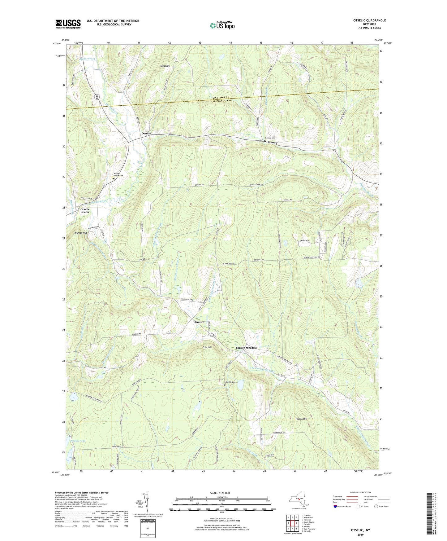
2023 topographic map quadrangle Otselic in the state of New York. Scale: 1:24000. Based on the newly updated USGS 7.5' US Topo map series, this map is in the following counties: Chenango, Madison. The map contains contour data, water features, and other items you are used to seeing on USGS maps, but also has updated roads and other features. This is the next generation of topographic maps. Printed on high-quality waterproof paper with UV fade-resistant inks.
Quads adjacent to this one:
West: South Otselic
Northwest: Erieville
North: West Eaton
Northeast: Hamilton
East: Earlville
Southeast: Norwich
South: East Pharsalia
Southwest: Pitcher
This map covers the same area as the classic USGS quad with code o42075f6.
Contains the following named places: Alder Meadow Brook, Beaver Meadow, Bonney, Bonney Cemetery, Coit Brook, Cole Hill, Cole Hill Cemetery, Mann Brook, Maple Grove Cemetery, Middletown Brook, Muller Brook, Otselic, Otselic Center, Perkins Pond, Pharsalia Game Refuge, Pigeon Hill, School Number 1, School Number 14, School Number 2, School Number 6, Stanbro, Town of Otselic, West Smyrna Baptist Church, ZIP Code: 13832