MyTopo
Williamstown New York US Topo Map
Couldn't load pickup availability
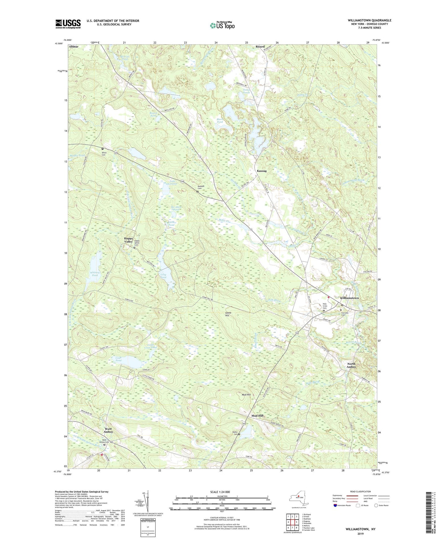
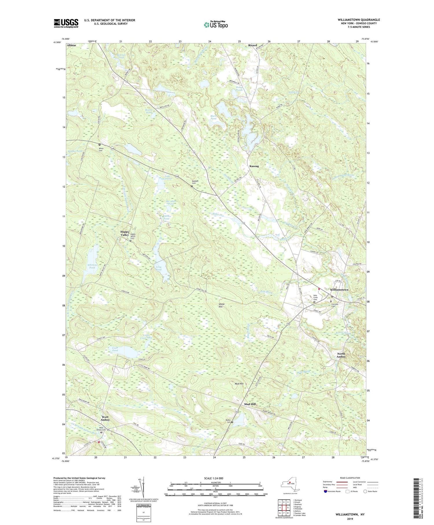
2019 topographic map quadrangle Williamstown in the state of New York. Scale: 1:24000. Based on the newly updated USGS 7.5' US Topo map series, this map is in the following counties: Oswego. The map contains contour data, water features, and other items you are used to seeing on USGS maps, but also has updated roads and other features. This is the next generation of topographic maps. Printed on high-quality waterproof paper with UV fade-resistant inks.
Quads adjacent to this one:
West: Dugway
Northwest: Richland
North: Orwell
Northeast: Redfield
East: Westdale
Southeast: Camden West
South: Panther Lake
Southwest: Mallory
Contains the following named places: Bass Lake, Bethel Church, Black Pond, Bud Lee Pond, Butler Cemetery, Camp Twelve Pines, Camp Zerbe, Checkered House, Coan Pond, Edick Pond, Fairview Cemetery, Gardner Creek, Green Pond, Happy Valley, Happy Valley Cemetery, Happy Valley State Wildlife Management Area, Holy Cross Cemetery, Ike Allen Pond, Indian Camp Brook, Kasoag, Kasoag Lake, Lake Loraine, Little Coan Pond, Long Pond, Madison Cemetery, Miller Creek, Mud Hill, Negro Pond, North Amboy, Poth Brook, Potter Creek, Ricard, Round Pond, Rowell Brook, Schader Farm, School Number 1, School Number 11, School Number 2, School Number 3, School Number 4, School Number 5, School Number 6, School Number 7, Sisley Ponds, Stone Hill, Town of Amboy, Town of Williamstown, Trout Pond, Wells Brook, West Amboy, West Amboy Cemetery, West Amboy Volunteer Fire Department, White Cemetery, Whitney Pond, Williamstown, Williamstown Church of Christ, Williamstown Elementary School, Williamstown Post Office, Williamstown Volunteer Fire Department, ZIP Codes: 13302, 13493