MyTopo
Willsboro New York US Topo Map
Couldn't load pickup availability
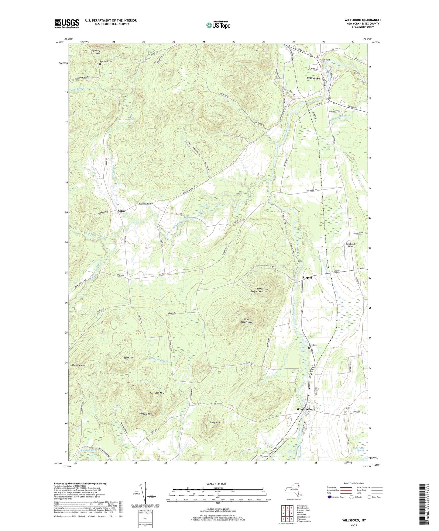
2019 topographic map quadrangle Willsboro in the state of New York. Scale: 1:24000. Based on the newly updated USGS 7.5' US Topo map series, this map is in the following counties: Essex. The map contains contour data, water features, and other items you are used to seeing on USGS maps, but also has updated roads and other features. This is the next generation of topographic maps. Printed on high-quality waterproof paper with UV fade-resistant inks.
Quads adjacent to this one:
West: Lewis
Northwest: Clintonville
North: Port Douglass
Northeast: Juniper Island
East: Charlotte
Southeast: Vergennes West
South: Westport
Southwest: Elizabethtown
Contains the following named places: Beaver Brook, Boardman Cemetery, Bonebender Airport, Boquet, Brookfield Church, Burt Cemetery, Cold Brook, Essex Station, Ferguson Mountain, Foot Hills Baptist Church, Guilderland Cemetery, Harvest Hill Farm, North Boquet Mountain, North Branch Boquet River, Paine Memorial Free Library, Payne Mountain, Reber, Richter Aero Airport, Saint Philip of Jesus Church, South Boquet Mountain, Sprig Mountain, Spruce Mill Brook, Sunset Airport, Town of Essex, Webb Royce Swamp, Whallonsburg, Whallonsburg Volunteer Fire Department, Whippie Mountain, Willsboro, Willsboro Census Designated Place, Willsboro Congregational Church of Christ, Willsboro Fire Department, Willsboro Post Office, Willsboro United Methodist Church, Willsboro Wastewater Treatment Facility, ZIP Codes: 12936, 12996