MyTopo
Willseyville New York US Topo Map
Couldn't load pickup availability
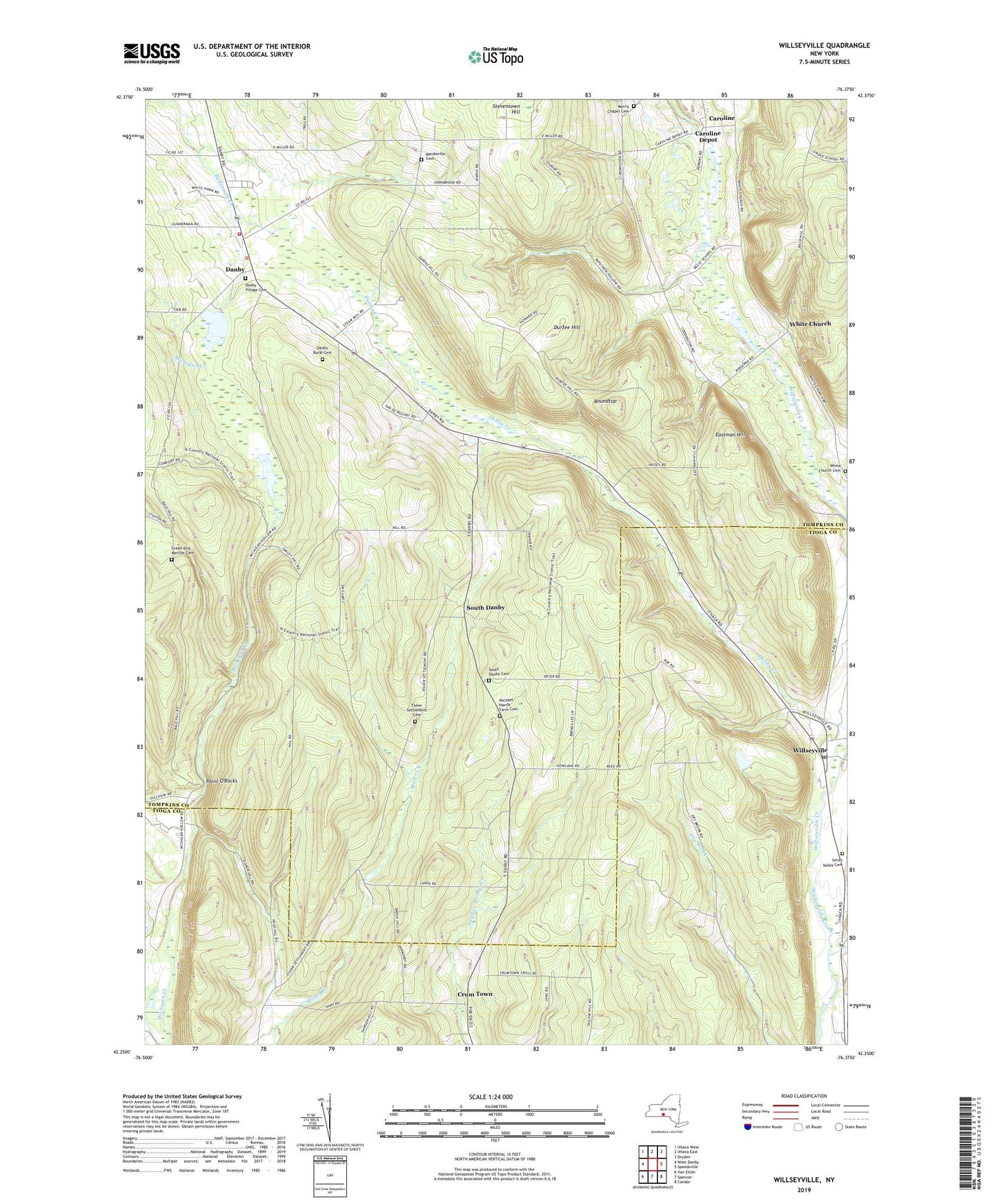
2019 topographic map quadrangle Willseyville in the state of New York. Scale: 1:24000. Based on the newly updated USGS 7.5' US Topo map series, this map is in the following counties: Tompkins, Tioga. The map contains contour data, water features, and other items you are used to seeing on USGS maps, but also has updated roads and other features. This is the next generation of topographic maps. Printed on high-quality waterproof paper with UV fade-resistant inks.
Quads adjacent to this one:
West: West Danby
Northwest: Ithaca West
North: Ithaca East
Northeast: Dryden
East: Speedsville
Southeast: Candor
South: Spencer
Southwest: Van Etten
Contains the following named places: Angel Ridge Farm, Arsenaults Field, Buttermilk Falls State Park, Caroline, Caroline Depot, Crum Town, Danby, Danby Census Designated Place, Danby Federated Church, Danby Fire District - Danby Volunteer Fire Company, Danby Rural Cemetery, Danby School, Danby State Forest, Danby Village Cemetery, Durfee Hill, Eastman Hill, Fisher Settlement Cemetery, Green And Mettler Cemetery, Hillview Terrace Mobile Home Park, Jennings Pond, Mandeville Cemetery, Michael Handy Farm Cemetery, Morris Chapel Cemetery, Point O'Rocks, Roundtop, Smith Valley Cemetery, South Danby, South Danby Cemetery, Town of Danby, White Church, White Church Cemetery, Willseyville, Willseyville Post Office, ZIP Code: 13864