MyTopo
Candor New York US Topo Map
Couldn't load pickup availability
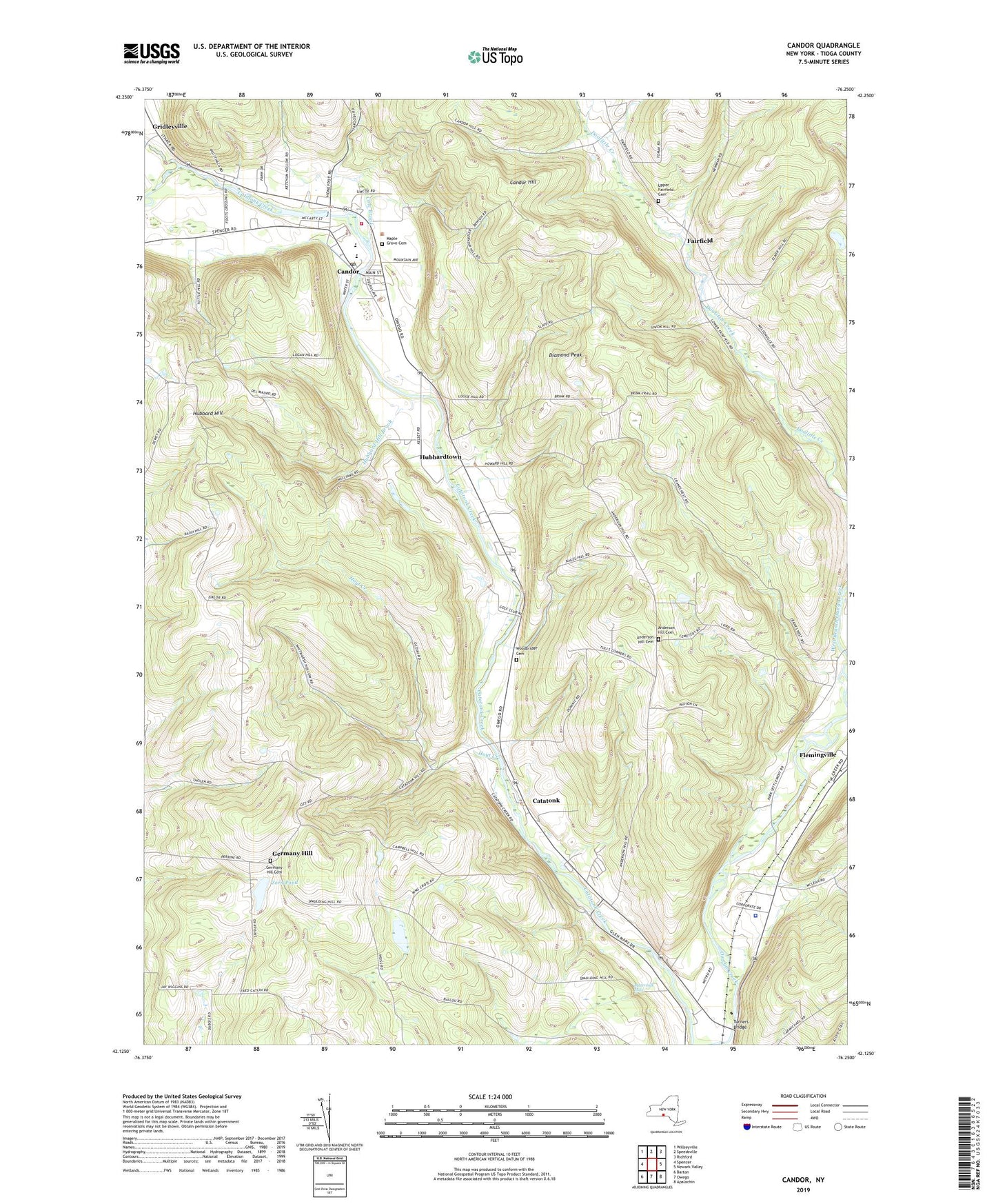
2023 topographic map quadrangle Candor in the state of New York. Scale: 1:24000. Based on the newly updated USGS 7.5' US Topo map series, this map is in the following counties: Tioga. The map contains contour data, water features, and other items you are used to seeing on USGS maps, but also has updated roads and other features. This is the next generation of topographic maps. Printed on high-quality waterproof paper with UV fade-resistant inks.
Quads adjacent to this one:
West: Spencer
Northwest: Willseyville
North: Speedsville
Northeast: Richford
East: Newark Valley
Southeast: Apalachin
South: Owego
Southwest: Barton
This map covers the same area as the classic USGS quad with code o42076b3.
Contains the following named places: AA Dairy, Allen Memorial Baptist Church, Anderson Hill Cemetery, Buttermilk Falls, Candor, Candor Congregational Church, Candor Elementary School, Candor Emergency Squad, Candor Fire Department, Candor Free Library, Candor Health Center, Candor Hill, Candor Junior-Senior High School, Candor Post Office, Catatonk, Catatonk Golf Course, Cole Brook, Crimson Mobile Home Court, Diamond Peak, East Branch Owego Creek, Fairfield, Fallow Hollow Deer Farm, Fish Haven Farm, Germany Hill, Germany Hill Cemetery, Gridleyville, Hamar Estates, Hamar Mobile Home Estates, Hoyt Creek, Hubbard Hill, Hubbard Hill Brook, Hubbardtown, Iron Kettle Farm, Jewell Mobile Home Park, Kingdom Hall of Jehovah's Witnesses, Klossner Farms, Lane Collyer Field, Lord Hill Church, Maple Grove Cemetery, Owego Heights, Owego Heights Mobile Home Park, Pebble Hill Mobile Home Park, Pine Tree Mobile Home Park, Saint Francis Church, Saint Marks Episcopal Church, Seventh Day Adventist Church, Tioga County, Tioga Industrial Park, Town of Candor, Turners Bridge, Upper Fairfield Cemetery, Village of Candor, West Branch Owego Creek, Willseyville Creek, Woodbridge Cemetery, Zorn Pond, ZIP Code: 13743