MyTopo
Worth Center New York US Topo Map
Couldn't load pickup availability
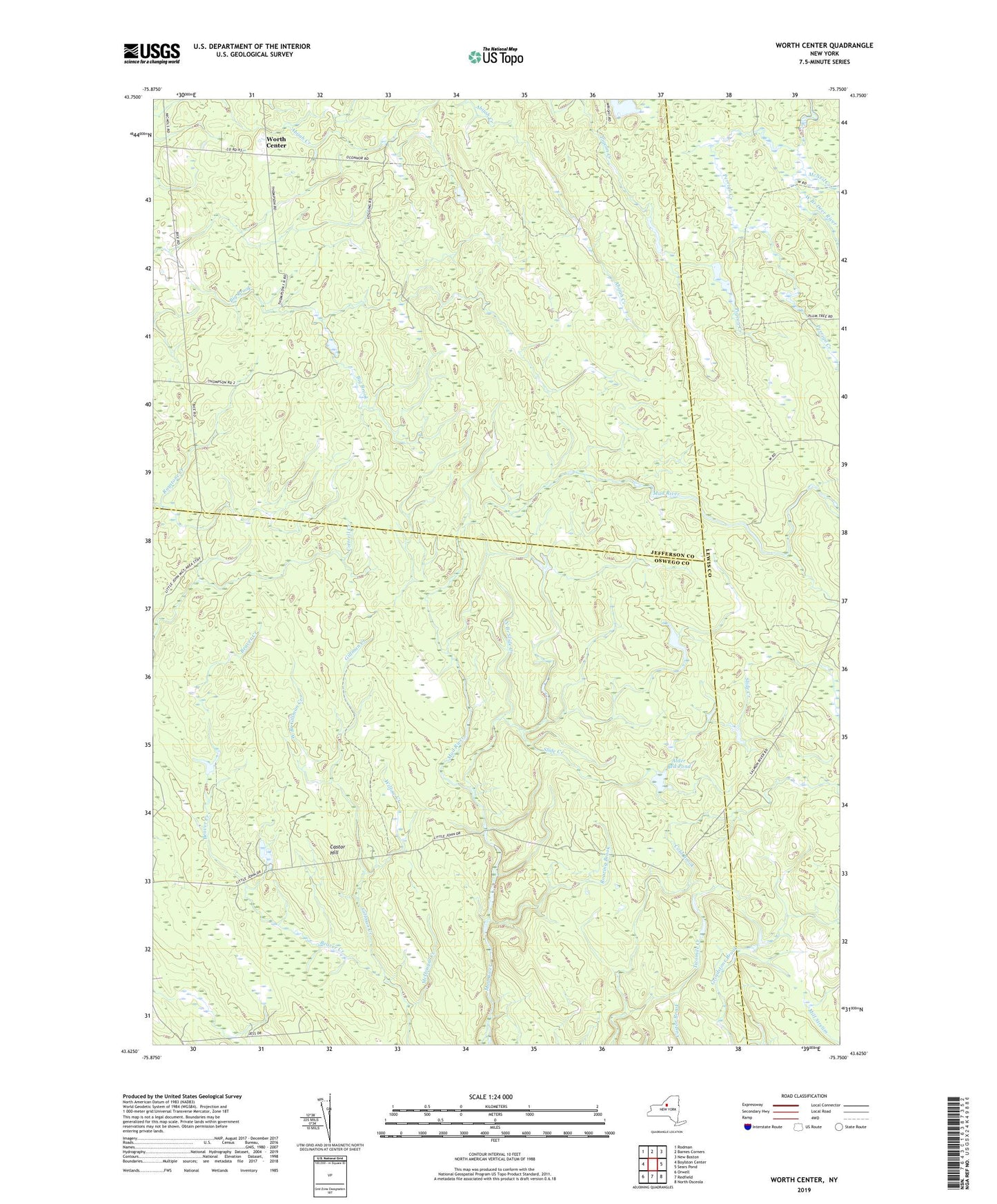
2019 topographic map quadrangle Worth Center in the state of New York. Scale: 1:24000. Based on the newly updated USGS 7.5' US Topo map series, this map is in the following counties: Oswego, Jefferson, Lewis. The map contains contour data, water features, and other items you are used to seeing on USGS maps, but also has updated roads and other features. This is the next generation of topographic maps. Printed on high-quality waterproof paper with UV fade-resistant inks.
Quads adjacent to this one:
West: Boylston Center
Northwest: Rodman
North: Barnes Corners
Northeast: New Boston
East: Sears Pond
Southeast: North Osceola
South: Redfield
Southwest: Orwell
Contains the following named places: Alder Bed Pond, Castor Hill, Gillman Creek, McDougal Creek, McNeil Creek, North Branch Slide Creek, Perrigo Creek, Roaring Brook, School Number 4, Slide Creek, Town of Worth, Twomile Creek, West Branch Gillman Creek, Willow Creek, Worth Center, ZIP Code: 13659