MyTopo
Asheboro North Carolina US Topo Map
Couldn't load pickup availability
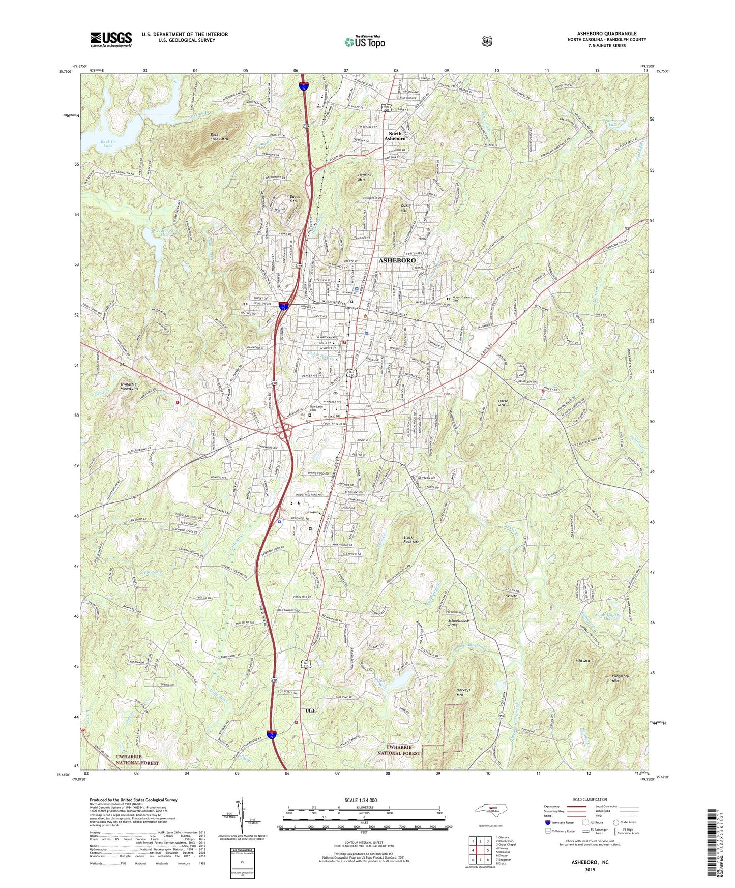
2019 topographic map quadrangle Asheboro in the state of North Carolina. Scale: 1:24000. Based on the newly updated USGS 7.5' US Topo map series, this map is in the following counties: Randolph. The map contains contour data, water features, and other items you are used to seeing on USGS maps, but also has updated roads and other features. This is the next generation of topographic maps. Printed on high-quality waterproof paper with UV fade-resistant inks.
Quads adjacent to this one:
West: Farmer
Northwest: Glenola
North: Randleman
Northeast: Grays Chapel
East: Ramseur
Southeast: Erect
South: Seagrove
Southwest: Eleazer
Contains the following named places: Ash - Rand Rescue Squad, Asheboro, Asheboro City Hall, Asheboro Fire Department Station 1, Asheboro High School, Asheboro Junior High School, Asheboro Police Department, Asheboro Post Office, Back Creek Lake, Back Creek Mountain, Balfour School, Briarcliff, Browers Church, Browers Pilgrim Church, Cedar Creek, Cedarwood Dam, Cedarwood Lake, Central School, Charlotte Church, City of Asheboro, Country Place, Cox Mountain, Crestview Church, Crossroads Center, Daves Mountain, Dogwood Acres Church, Eastside Volunteer Fire Protection Association Station 1, Farlow Lake Dam, Farlows Lake, Giles Chapel, Greenes Branch, Hamlet Lakes, Hammer Village Shopping Center, Harveys Mountain, Hedrick Mountain, Hillside Shopping Center, Hilltop Church, Hinshaw Airport, Horse Mountain, John Bunch Lake, John Bunch Lake Dam, Laurel Wood Hills, Lindley Park Elementary School, Loflin School, Long Branch, McCrary School, Middle Mountain, Mount Calvary Cemetery, North Asheboro, North Asheboro Junior High School, North Carolina Zoological Park, North Prong Richland Creek, North Shore, Northgate Shopping Center, Oakie Mountain, Oaklawn Cemetery, Oakwood Park Church, Old City Cemetery, Piney Mountain Estates, Purgatory Mountain, Randolph Correctional Center, Randolph County, Randolph County Court House, Randolph County Sheriff's Office, Randolph Hospital, Randolph Mall, Randolph Technical Institute, Redding Hills, Richland Church, Russells Grove Church, Schoolhouse Ridge, Shaw-Hudson Lake, Shaw-Hudson Lake Dam, South Prong Richland Creek, Stack Rock Mountain, Tantraugh Branch, Teachey School, Township of Asheboro, Ulah, Ulah Volunteer Fire Department Station 11, Ulah Volunteer Fire Protection Station 12, Vestal Creek, Village Market Place, W A McCrary Lake, W A McCrary Lake Dam, WCSE-FM (Asheboro), West Chapel, Westridge, Westside Volunteer Fire and Rescue Department Station 13, WGWR-AM (Asheboro), Whispering Pines Church, Winningham Farm, ZIP Codes: 27203, 27205