MyTopo
Glenola North Carolina US Topo Map
Couldn't load pickup availability
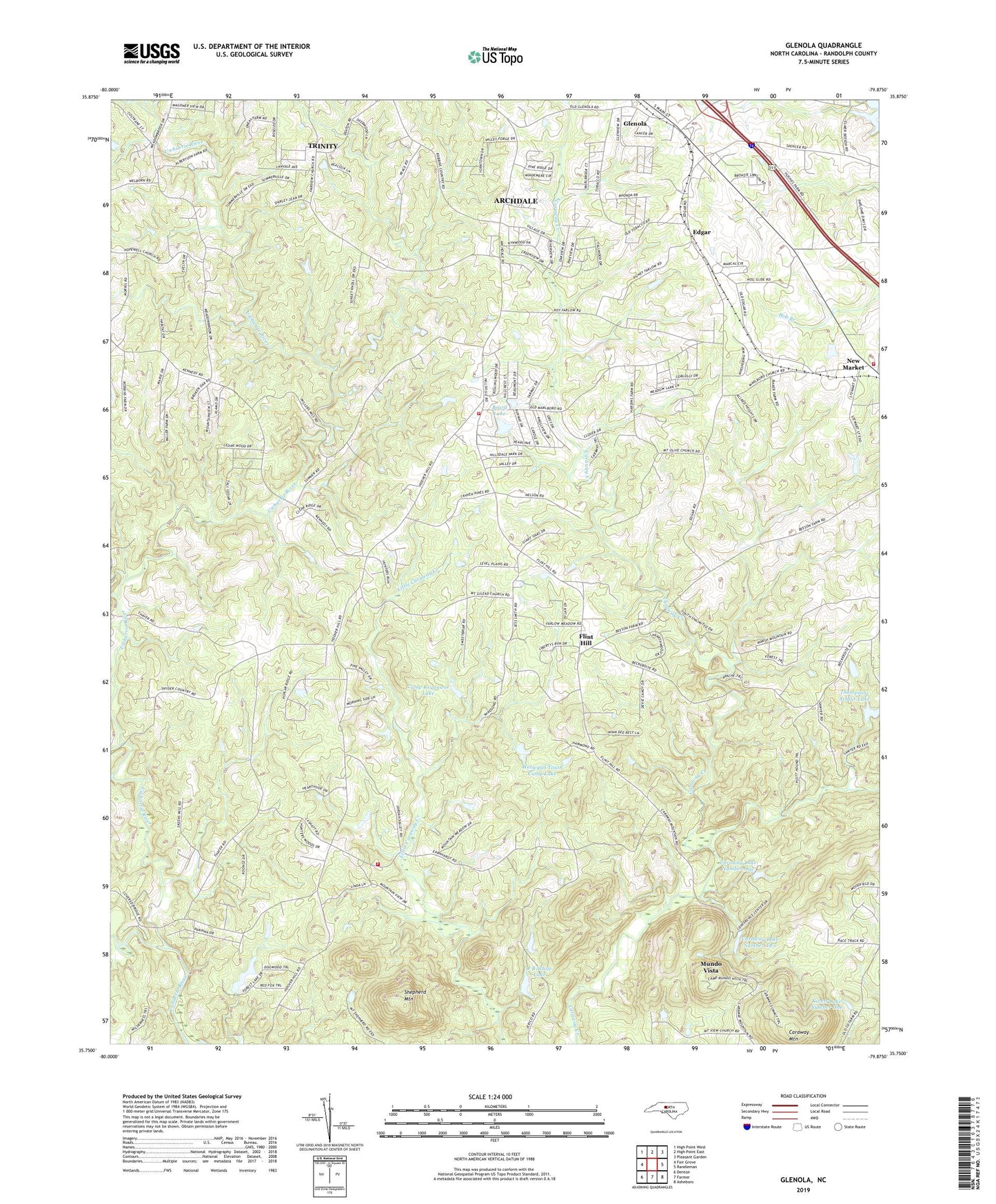
2022 topographic map quadrangle Glenola in the state of North Carolina. Scale: 1:24000. Based on the newly updated USGS 7.5' US Topo map series, this map is in the following counties: Randolph. The map contains contour data, water features, and other items you are used to seeing on USGS maps, but also has updated roads and other features. This is the next generation of topographic maps. Printed on high-quality waterproof paper with UV fade-resistant inks.
Quads adjacent to this one:
West: Fair Grove
Northwest: High Point West
North: High Point East
Northeast: Pleasant Garden
East: Randleman
Southeast: Asheboro
South: Farmer
Southwest: Denton
This map covers the same area as the classic USGS quad with code o35079g8.
Contains the following named places: Beard Lake, Beard Lake Dam, Camp Caraway, Camp Keyauwee Lake, Camp Keyauwee Lake Dam, Caraway Church, Caraway Dam Number One, Caraway Dam Number Two, Caraway Lake Number One, Caraway Lake Number Two, Caraway Mountain, Edgar, Fairview Church, Flint Hill, Glenola, Guil - Rand Fire Department Station 21, Hopewell Church, J B White Lake, J B White Lake Dam, Johnson Field, Kivett Lake Dam Number One, Kivett Lake Number One, Leath Dam, Leath Lake, Liberty Grove Church, Little Uwharrie River, Marlboro Church, Mount Gilead Church, Mount Olivet Church, Mount Pleasant Church, Mount Shepherd Camp, Mount Vernon Church, Mundo Vista, Poplar Ridge Church, Shepherd Mountain, Sophia Fire Department Station 29, Tabernacle Volunteer Fire Department Station 28, Thompson-Arthur Lake, Thompson-Arthur Lake Dam, Township of Back Creek, Township of New Market, Township of Tabernacle, Township of Trinity, Trindale Church, Wesleyan Youth Camp Lake, Wesleyan Youth Camp Lake Dam, ZIP Codes: 27350, 27370