MyTopo
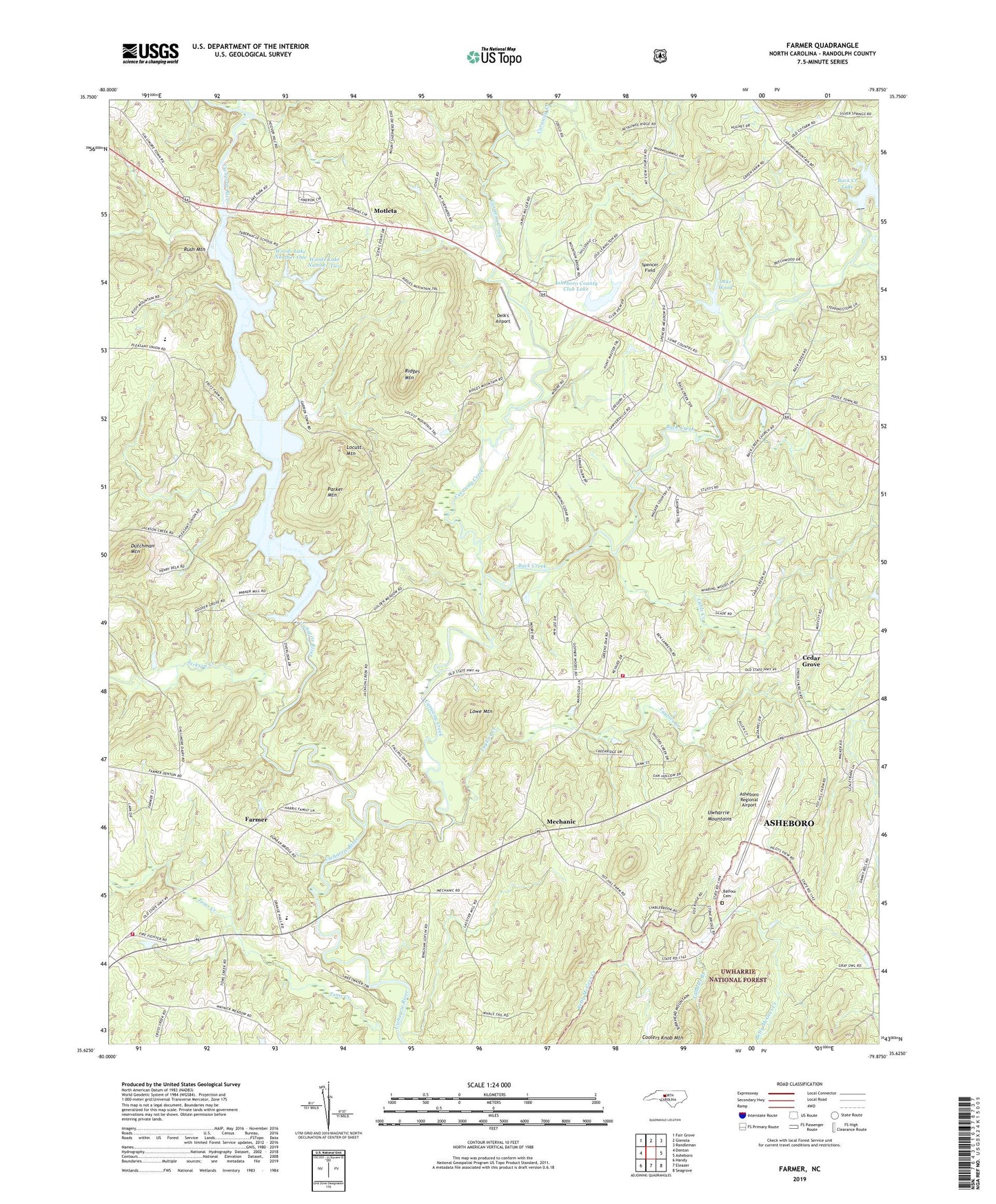
Farmer North Carolina US Topo Map
Couldn't load pickup availability
Also explore the Farmer Forest Service Topo of this same quad for updated USFS data
2022 topographic map quadrangle Farmer in the state of North Carolina. Scale: 1:24000. Based on the newly updated USGS 7.5' US Topo map series, this map is in the following counties: Randolph. The map contains contour data, water features, and other items you are used to seeing on USGS maps, but also has updated roads and other features. This is the next generation of topographic maps. Printed on high-quality waterproof paper with UV fade-resistant inks.
Quads adjacent to this one:
West: Denton
Northwest: Fair Grove
North: Glenola
Northeast: Randleman
East: Asheboro
Southeast: Seagrove
South: Eleazer
Southwest: Handy
This map covers the same area as the classic USGS quad with code o35079f8.
Contains the following named places: Asheboro Country Club, Asheboro Country Club Lake Dam, Asheboro County Club Lake, Asheboro Regional Airport, Back Creek, Back Creek Church, Balfour Cemetery, Bethel Church, Cable Creek, Caraway Creek, Cedar Fork Creek, Cedar Grove, Clyde Lucas Lake Dam, Delk's Airport, Dutchman Mountain, Farmer, Farmer Elementary School, Farmer Fire Department, Garren Grove Church, Gospel Tabernacle, Hoovers Grove Church, Hopewell Church, Jackson Creek, Lake Wood, Lake Wood Dam, Little Caraway Creek, Locust Mountain, Lowe Mountain, Mechanic, Motleta, Mount Shepherd Church, New Union Church, Parker Mountain, Pleasant Union Church, Ridges Mountain, Rush Mountain, Saint Marks Church, Sawyersville Church, Science Hill Church, Smyrna Grove Church, Spencer Field, Tabernacle School, Talbotts Branch, Taylors Creek, Township of Cedar Grove, Township of Concord, W Clyde Lucas Lake, Westside Volunteer Fire and Rescue Station 23, Woods Lake Dam Lower, Woods Lake Dam Upper, Woods Lake Number One, Woods Lake Number Two