MyTopo
Ramseur North Carolina US Topo Map
Couldn't load pickup availability
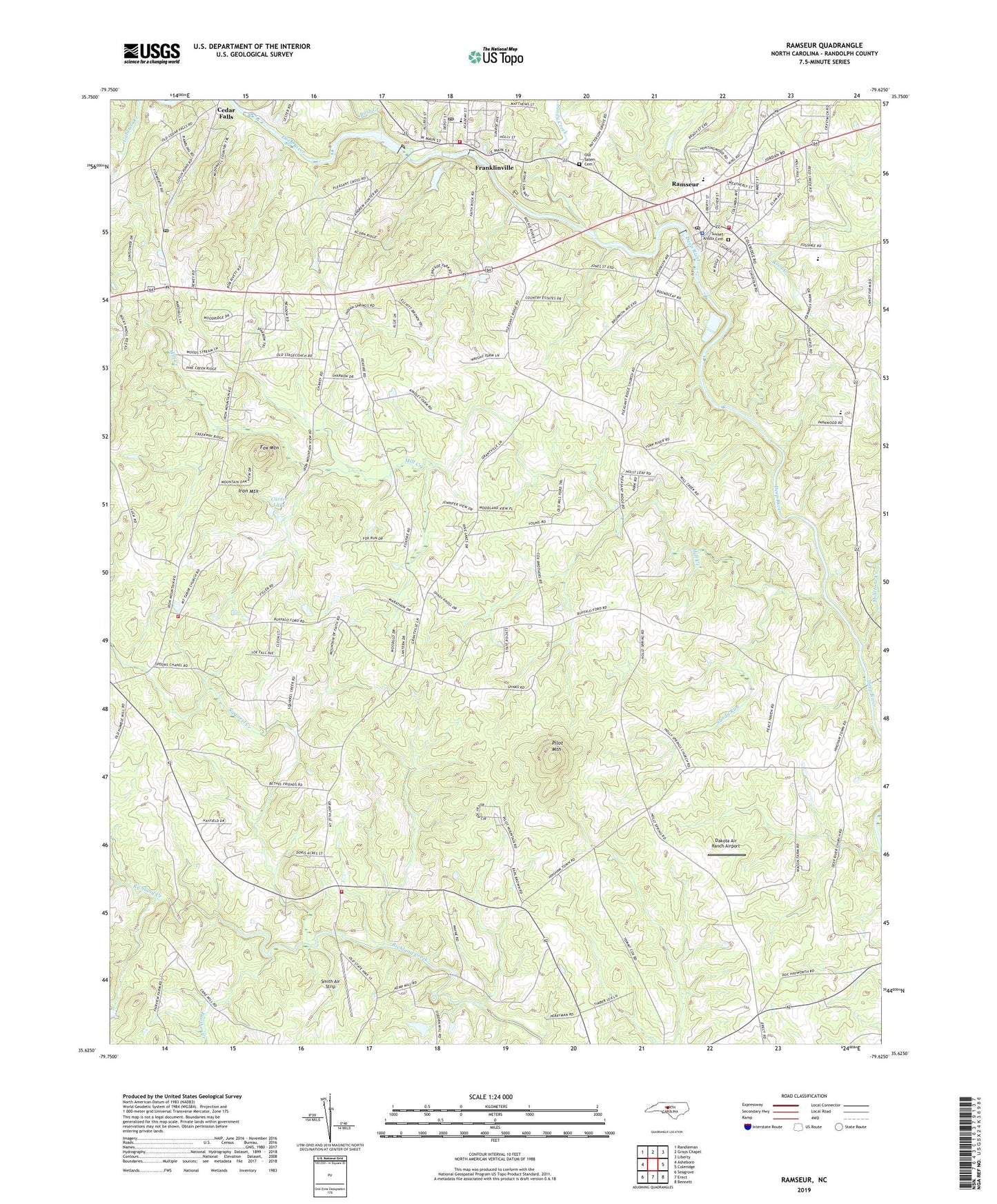
2022 topographic map quadrangle Ramseur in the state of North Carolina. Scale: 1:24000. Based on the newly updated USGS 7.5' US Topo map series, this map is in the following counties: Randolph. The map contains contour data, water features, and other items you are used to seeing on USGS maps, but also has updated roads and other features. This is the next generation of topographic maps. Printed on high-quality waterproof paper with UV fade-resistant inks.
Quads adjacent to this one:
West: Asheboro
Northwest: Randleman
North: Grays Chapel
Northeast: Liberty
East: Coleridge
Southeast: Bennett
South: Erect
Southwest: Seagrove
This map covers the same area as the classic USGS quad with code o35079f6.
Contains the following named places: Allen H Leonard Memorial Park, Bethel Church, Bush Creek, Carter Lake, Carter Lake Dam, Cedar Falls Post Office, Dakota Air Ranch Airport, East Side Volunteer Fire Department Station 19, East Side Volunteer Fire Protection Association Station 3, Fox Mountain, Franklinville, Franklinville Elementary School, Franklinville Fire Department Station 8, Franklinville Post Office, Gospel Church, Holly Springs Church, Iron Mountain, Mill Creek, Millstone Creek, Mount Taber Church, Old Salem Cemetery, Panther Creek, Pilot Mountain, Pleasant Cross Church, Pleasant Ridge Church, Pugh Field, Ramseur, Ramseur Elementary School, Ramseur Fire Department Station 4, Ramseur Lake, Ramseur Lake Dam, Ramseur Police Department, Ramseur Post Office, Randolph Mill Dam, Randolph Mill Lake, Reed Creek, Sandy Creek, Sandy Run, Smith Air Strip, Spoons Chapel, Squirrel Creek, Stouts Chapel, Sunset Knolls Cemetery, Town of Franklinville, Town of Ramseur, Township of Grant, ZIP Code: 27316