MyTopo
Catherine Lake North Carolina US Topo Map
Couldn't load pickup availability
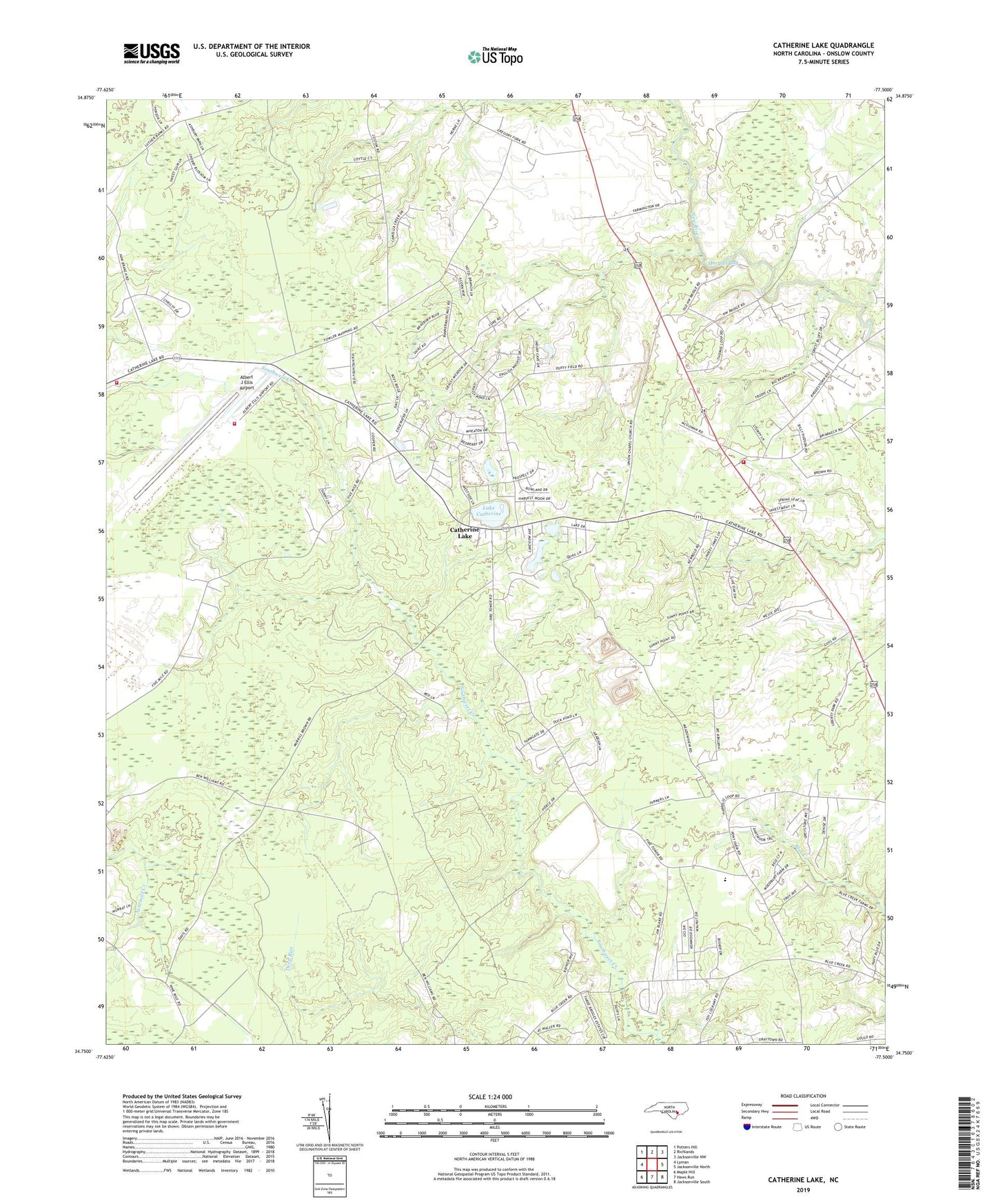
2022 topographic map quadrangle Catherine Lake in the state of North Carolina. Scale: 1:24000. Based on the newly updated USGS 7.5' US Topo map series, this map is in the following counties: Onslow. The map contains contour data, water features, and other items you are used to seeing on USGS maps, but also has updated roads and other features. This is the next generation of topographic maps. Printed on high-quality waterproof paper with UV fade-resistant inks.
Quads adjacent to this one:
West: Lyman
Northwest: Potters Hill
North: Richlands
Northeast: Jacksonville NW
East: Jacksonville North
Southeast: Jacksonville South
South: Haws Run
Southwest: Maple Hill
This map covers the same area as the classic USGS quad with code o34077g5.
Contains the following named places: Albert J Ellis Airport, Albert J Ellis Airport Fire and Rescue, Antioch Church, Back Swamp Volunteer Fire Department, Bethel Church, Catherine Lake, Cowhorn Swamp, Faith Tabernacle Church, Family of God Church, Floyd Lake, Fox Creek Mobile Home Park, Lake Catherine, Little Mission Temple, Onslow County EMS Station 4, Onslow Gospel Assembly, Rhodestown Volunteer Fire Department, Richlands Church, Saint Mary Church, Township of Jacksonville, Township of Richlands, Union Chapel Church, Union Church, ZIP Code: 28540