MyTopo
Maple Hill North Carolina US Topo Map
Couldn't load pickup availability
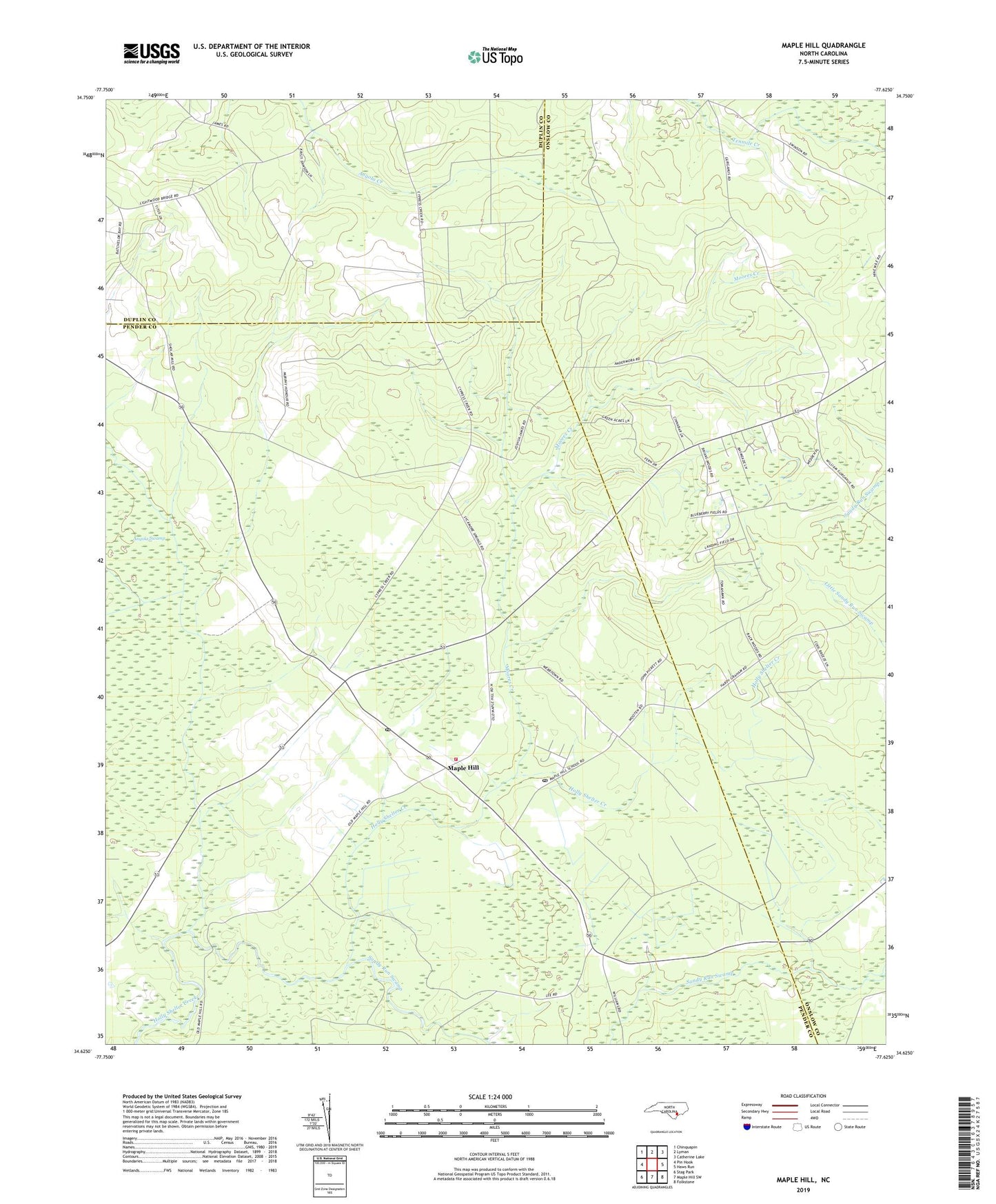
2022 topographic map quadrangle Maple Hill in the state of North Carolina. Scale: 1:24000. Based on the newly updated USGS 7.5' US Topo map series, this map is in the following counties: Pender, Onslow, Duplin. The map contains contour data, water features, and other items you are used to seeing on USGS maps, but also has updated roads and other features. This is the next generation of topographic maps. Printed on high-quality waterproof paper with UV fade-resistant inks.
Quads adjacent to this one:
West: Pin Hook
Northwest: Chinquapin
North: Lyman
Northeast: Catherine Lake
East: Haws Run
Southeast: Folkstone
South: Maple Hill SW
Southwest: Stag Park
This map covers the same area as the classic USGS quad with code o34077f6.
Contains the following named places: Angola, Angola Creek, Maple Hill, Maple Hill African Methodist Episcopal Church, Maple Hill Church, Maple Hill Post Office, Maple Hill School, Maple Hill Village Post Office, Maple Hill Volunteer Fire Department, Moores Creek, Pender Volunteer Emergency Medical Services and Rescue Station 8, Pilgrims Rest Church, Spring Church, ZIP Code: 28454