MyTopo
Cerro Gordo North Carolina US Topo Map
Couldn't load pickup availability
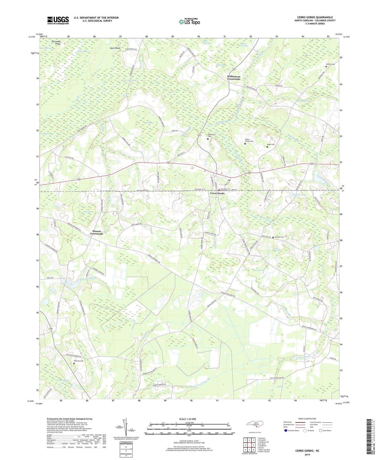
2022 topographic map quadrangle Cerro Gordo in the state of North Carolina. Scale: 1:24000. Based on the newly updated USGS 7.5' US Topo map series, this map is in the following counties: Columbus. The map contains contour data, water features, and other items you are used to seeing on USGS maps, but also has updated roads and other features. This is the next generation of topographic maps. Printed on high-quality waterproof paper with UV fade-resistant inks.
Quads adjacent to this one:
West: Fair Bluff
Northwest: Fairmont
North: Evergreen
Northeast: Chadbourn NE
East: Chadbourn
Southeast: Tabor City East
South: Tabor City West
Southwest: Duford
This map covers the same area as the classic USGS quad with code o34078c8.
Contains the following named places: Annetts Pond, Annetts Pond Dam, Brown Mill Branch, Bullard Cemetery, Bush Island, Cedar Grove, Cedar Grove Church, Cerro Gordo, Cerro Gordo Baptist Church, Cerro Gordo Elementary School, Cerro Gordo Post Office, Cerro Gordo School, Cerro Gordo Volunteer Fire and Rescue Squad, Cow Branch, Cow Pen Bay, Cypress Bay, Cypress Branch, Dunn Swamp, Edwards Cemetery, Faith Lighthouse Church, Frink Crossing, Gowans Cemetery, Greene Branch, Hinson Crossroads, Long Branch, Meares Bay, Middle Swamp, Mill Branch, Mill Pond, Mount Moriah Cemetery, Mount Moriah Church, Mount Tabor Presbyterian Church, Pages Mill Church, Pagett Bay, Piney Forest Church, Porter Swamp, Porter Swamp Church, Regar Cemetery, Robin Bay, Sandy Fork Bay, Town of Cerro Gordo, Township of Cerro Gordo, Uncles Branch, Water Branch, Water Hole Bay, West Columbus High School, Williamson Cemetery Number 1, Williamson Crossroads, Wolf Trap Branch, ZIP Code: 28430