MyTopo
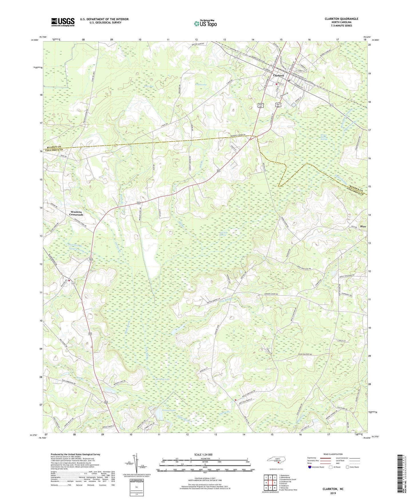
Clarkton North Carolina US Topo Map
Couldn't load pickup availability
2022 topographic map quadrangle Clarkton in the state of North Carolina. Scale: 1:24000. Based on the newly updated USGS 7.5' US Topo map series, this map is in the following counties: Columbus, Bladen. The map contains contour data, water features, and other items you are used to seeing on USGS maps, but also has updated roads and other features. This is the next generation of topographic maps. Printed on high-quality waterproof paper with UV fade-resistant inks.
Quads adjacent to this one:
West: Chadbourn NE
Northwest: Bladenboro
North: Abbottsburg
Northeast: Elizabethtown South
East: Emerson
Southeast: Lake Waccamaw West
South: Whiteville
Southwest: Chadbourn
This map covers the same area as the classic USGS quad with code o34078d6.
Contains the following named places: Brights Lake, Browders Branch, Brown Marsh Swamp, Butler Branch, Cherry Branch, Christian Plain Church, Clarkton, Clarkton Fire Department, Clarkton High School, Clarkton Post Office, Clarkton Public Library, Clarkton Rescue Squad, Curries Branch, Elkton Swamp, Graham Tabernacle, Inmans Lake, Kelly Swamp, Love Grove Church, Mill Branch, Mount Zion Church, North Whiteside Church, North Whiteville Volunteer Fire Department, Peace United Church, Piney Grove Church, Pleasant Hill Church, Raven Bay, Red Hill Swamp, Saint James Church, Sandhill Missionary Church, Slades Swamp, Town of Clarkton, Township of Welches Creek, Township of Western Prong, Troy Mill Branch, Welch Creek Church, Western Prong, Western Prong Church, White Marsh - Welches Creek Volunteer Fire Department, Wootens Crossroads