MyTopo
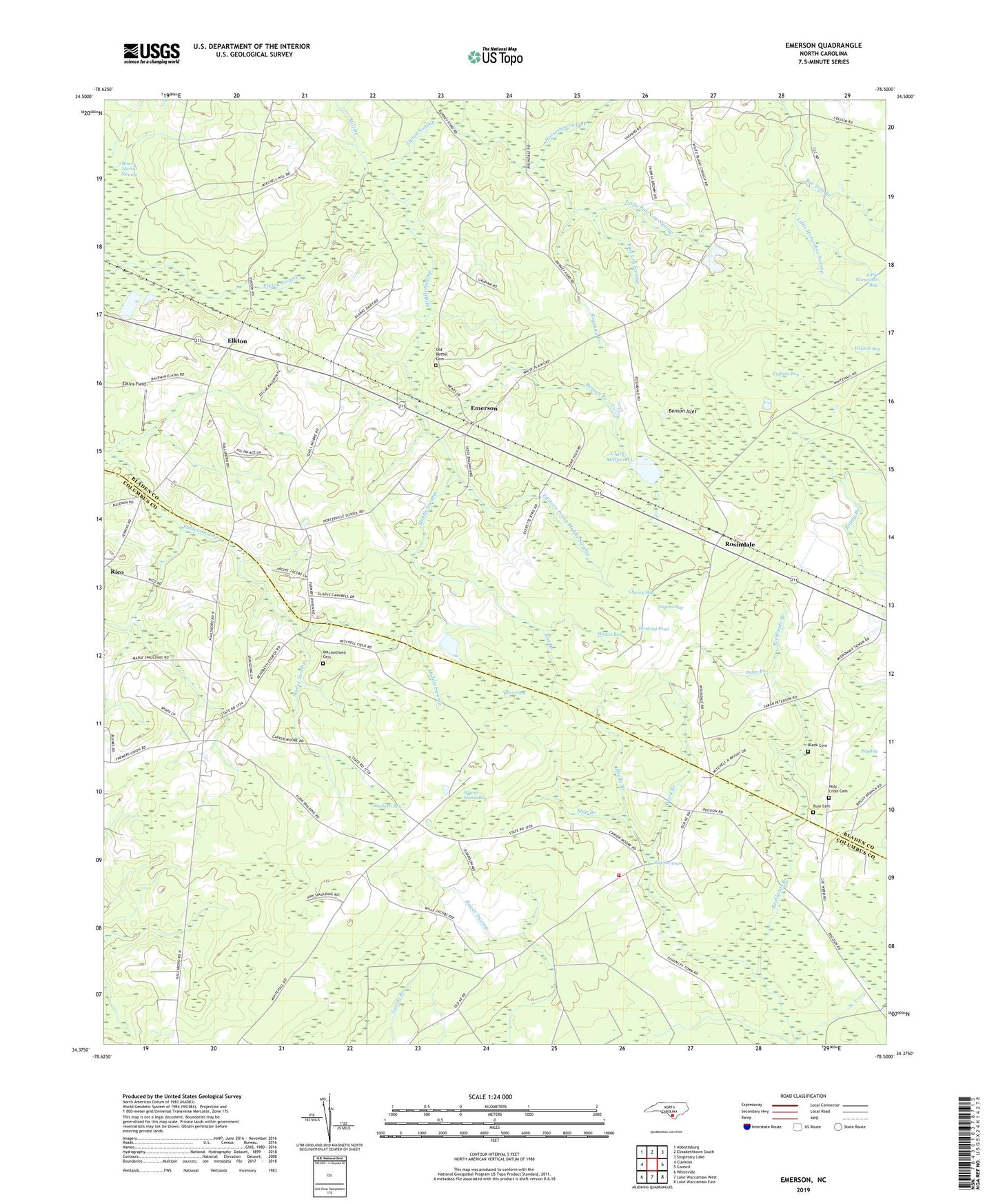
Emerson North Carolina US Topo Map
Couldn't load pickup availability
2022 topographic map quadrangle Emerson in the state of North Carolina. Scale: 1:24000. Based on the newly updated USGS 7.5' US Topo map series, this map is in the following counties: Bladen, Columbus. The map contains contour data, water features, and other items you are used to seeing on USGS maps, but also has updated roads and other features. This is the next generation of topographic maps. Printed on high-quality waterproof paper with UV fade-resistant inks.
Quads adjacent to this one:
West: Clarkton
Northwest: Abbottsburg
North: Elizabethtown South
Northeast: Singletary Lake
East: Council
Southeast: Lake Waccamaw East
South: Lake Waccamaw West
Southwest: Whiteville
This map covers the same area as the classic USGS quad with code o34078d5.
Contains the following named places: Bear Pond, Bee Tree Branch, Benson Branch, Benson Islet, Big Bay, Blank Cemetery, Box Branch, Buie Cemetery, Central Church, Chancy Bay, Clark Millpond, Cypress Bay, Dam Branch, Drinking Pond, Eastern Prong Middle Swamp, Elkins Field, Elkton, Elkton Church, Emerson, Farmers Union, Hasket Bay, Holy Cross Cemetery, Horseshoe Swamp, Little Horseshoe Bay, Little Pine Log Swamp, Meares Bay, Middle Swamp, Mill Branch, Mitchellfield Cemetery, New Jerusalem Church, Old Bethel Cemetery, Philadelphia Church, Pierces Chapel, Pine Log Swamp, Porterville School, Reedy Branch, Rehoboth Church, Richlands Branch, Rico, Rosindale, Saint James Church, Saint James Volunteer Fire Department, Sandy Plain Church, Sawhorn Bay, Shady Grove Church, Shipman Branch, Slap Branch, Township of Whites Creek, Union Church, Waccamaw Siouan State Designated Tribal Statistical Area, Ward Branch, White Plains Church, Wildcat Bay, Winnie Moore Bay, ZIP Code: 28433