MyTopo
Coats North Carolina US Topo Map
Couldn't load pickup availability
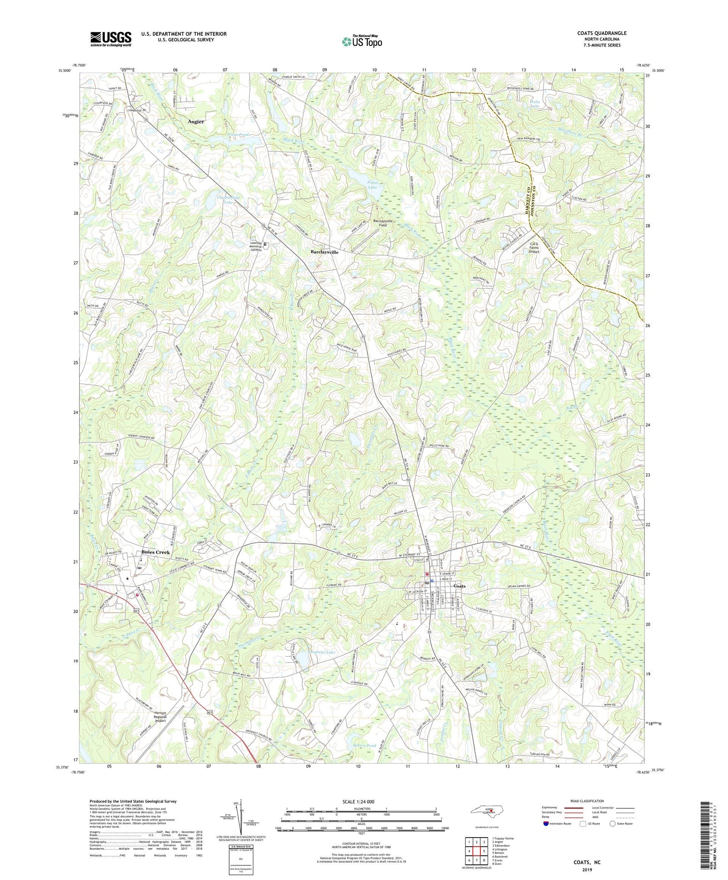
2019 topographic map quadrangle Coats in the state of North Carolina. Scale: 1:24000. Based on the newly updated USGS 7.5' US Topo map series, this map is in the following counties: Harnett, Johnston. The map contains contour data, water features, and other items you are used to seeing on USGS maps, but also has updated roads and other features. This is the next generation of topographic maps. Printed on high-quality waterproof paper with UV fade-resistant inks.
Quads adjacent to this one:
West: Lillington
Northwest: Fuquay-Varina
North: Angier
Northeast: Edmondson
East: Benson
Southeast: Dunn
South: Erwin
Southwest: Bunnlevel
Contains the following named places: Bakers Pond, Bakers Pond Dam, Barclaysville, Barclaysville Field, Bethel Church, Big Branch, Buies Creek, Buies Creek Census Designated Place, Buies Creek Elementary School, Buies Creek Post Office, Buies Creek Volunteer Fire Department, C A G Farms Airport, Campbell University, Chesterfield Lake, Chesterfield Lake Dam, Coats, Coats Elementary School, Coats Grove Fire and Rescue Department, Coats Police Department, Coats Post Office, Dushee Shaw Halfway House, East Buies Creek, Gregorys Lake, Gregorys Lake Dam, Guys Pond, Guys Pond Dam, Harnett County Emergency Medical Service, Harnett Regional Jetport, Holts Lake, Lakeside Memorial Gardens, Norman Urquhart Gristmill, Plainview Church, Pleasant Memory Church, Pleasant Plains Church, Popes Lake, Popes Lake Dam, Prospect Church, Stewart Airport, Town of Coats, Township of Black River, Township of Grove, WCCE-FM (Buies Creek), ZIP Codes: 27501, 27521