MyTopo
Bunnlevel North Carolina US Topo Map
Couldn't load pickup availability
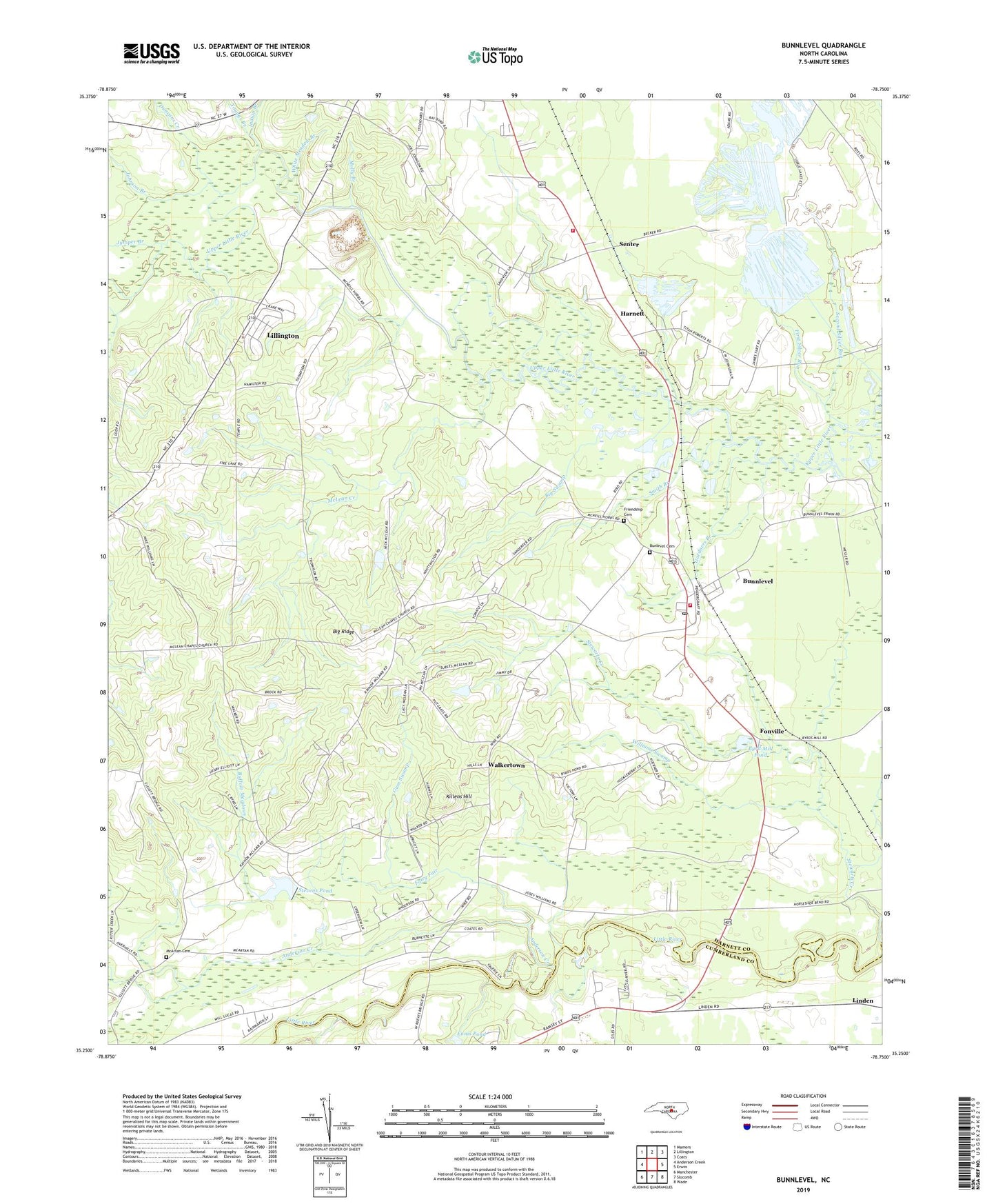
2022 topographic map quadrangle Bunnlevel in the state of North Carolina. Scale: 1:24000. Based on the newly updated USGS 7.5' US Topo map series, this map is in the following counties: Harnett, Cumberland. The map contains contour data, water features, and other items you are used to seeing on USGS maps, but also has updated roads and other features. This is the next generation of topographic maps. Printed on high-quality waterproof paper with UV fade-resistant inks.
Quads adjacent to this one:
West: Anderson Creek
Northwest: Mamers
North: Lillington
Northeast: Coats
East: Erwin
Southeast: Wade
South: Slocomb
Southwest: Manchester
This map covers the same area as the classic USGS quad with code o35078c7.
Contains the following named places: Anderson Church, Anderson Creek, Anderson Creek Church, Bakers Pond Dam, Big Swamp, Buffalo Meadows, Bunlevel Cemetery, Bunnlevel, Bunnlevel Census Designated Place, Bunnlevel Post Office, Bunnlevel Volunteer Fire Department, Byrd Mill Pond, Cumberland Union Church, Davis Chapel, Duncans Creek, Fairy Fair, First Silver Run, Flatwoods Community Fire Department, Fonville, Friendship Cemetery, Friendship Church, Gardners Branch, Gum Swamp, Harmony Church, Harnett, Harnett County, Harnett County Emergency Medical Service Transport and 911 Ambulance - Flatwoods, Harnett Quarry, Indian Branch, Johnson Branch, Juniper Branch, Kates Creek, Killens Hill, Linden Chapel, McArtan Cemetery, McLean Creek, McLeans Church, Molly Branch, Mount Ariel Church, Mount Pleasant Church, Pleasant Hill Church, Poplar Grove Church, Second Silver Run, Senter, Smith Branch, Stevens Pond, Stewarts Creek, Tabernacle Church, Township of Lillington, Township of Stewarts Creek, Walkertown, White Meadow Branch, Williams Swamp, Woods Lake Dam, Youngs Branch, ZIP Code: 28323