MyTopo
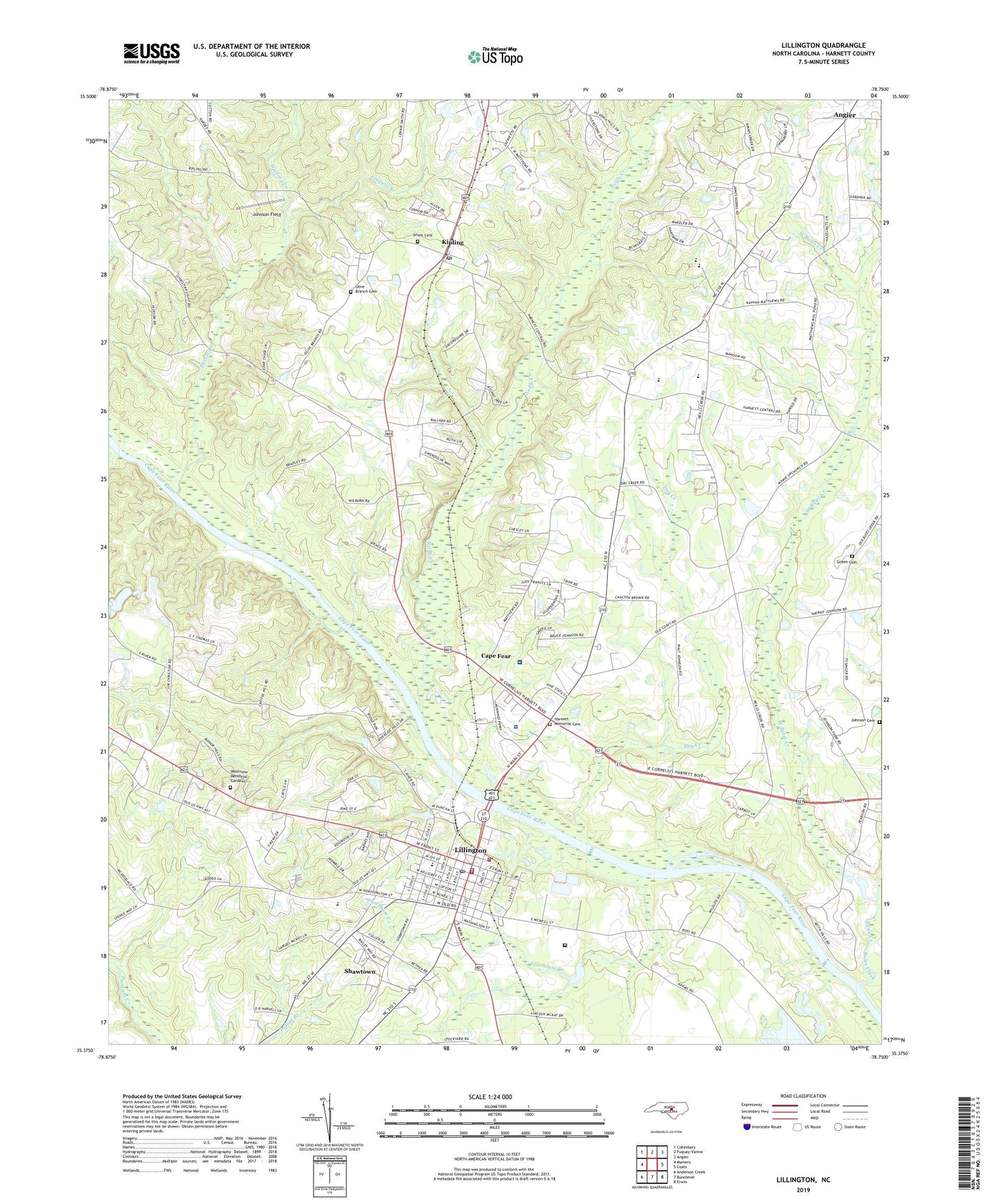
Lillington North Carolina US Topo Map
Couldn't load pickup availability
2022 topographic map quadrangle Lillington in the state of North Carolina. Scale: 1:24000. Based on the newly updated USGS 7.5' US Topo map series, this map is in the following counties: Harnett. The map contains contour data, water features, and other items you are used to seeing on USGS maps, but also has updated roads and other features. This is the next generation of topographic maps. Printed on high-quality waterproof paper with UV fade-resistant inks.
Quads adjacent to this one:
West: Mamers
Northwest: Cokesbury
North: Fuquay-Varina
Northeast: Angier
East: Coats
Southeast: Erwin
South: Bunnlevel
Southwest: Anderson Creek
This map covers the same area as the classic USGS quad with code o35078d7.
Contains the following named places: A J White Dam, Bethlehem Church, Buies Creek, Cape Fear, Cape Fear Church, Cedar Grove Church, Cedar Rock Church, Coopers Branch, Dry Creek, Fellowship Church, Fish Creek, Green Cemetery, Green Chapel, Harnett Central High School, Harnett Correctional Institution, Harnett County Sheriff's Office, Harnett Memorial Cemetery, Hector Creek, Johnson Cemetery, Johnson Field, Kipling, Kipling Post Office, Lafayette School, Lillington, Lillington Middle School, Lillington Police Department, Lillington Post Office, Lillington Volunteer Fire Department, Mc Coy Grove Church, Neills Creek, Neills Creek Church, North Carolina State Highway Patrol Troop B District 8, North Harnett School, Olive Branch Cemetery, Pleasant Union Church, Poorhouse Creek, Shawtown, Shawtown Elementary School, Smith Cemetery, Summerville Bunnlevel Fire and Rescue, Summerville Church, Tirzah Airport, Town of Lillington, Township of Hectors Creek, Township of Neills Creek, WCCE-FM (Buies Creek), Wesley Chapel, West Buies Creek, Westview Memorial Gardens, WLLN-AM (Lillington), ZIP Code: 27546