MyTopo
Cokesbury North Carolina US Topo Map
Couldn't load pickup availability
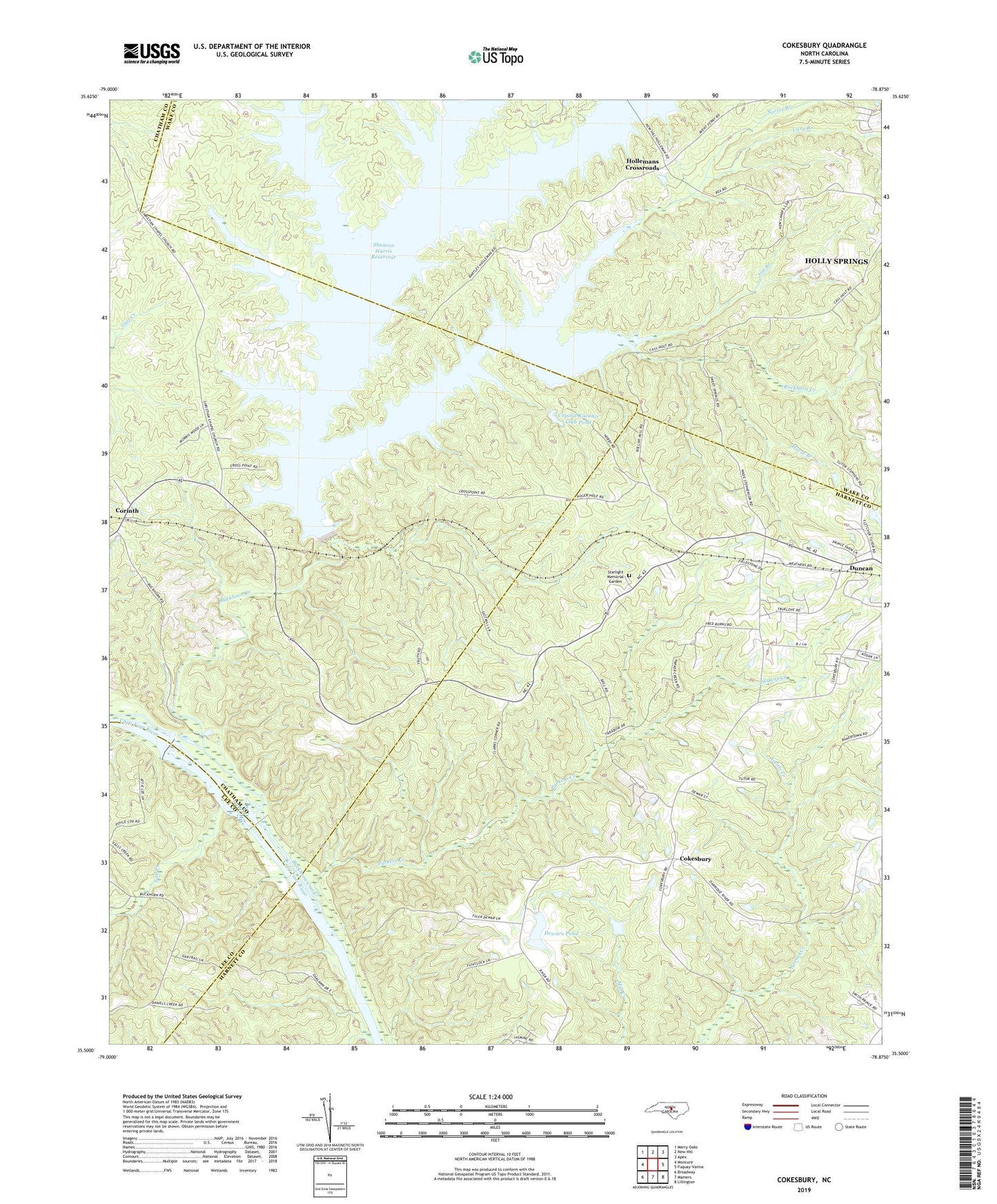
2019 topographic map quadrangle Cokesbury in the state of North Carolina. Scale: 1:24000. Based on the newly updated USGS 7.5' US Topo map series, this map is in the following counties: Harnett, Chatham, Wake, Lee. The map contains contour data, water features, and other items you are used to seeing on USGS maps, but also has updated roads and other features. This is the next generation of topographic maps. Printed on high-quality waterproof paper with UV fade-resistant inks.
Quads adjacent to this one:
West: Moncure
Northwest: Merry Oaks
North: New Hill
Northeast: Apex
East: Fuquay-Varina
Southeast: Lillington
South: Mamers
Southwest: Broadway
Contains the following named places: Bethel Church, Buckhorn Creek, Buckhorn Dam, Buckhorn Lake, Buckhorn Lake Dam, Buckhorn Methodist Church, Capital Kiwanis Club Pond Dam, Capitol Kiwanis Club Pond, Cary Branch, Chalk Level Church, Christian Chapel, Cokesbury, Collins Grove Church, Corinth, Cumberland Church, Daniels Creek, Dennis Crossroads, Dewars Pond, Dewars Pond Dam, Fall Creek, Hollemans Crossroads, Horse Branch, Jim Branch, Little White Oak Creek, Macedonia Church, Norris Branch, Parkers Creek, Prince Chapel, Shearon Harris Reservoir, Starlight Memorial Garden, Sweet Springs Church, Thomas Creek, Tom Jack Creek, Township of Buckhorn, White Oak Creek, ZIP Code: 27540