MyTopo
Crutchfield Crossroads North Carolina US Topo Map
Couldn't load pickup availability
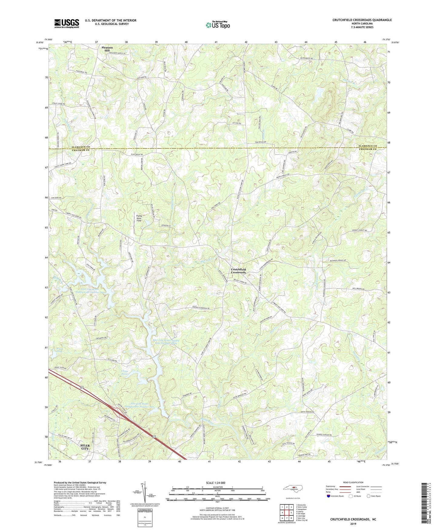
2019 topographic map quadrangle Crutchfield Crossroads in the state of North Carolina. Scale: 1:24000. Based on the newly updated USGS 7.5' US Topo map series, this map is in the following counties: Chatham, Alamance. The map contains contour data, water features, and other items you are used to seeing on USGS maps, but also has updated roads and other features. This is the next generation of topographic maps. Printed on high-quality waterproof paper with UV fade-resistant inks.
Quads adjacent to this one:
West: Liberty
Northwest: Kimesville
North: Snow Camp
Northeast: Saxapahaw
East: Silk Hope
Southeast: Siler City NE
South: Siler City
Southwest: Coleridge
Contains the following named places: Bethlehem Church, Clapp Pond, Clapp Pond Dam, Creek River Farms, Crutchfield Crossroads, Flint Ridge Airport, Flint Ridge Church, Fogleman Dairy, Greenbrier Creek, Johnson Creek, Lacys Creek, Lynch Farm, Mud Lick Creek, Nick Creek, North Rocky River Prong, Pine Hill Church, Piney Grove Church, Plainfield Church, Pleasant Grove Church, Pleasant Hill, Pleasant Hill Church, Rocky River Church, Siler City Water Supply Lake Number One, Siler City Water Supply Lake Number One Dam, Siler City Water Supply Lake Number Three, Siler City Water Supply Lake Number Three Dam, Siler City Water Supply Lake Number Two, Siler City Water Supply Lake Number Two Dam, Township of Albright, Wood Pond, Wood Pond Dam