MyTopo
Liberty North Carolina US Topo Map
Couldn't load pickup availability
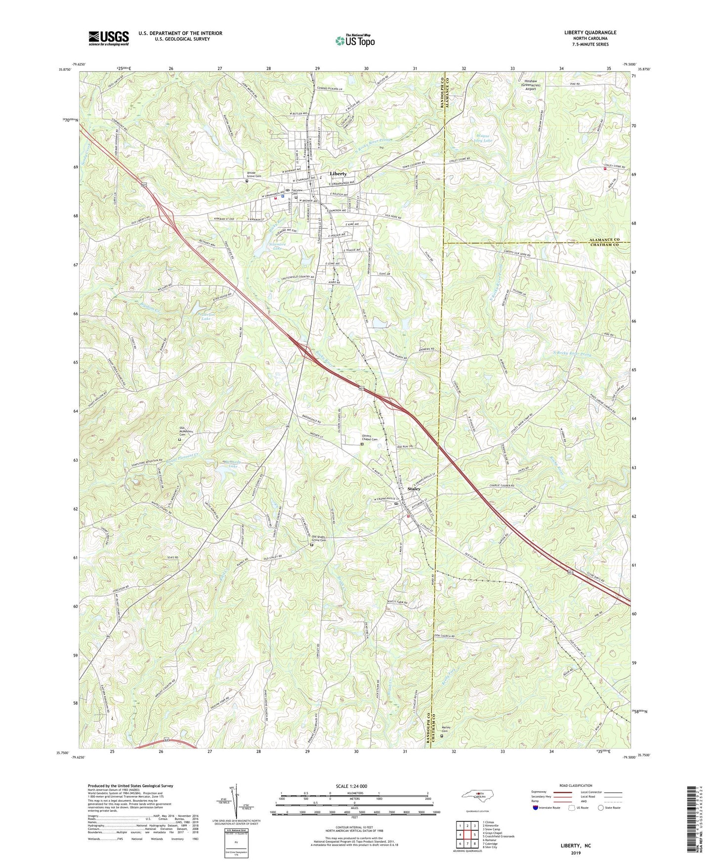
2022 topographic map quadrangle Liberty in the state of North Carolina. Scale: 1:24000. Based on the newly updated USGS 7.5' US Topo map series, this map is in the following counties: Randolph, Chatham, Alamance. The map contains contour data, water features, and other items you are used to seeing on USGS maps, but also has updated roads and other features. This is the next generation of topographic maps. Printed on high-quality waterproof paper with UV fade-resistant inks.
Quads adjacent to this one:
West: Grays Chapel
Northwest: Climax
North: Kimesville
Northeast: Snow Camp
East: Crutchfield Crossroads
Southeast: Siler City
South: Coleridge
Southwest: Ramseur
This map covers the same area as the classic USGS quad with code o35079g5.
Contains the following named places: Amose Grove Cemetery, Bethany Church, Eastern Randolph High School, Fairview Cemetery, Fox Turkey Farm, Gilmore Plant and Bulb Farm, Hickory Grove Church, Holly Chapel, Kennedy Lake, Kennedy Lake Dam, Langley Dairy Farm, Liberty, Liberty Elementary School, Liberty Fire Department, Liberty Grove Church, Liberty Police Department, Liberty Post Office, Louise Grove Church, Marley Cemetery, Mount Olivet Church, Mount Pleasant Church, Old McMasters Cemetery, Old Shady Grove Cemetery, Olivers Chapel, Olivers Chapel Cemetery, Overman Lake Dam, Patterson Lake, Patterson Lake Dam, Pine View Church, Randolph County Emergency Medical Services - Liberty, Reedy Fork, Rocky River Church, Shady Grove Church, Sizemore Lake, Sizemore Lake Dam, Snow Camp Volunteer Fire Department Station 15, Staley, Staley Post Office, Staley Volunteer Fire Department Station 7, Town of Liberty, Town of Staley, Township of Columbia, Township of Liberty, Wayne Isley Dam, Wayne Isley Lake, White Cross Church, Zion Church, ZIP Code: 27355